
By Carrie Liotta | Space Coast Waterfront REALTOR® | Merritt Island Real Estate Waterfront Specialist | Top 5% Realtor in Brevard County | 321coastalliving.com The Two Waterways That Define Merritt Island : There’s a question I get from serious waterfront buyers that almost no other real estate agent on the Space Coast bothers to answer in any useful depth. It goes something like this: “We know we want waterfront on Merritt Island. But do we want the Banana River side or the Indian River side—and does it actually matter?” It matters. Significantly. And the way most buyers get talked out of caring about it—by agents who treat waterfront as interchangeable, who lead with square footage instead of waterway geometry—is one of the more expensive mistakes a Space Coast buyer can make. My job isn’t to close you on a listing. It’s to make sure you understand what you’re getting into before you commit serious money. The buyers who thank me months after closing aren’t the ones I moved fastest—they’re the ones I slowed down long enough to ask the right questions. Let me be specific about why those questions matter, and then we can work through the neighborhood picture that helps buyers actually calibrate. Watch: Merritt Island Waterfront — What Buyers Need to Know Before They Searchhttps://youtu.be/Ii3L_Bb9cOs?si=YLjvq-V5_1TSi3ZD Two Waterways, One Island, Completely Different Lives Merritt Island is a barrier island in Brevard County, Florida—situated between the Indian River Lagoon to the west and the Banana River to the east, with the Atlantic beyond that. The island is also home to Kennedy Space Center, which has two effects on the real estate picture that buyers rarely anticipate: it creates no-motor zones in the northern Banana River that protect the area from boat traffic and overdevelopment, and it gives residents front-row seats to rocket launches from their backyard docks. But let’s focus on the waterways themselves, because this is what actually determines whether you’ll love or merely tolerate your waterfront home. “Carrie Liotta made buying my waterfront home in Cocoa Beach an incredible experience! She’s truly a Cocoa Beach waterfront property expert and knows the local market inside and out.” — Verified Client Review The Indian River Lagoon The Indian River Lagoon is part of the Atlantic Intracoastal Waterway. From a boating perspective, this is the fundamental fact. The ICW is the major navigable corridor running from Miami to Virginia—and homes on the Indian River side of Merritt Island have direct, unimpeded access to it. Larger cruising vessels, long-distance boaters, and anyone running north or south along the Florida coast without wanting to fight the open ocean repeatedly—this is your waterway. The Indian River is also wider. Depending on where you’re sitting on the western shore of Merritt Island, you might be looking across open water half a mile wide or more, with the Florida mainland as a distant backdrop. Sunsets from the western-facing Indian River homes are notable—wide sky, open water, the occasional cruise ship sliding out of Port Canaveral in the middle distance. It is a different kind of beautiful than the Banana River: broader, more dramatic, more active. The trade-off is that wider open water means more chop on windy days, and the Indian River corridor carries significant boat traffic in the high-traffic central Merritt Island stretch. A wake from a passing vessel when you’re sitting at the dock is the price of living on a busy waterway. That’s not a complaint—just something buyers should actually know before committing. The Banana River The Banana River is 31 miles long, running along Merritt Island’s eastern edge. It is not part of the Intracoastal Waterway—its only exit to the ocean is through the lock at Port Canaveral, which makes it functionally a closed lagoon from a navigation standpoint. For a cruiser with a long-range itinerary, this is a significant limitation. For a family with a pontoon boat who wants dolphin sightings on Saturday morning, it’s largely irrelevant. The Banana River is calmer and shallower than the Indian River—the system averages about four feet of depth overall, but conditions vary substantially by location. It hosts one of the largest permanent manatee populations in Florida, particularly in the northern sections. Dolphins are endemic. The wildlife observation from a Banana River dock on any given morning is consistently excellent. The eastern orientation of Banana River homes means sunrise views, not sunsets. The barrier island frames the eastern horizon. It is an intimate, nature-driven aesthetic, distinct from the wide-open-sky drama of an Indian River sunset. Water quality is worth understanding honestly. The Banana River, because it has no direct ocean inlets, flushes less efficiently than the Indian River sections that connect to multiple inlets along the ICW. Buyers should research current conditions rather than relying on an optimistic framing from anyone trying to sell them a property. I’d rather tell you something uncomfortable in month one than have you discover it in month six. The Canal Factor: What Lies Between the Two Rivers Most of the waterfront inventory on Merritt Island isn’t directly on either river—it’s in the canal neighborhoods that thread through the island between them. This is important context for buyers who conflate “waterfront” with “on the river,” because the canal home experience is meaningfully different from the riverfront experience. Canal homes offer protected water, neighborhood-scale community, and practical dockage for boats that will use the waterway regularly. They typically come at a more accessible price point than direct riverfront property, and they trade panoramic views and open-water exposure for calm water, no chop, and immediate usability. A well-chosen canal home in a neighborhood that connects efficiently to both rivers and to Port Canaveral is an exceptional Merritt Island waterfront living experience. A poorly chosen canal home—one with depth issues, bridge restrictions, or a route that adds substantial time to every trip—is a frustrating asset. Riverfront homes offer the view: open water, wildlife panoramas, sunset drama on the Indian River side, sunrise and manatee mornings on the Banana River side. They carry a price premium that
Merritt Island is one of Brevard County’s strongest real estate markets for waterfront homes, boating access, canal-front neighborhoods, relocation buyers, and Space Coast lifestyle moves. This hub collects Carrie Liotta’s local guidance on Merritt Island neighborhoods, home values, flood-zone considerations, seawalls, docks, schools, commuting, and what buyers and sellers should understand before making a move.

What Every Serious Buyer Gets Wrong About Merritt Island Waterfront (And Why It Costs Them the Right Home)
By Carrie Liotta | Top Rated Merritt Island FL Real Estate Waterfront Specialist | Top 5% Realtor in Brevard County | 321coastalliving.com What Every Serious Buyer Gets Wrong About Merritt Island Waterfront: Most buyers who come to me looking for a waterfront home on Merritt Island have already done their research. They’ve scrolled Zillow, they’ve watched YouTube tours, they’ve read a handful of “top 10 waterfront neighborhoods” articles. And almost every one of them arrives with the same blind spot: they’re searching by view, when they should be searching by boat. That distinction sounds minor. It isn’t. The difference between a canal home that works brilliantly for a boater and one that leaves them frustrated within the first season often comes down to factors that don’t show up in listing photos: canal depth at mean low water, bridge clearance, prevailing wake, and which waterway that canal ultimately connects to—the Banana River or the Indian River Lagoon. If you’re spending $600,000 to $2 million on waterfront real estate on Merritt Island FL, and you plan to keep a boat at the dock, those details are the whole game. Let me walk you through what the algorithms don’t tell you. The Waterway Geography That Actually Matters Merritt Island sits between two rivers. The Indian River Lagoon runs along the island’s western edge—wider, part of the Atlantic Intracoastal Waterway, and historically the more active boating corridor. The Banana River runs along the island’s eastern edge, separated from the ocean by the Cape Canaveral barrier island. These two waterways share an ecosystem, but they behave differently, and the homes that front them serve different buyers. Between these two rivers, Merritt Island is threaded with canal neighborhoods—some dug in the postwar boom years, some older, some privately maintained and some county-maintained. These canals are where a large portion of the waterfront inventory actually lives. And not all canals are created equal. A canal in Diana Shores or Waterway Manor that connects directly through Sykes Creek to the Barge Canal gives a boater an efficient, relatively deep-water path to reach both the Banana River and Indian River, and ultimately to the Port Canaveral locks and the Atlantic. A canal that dead-ends in a quiet neighborhood pocket might give you beautiful views and morning coffee with manatees, but it won’t give you offshore fishing. The first question I ask every boater-buyer isn’t what size boat they have now. It’s what size boat they eventually want—because that answer drives everything. Watch: Merritt Island Waterfront — What Buyers Need to Know Before They Searchhttps://youtu.be/Ii3L_Bb9cOs?si=YLjvq-V5_1TSi3ZD “She’s truly a Cocoa Beach waterfront property expert and knows the local market inside and out.” — Verified Client Review Deep-Water Canal Neighborhoods: Where Boaters Actually Want to Be As one of the top rated waterfront specialists on Florida’s Space Coast, the neighborhoods below are where I consistently direct serious boating buyers first—not because they’re the most photographed, but because they actually work. Diana Shores Diana Shores is one of the more underappreciated boating communities on central Merritt Island. About half of the lots in this neighborhood sit on deep-water canals, and the neighborhood’s connection to Sykes Creek gives boaters access to both rivers and a clear path to Port Canaveral and the ocean. Underground utilities mean storm outages hit this neighborhood less severely than many others, which matters during hurricane season when you’re managing a vessel at a dock. Homes here were built during the Kennedy Space Center boom of the 1960s, but they’ve been continuously updated, and the range of renovation quality is wide. That makes Diana Shores a market where a knowledgeable buyer can still find genuine value—if they can assess a structure accurately and aren’t scared off by avocado appliances in an otherwise solid home. Waterway Manor Waterway Manor is tucked behind the Publix shopping plaza off SR-3 in central Merritt Island. The majority of the 125-plus homes here sit on waterfront property, and the calm canals wind through the neighborhood in a way that makes it feel unexpectedly private for such a central location. HOA fees run about $100 per year—nominal by any standard—and the canal access connects to both the Indian River and Banana River systems, which is what boating buyers want. The homes are modestly sized, mostly built in the 1960s, and priced accordingly compared to South Tropical Trail estates. This neighborhood attracts practical boaters: people who want daily usability over trophy real estate. If your priority is getting out on the water efficiently and often, Waterway Manor has logic behind it that a lot of buyers miss because it doesn’t photograph like a magazine spread. Sykes Cove Sykes Cove is family-friendly in its social character, with community events and a lakeside gazebo, but it’s genuinely usable for boaters. The navigable canals connect to Sykes Creek, which gives access to the Barge Canal, and from there, both rivers and offshore access. It’s a neighborhood that works for buyers who want a community feel without sacrificing the boating lifestyle—a combination that’s harder to find than it sounds. Villa De Palmas Villa De Palmas sits north of SR-528, positioned between State Road 3 and Sykes Creek. More than half of the 250-plus homes in this community have waterfront lots, and the Barge Canal connection means a boat can reach the Indian River, Banana River, and Port Canaveral locks from this neighborhood. The closest public boat ramp is Kelly Park on Banana River Drive. The character here leans toward a quieter boating community—recreational fishing, sunset cruises, the kind of waterfront life that isn’t about impressing anyone. Prices tend to be more accessible than south Merritt Island’s trophy corridor. North Merritt Island vs. South Merritt Island: The Honest Comparison This is among the most common questions I receive as a Space Coast waterfront REALTOR® working with both local and relocating buyers. The honest answer: it depends entirely on what you’re optimizing for, and the two ends of the island serve genuinely different lifestyles. North Merritt Island backs against the Merritt Island National Wildlife Refuge. The atmosphere is

Adelaide in Viera vs. Waterfront on Merritt Island: The Luxury Decision Nobody Talks About Honestly
Adelaide in Viera vs. Waterfront on Merritt Island: The Luxury Decision Nobody Talks About Honestly: You have been searching for a home on the Space Coast for weeks. Maybe months. You walked through a model in Adelaide with disappearing sliders, a wine cellar, and a lake view that genuinely stopped you in your tracks. Then you drove twenty minutes east, stood on a dock in a Merritt Island canal neighborhood, and watched a dolphin surface ten feet from somebody’s boat lift. Now you are stuck between two completely different versions of what luxury means on this coastline. This is one of the most common crossroads I see working with relocating buyers as a Space Coast waterfront Realtor. Most content online either sells you on new construction or romanticizes waterfront living. Neither approach helps you make an informed decision. So let me walk through this the way I do with my own clients. No hype, no pressure. Just the tradeoffs, the financial layers, and the lifestyle differences that actually matter when you are writing a check north of a million dollars. Let’s eliminate the wrong homes first so the right ones feel obvious. What Adelaide in Viera Actually Is Adelaide is a gated luxury enclave inside Viera, one of the top-ranked master-planned communities in the country. It spans approximately 460 acres surrounding the 120-acre Lake Adelaide. Builders like Christopher Burton Luxury Homes, AR Homes, and Elan Builders have been selected to build here. The community includes roughly 147 oversized homesites, with 18 premium lots behind a second gate in The Reserve at Adelaide. Current pricing puts most homes in the range of two million to over four and a half million dollars, with price per square foot averaging roughly eight hundred dollars. These are custom-built, architecturally distinct homes with modern systems, impact-rated construction, and full smart-home integration. Lake Adelaide itself permits electric-motor boats, kayaks, and paddlecraft, but this is a recreational freshwater lake, not a navigable waterway. Viera as a whole is located west of US-1, which means it sits on higher ground and does not connect to the Indian River Lagoon, the Banana River, or any saltwater navigable system. You are approximately twenty minutes from the closest beach and the nearest public boat ramp to saltwater. “Carrie knows the Space Coast inside and out, and her expertise in the Melbourne real estate market is unmatched. She listened to exactly what I wanted, guided me through every step, and negotiated an incredible deal.” — Relocating buyer, Suntree/Melbourne What Merritt Island Waterfront Actually Delivers Merritt Island is fundamentally different. It is a forty-mile-long barrier island bordered by the Indian River to the west, the Banana River to the east, and Sykes Creek running through the middle. Waterfront homes here provide direct access to one of the most biologically diverse estuaries in North America—the Indian River Lagoon. The median listing price for waterfront homes on Merritt Island currently sits around $499,000, though that spans everything from modest canal homes to multi-million-dollar riverfront estates. The most prestigious properties on the southern legs of the island, some spanning from the Indian River to the Banana River, reach well past three million dollars. What you get with a resale waterfront home on Merritt Island that Adelaide cannot replicate: private docks, boat lifts, deep-water canal access to Sykes Creek, the Intracoastal Waterway, and the Atlantic via the Canaveral Locks. Sunrise views over the Banana River. Dolphins, manatees, and rocket launches from your own backyard. This is the daily waterfront lifestyle that defines Merritt Island real estate waterfront at every price point. What you will also encounter: older construction, potential seawall maintenance or replacement costs, flood zone considerations, higher insurance premiums on pre-2002 homes, and the due diligence required to evaluate canal depth, bridge clearance, and dock permitting. Just so you know, I want you to be prepared—this is what it actually costs to own waterfront on the Space Coast. Adelaide in Viera vs. Waterfront on Merritt Island: The Luxury Decision Nobody Talks About Honestly: The Financial Layer Most Buyers Miss The sticker price is not the full picture on either side. New Construction in Adelaide Homes built to current Florida hurricane codes (post-2002) qualify for significantly better insurance rates. Impact-rated windows, modern roof-to-wall connections, and sealed-deck construction earn wind mitigation credits that reduce premiums by thousands of dollars annually. Adelaide homes sit in higher-elevation areas, typically in FEMA Flood Zone X, where flood insurance is not required by lenders and optional policies run just a few hundred dollars per year. New construction also means builder warranties, energy-efficient systems, and zero deferred maintenance. You are not inheriting someone else’s roof timeline, plumbing age, or electrical panel limitations. Resale Waterfront on Merritt Island Many waterfront homes on Merritt Island were built before current hurricane codes. This can mean higher insurance premiums, especially if a wind mitigation inspection reveals older construction methods. Flood zone mapping varies significantly block by block. Some mainland Indian River addresses fall in Zone X, while lagoon-side and barrier island homes commonly land in AE or VE zones, where flood insurance is mandatory and premiums can range from two thousand to well over ten thousand dollars annually under FEMA’s Risk Rating 2.0. Seawall replacement is a significant cost that catches buyers off guard. First-generation seawalls from the 1960s have limited life remaining and replacement runs $80,000 to over $100,000. Second-generation seawalls from the 2000s typically have ten to twenty years of useful life. A brand-new seawall gives you decades of worry-free use. This is not optional maintenance—it is structural protection for your property and something any top rated Merritt Island FL real estate agent waterfront specialist will evaluate before you write an offer. “She’s the only one really breaking down seawalls, bridges, and true costs.” — Space Coast buyer Comparing the True Cost of Ownership Cost Factor Adelaide New Construction Merritt Island Resale Waterfront Purchase Price Range $2M – $4.5M+ $499K – $3.6M+ Insurance (Wind + Flood) Lower: modern code, Zone X, wind-mit credits Higher: older construction, AE/VE zones possible Seawall / Dock Costs N/A $30K – $100K+ replacement; ongoing maintenance HOA

Is Merritt Island a Good Place to Live? The Honest Guide for Military, Aerospace & Waterfront Buyers
You’ve done the searches. You’ve read the polished overviews. Here’s what those results left out — and what you actually need to know before you make an offer on Merritt Island waterfront. By Carrie Liotta321 Coastal LivingTop 5% REALTOR® · Brevard County321coastalliving.com Watch at @CarrieLiottaSpaceCoastRealtor for weekly Space Coast market content.Is Merritt Island a Good Place to Live? This guide is for you if: you’re PCS-ing to Patrick Space Force Base, relocating for an aerospace role at SpaceX, Blue Origin, or KSC, or actively searching for waterfront homes on Merritt Island in the $600k–$1.2M range — and you want real information, not marketing copy. Everything below mirrors what I cover in the video above: commute realities, canal depth and bridge clearance due diligence, and how to tell which part of the island actually fits your life. When buyers search “Is Merritt Island a good place to live,” they tend to get a version of the same answer. Beautiful waterways. Close to Kennedy Space Center. Great outdoor lifestyle. All of that is technically true — and practically useless for someone trying to make a serious purchase decision. What serious buyers actually need to know is this: Merritt Island is not one neighborhood. It’s a 26-mile land mass with distinct communities, very different commute profiles, and waterfront properties that vary dramatically in their actual boating access. Where you buy on the island matters as much as whether you buy there. As a Space Coast waterfront REALTOR® who works specifically with military families, aerospace relocators, and out-of-state buyers, I’ve watched this geography gap create frustration — and in some cases, expensive regret — more times than I can count. This guide closes that gap before you start touring. What Merritt Island Actually Is — And Why the Geography Matters Merritt Island sits between the Indian River Lagoon to the west and the Banana River Lagoon to the east, positioned between Titusville to the north and Melbourne to the south. It spans roughly 26 miles tip to tip. The northern third of the island is the Merritt Island National Wildlife Refuge — one of the most biologically diverse refuges in the continental U.S. That land is protected and will never be developed. Residential communities occupy the central and southern portions of the island. Here’s the detail most buyers miss: North Merritt Island and South Merritt Island are functionally different housing decisions. North of SR-528, you’re closer to Kennedy Space Center, the SpaceX and Blue Origin facilities, and the wildlife refuge. South of SR-528, you’re closer to Patrick Space Force Base, Cocoa Beach, and the denser canal system with more established waterfront neighborhoods. Filtering your search by “Merritt Island” without knowing which end of the island you need is like searching “Miami” when you mean Coral Gables. The geography matters. Let’s look at exactly how it plays out for commutes. ★★★★★ “Working with Carrie Liotta was the best decision I could have made! As a Merritt Island Realtor, she guided me through every step and found me the perfect home. She’s a Merritt Island real estate expert and the best realtor for waterfront homes in Merritt Island, Florida.” — VERIFIED CLIENT · MERRITT ISLAND, FL Commute Times: Real Numbers for Military & Aerospace Buyers This is the section I spend the most time on with out-of-state buyers, because it’s where avoidable mistakes happen. Commute calculators will give you a general number. What they won’t tell you is that the same address labeled “Merritt Island” can be 20 minutes from your base or 50 — depending on which part of the island you’re on. Patrick Space Force Base Patrick is located at the southern end of Cape Canaveral, just east of Cocoa Beach. From South Merritt Island, you’re looking at a 20–30 minute commute via SR-528 east to A1A south into the base. Traffic on the Beachline is generally light — this is not an I-4 or I-95 situation. From North Merritt Island — above SR-528 — that commute extends to 40–50 minutes. Not a dealbreaker, but over a 3–4 year assignment it’s a meaningful quality-of-life variable. Know it before you narrow your search. If the absolute shortest Patrick commute is your top priority, Cocoa Beach itself is closer — sometimes under 10 minutes. But for military families who intend to stay beyond their assignment, Merritt Island consistently wins on square footage, lot size, and waterfront access per dollar. A $650k budget buys considerably more house — and often a canal-front lot — on Merritt Island than the equivalent in Cocoa Beach. Kennedy Space Center, SpaceX & Blue Origin The aerospace campus at KSC — including SpaceX at Launch Complex 39A and Blue Origin at Launch Complex 36 — sits at the northern end of the island and into Cape Canaveral. From South Merritt Island, expect 35–45 minutes. From North Merritt Island, that drops to 20–30 minutes. One thing commute calculators don’t capture: Kennedy Space Center has multiple access points and several distinct campuses. Contractors badged to a specific facility may find their ideal home location shifts by several miles depending on which gate they use. It’s worth clarifying before you start touring. Destination From South Merritt Island From North Merritt Island Primary Route Patrick Space Force Base 20–30 min 40–50 min SR-528 E → A1A S Kennedy Space Center 30–40 min 15–25 min SR-528 W → KSC Rd SpaceX LC-39A 35–45 min 20–30 min SR-528 N, KSC access Blue Origin LC-36 35–45 min 20–28 min North of KSC, Cape side Cocoa Beach 15–25 min 30–40 min SR-528 E or A1A Port Canaveral 20–30 min 30–40 min SR-528 E ★★★★★ “Who is the best real estate agent in Merritt Island Florida? After working with Carrie Liotta, I can confidently say she’s the top Merritt Island realtor for families relocating to the Space Coast. We were asking ‘how do we find a home in Merritt Island near good schools’ and ‘what are the best neighborhoods in Brevard County for families,’ and Carrie had all the answers… Her expertise in Space Coast real estate, Merritt Island property values, Cocoa Beach area communities, and Cape Canaveral neighborhoods made

Is Merritt Island a Good Place to Live? The Honest Guide for Military, Aerospace, and Relocation Buyers | Carrie Liotta, Trusted Realtor
Guide for Military, Aerospace, and Relocation Buyers: You’ve been doing your research. You typed the question into Google, probably into ChatGPT, maybe into Perplexity. The answers you got were polished and vague: ‘Merritt Island is a wonderful community located in Brevard County, Florida, with beautiful waterways and proximity to Kennedy Space Center. Merritt Island waterfront can be appealing for military, aerospace, and relocation buyers; Carrie can help compare the waterfront details as your Merritt Island waterfront Realtor. What you actually want to know is whether Merritt Island makes sense for your life — specifically. If you’re PCS-ing to Patrick Space Force Base, you want to know about commute times, gate access, and whether it’s better than Cape Canaveral or Cocoa Beach. If you’re moving for an aerospace job at SpaceX or Blue Origin, you want to know which side of the island to buy on. And if you’re eyeing a waterfront home with a boat slip, you want to know whether your boat can actually get anywhere from that canal. This guide answers all three of those questions directly. Guide for Military, Aerospace, and Relocation Buyers: Merritt Island at a Glance: What It Actually Is Merritt Island is a barrier island — technically not an island in the traditional sense, but a land mass between the Indian River Lagoon to the west and the Banana River Lagoon to the east. It sits between the Atlantic coast and the mainland of Brevard County, roughly centered between Titusville to the north and Melbourne to the south. The island spans roughly 26 miles from north to south and is crisscrossed by canals, waterways, and wildlife preserves. The Merritt Island National Wildlife Refuge occupies its northern third — one of the most biologically diverse refuges in the continental U.S. The residential communities occupy the central and southern portions. This geography matters because Merritt Island is not a single neighborhood. It has distinct pockets with very different feels, access levels, and price points. South Merritt Island neighborhoods like Sykes Creek and Country Club Estates feel worlds apart from the quieter north, and the difference between canal-front and lagoon-front is significant in ways most buyers don’t fully understand until they’ve lived it. Merritt Island is not one thing. The question is which part fits your life — and that depends on answers most listings don’t ask for. Commutes: The Numbers That Actually Matter Patrick Space Force Base Patrick Space Force Base is located at the southern end of Cape Canaveral, just east of Cocoa Beach. From most of south Merritt Island, you’re looking at a 20 to 30-minute commute, depending on which gate you use and where on the island you live. The primary route is via SR-528 (the Beachline) east toward Cocoa Beach, then south on A1A into the base. Traffic on the Beachline is generally light compared to I-95 corridors. There’s no consistent rush-hour bottleneck that would turn a 25-minute drive into an hour. Buyers assigned to Patrick should also consider Cocoa Beach condos and single-family homes, which offer shorter commutes (sometimes under 10 minutes), but Merritt Island consistently wins on square footage, lot size, and access to waterways — which matters for buyers who intend to stay after their assignment ends. One realistic note: buying north of Pineda Causeway on Merritt Island will extend your commute to Patrick meaningfully. North Merritt Island is closer to Kennedy Space Center — not Patrick. Keep that geography in mind. Kennedy Space Center, SpaceX, and Blue Origin The aerospace campus at Kennedy Space Center — including NASA’s KSC visitor complex, the Vehicle Assembly Building, the KSC industrial area, SpaceX’s launch facilities at Launch Complex 39A, and Blue Origin’s operations at Launch Complex 36 — sits at the northern end of Merritt Island and Cape Canaveral. From the central and southern portions of Merritt Island, your commute to KSC employment areas ranges from 25 to 45 minutes, depending on exactly where you work and which security checkpoint applies to your badging. From North Merritt Island — communities above SR-528 — the commute to KSC drops to 15–25 minutes and to Titusville-adjacent facilities it can be under 20. Buyers with daily KSC or SpaceX/Blue Origin access have a legitimate reason to prioritize north-island or Titusville-area inventory. What doesn’t show up in commute calculators: Kennedy Space Center has multiple access points and several campuses. If you’re a contractor with badge access to a specific facility, the actual gate you use may shift your ideal home location by several miles. This is worth clarifying before you start touring homes. Commute Summary Table Destination From S. Merritt Island From N. Merritt Island Notes Patrick Space Force Base 20–30 min 40–50 min Via SR-528 E to A1A S Kennedy Space Center Main 30–40 min 15–25 min Via SR-528 W to KSC Rd SpaceX LC-39A 35–45 min 20–30 min Via SR-528 N, KSC access Blue Origin LC-36 35–45 min 20–28 min North of KSC, Cape side Port Canaveral 20–30 min 30–40 min Via SR-528 E Cocoa Beach 15–25 min 30–40 min Via SR-528 or A1A Is Merritt Island Right for Your Lifestyle? For Military Families at Patrick Military buyers coming to Patrick Space Force Base often arrive with a specific wish list: good schools, room for the family, reasonable commute, and ideally some connection to water or outdoor recreation. Merritt Island delivers on most of these. Brevard Public Schools serve Merritt Island, with Merritt Island High School being a respected option. Edgewood Junior/Senior High, in south Merritt Island, is another strong program. School proximity varies by neighborhood, so this warrants checking with current district zoning maps. The island has a quietly suburban feel with genuine outdoor access — not the manufactured version. You’re 10 minutes from the beach at Cocoa Beach, and if you have any interest in kayaking, paddleboarding, or fishing, the Indian River Lagoon is one of the most biodiverse estuaries on the Atlantic coast. That’s not tourism marketing; it’s an ecological distinction that affects quality of life. Housing value per square foot is generally better on Merritt Island than in Cocoa

Buying Waterfront on Merritt Island Without the Expensive Surprises | Carrie Liotta Trusted Realtor
By Carrie Liotta | Best Realtor for Waterfront Homes Merritt Island Florida | www.321coastalliving.com | YouTube Waterfront on Merritt Island: There is a version of the waterfront buying experience that goes exactly right: you find the property, due diligence confirms what the listing suggested, and closing is straightforward. Then there is the version where the buyer discovers — after the contract, or after the closing — that the seawall needs $40,000 in work, the flood zone changed last year, and closing costs came in $8,000 higher than the budget allowed. The difference between those two experiences is almost never luck. It is preparation. As a Space Coast REALTOR® specializing in waterfront and luxury, preparation is not a courtesy I extend to buyers — it is the service. The goal is for every person I work with to feel what one client described perfectly: “She was with us every step of the way from touring to closing, and always went out of her way to ensure our needs were met.” Let me show you exactly how this plays out across the three areas where buyers face the most expensive surprises in the Merritt Island waterfront real estate market. Seawall Condition: The Due Diligence Step That Changes the Negotiation What a Marine Inspection Reveals That a Standard Home Inspection Misses Ordering a marine inspection of the seawall during your due diligence period is the waterfront equivalent of a standard home inspection — except most buyers do not know to ask for it. The inspection tells you the structural condition of the most expensive infrastructure component the property contains. As the Merritt Island waterfront living real estate agent I am, I recommend this on every single waterfront purchase without exception. A thorough marine inspection in the Merritt Island area goes beyond a visual check of the cap and visible panels. Experienced contractors probe for voids behind the wall — areas where soil has migrated through gaps in panels or cap cracks. These voids are invisible from the yard surface until they grow large enough to cause visible ground settling. The polyurethane grout injection techniques that have become standard for addressing this problem work by introducing moisture-reactive material into voids, binding the remaining soil and restoring the structural confinement the wall depends on. Finding and treating this issue early is dramatically less expensive than addressing it after panel failure. The documentation this inspection produces also supports resale value. Brevard County building and permitting recordscan provide a starting point for understanding what permitted work has been done on a property’s marine structures — a useful pre-offer research step. Vinyl Seawalls: The Long-Term Value Case Marine contractors throughout Brevard County — the professionals who actually build and repair these structures — consistently point to vinyl seawall installation as the long-term value choice for residential waterfront in this market. The reasoning: vinyl resists marine borers (which make wood unviable over time in these waters), handles UV without degradation, and does not corrode in the salt-influenced environment the way steel or aluminum can. Local contractors like those serving the Merritt Island and Cocoa Beach waterfront areas frame it clearly: the long-term cost of ownership consistently favors vinyl over any alternative material. New vinyl seawall installation in East Central Florida runs roughly $500 to $600 per linear foot with a wood cap. Properties with existing vinyl seawalls in documented good condition carry that as a genuine selling feature — future buyers see a long remaining service life without a major capital event on the near horizon. Properties with aging wood or concrete seawalls near end of life carry a deferred cost that belongs in your price negotiation. The Maintenance Schedule That Protects the Asset Annual maintenance budget: $500–$1,500 for inspection, minor crack sealing, and cap maintenance. Periodic repair reserve: $5,000–$20,000 for more significant work every 10 to 15 years on a well-maintained wall. Full replacement: The long-term capital event at $500–$600 per linear foot for vinyl. Knowing these numbers before you buy means you can underwrite the property correctly — and recognize immediately when a listing price does not reflect deferred seawall maintenance. “She got our house sold! From the start, her approach was impressive — the photography, video tour and social media outreach were outstanding, leading to multiple offers in a down market. She was an absolute rock when it came to managing the multiple hurdles. She kept us informed every step of the way.” — Verified Seller, Cocoa FL Home — Summer 2025 “Let’s eliminate the wrong homes first so the right ones feel obvious. The seawall inspection is what makes that possible.” FEMA Flood Maps: Reading the Revised Landscape Parcel by Parcel Why Parcel-Level Verification Is Non-Negotiable The first major FEMA flood map revision in Brevard County in 25 years used updated storm surge modeling that produced genuinely more accurate, parcel-level flood risk profiles. The result: two houses on the same street can carry different flood zone designations and entirely different insurance obligations. Portions of North Merritt Island moved into flood zones under the revised maps; some canal-front properties along the Indian River Lagoon were simultaneously removed from high-risk zones. The practical step is simple and takes minutes: verify the flood zone designation for the specific parcel at the FEMA Flood Map Service Center before making an offer. Do not rely on the current owner’s insurance status. Do not rely on neighborhood generalizations. Get the parcel-specific designation. This is a step I take for every property I show to buyers searching for real estate Merritt Island FL waterfront. The Elevation Certificate: Your Most Valuable Due Diligence Document If the property is in a Special Flood Hazard Area, the elevation certificate determines how the flood insurance policy is rated. A home built above Base Flood Elevation within a flood zone will be rated very differently from one at or below BFE — the premium difference can be thousands of dollars annually. Many waterfront properties on Merritt Island are elevated, and buyers who invest in an elevation certificate during due diligence often find the insurance cost significantly more manageable than the flood zone designation alone suggested. FloodSmart.gov provides a clear explanation of how elevation
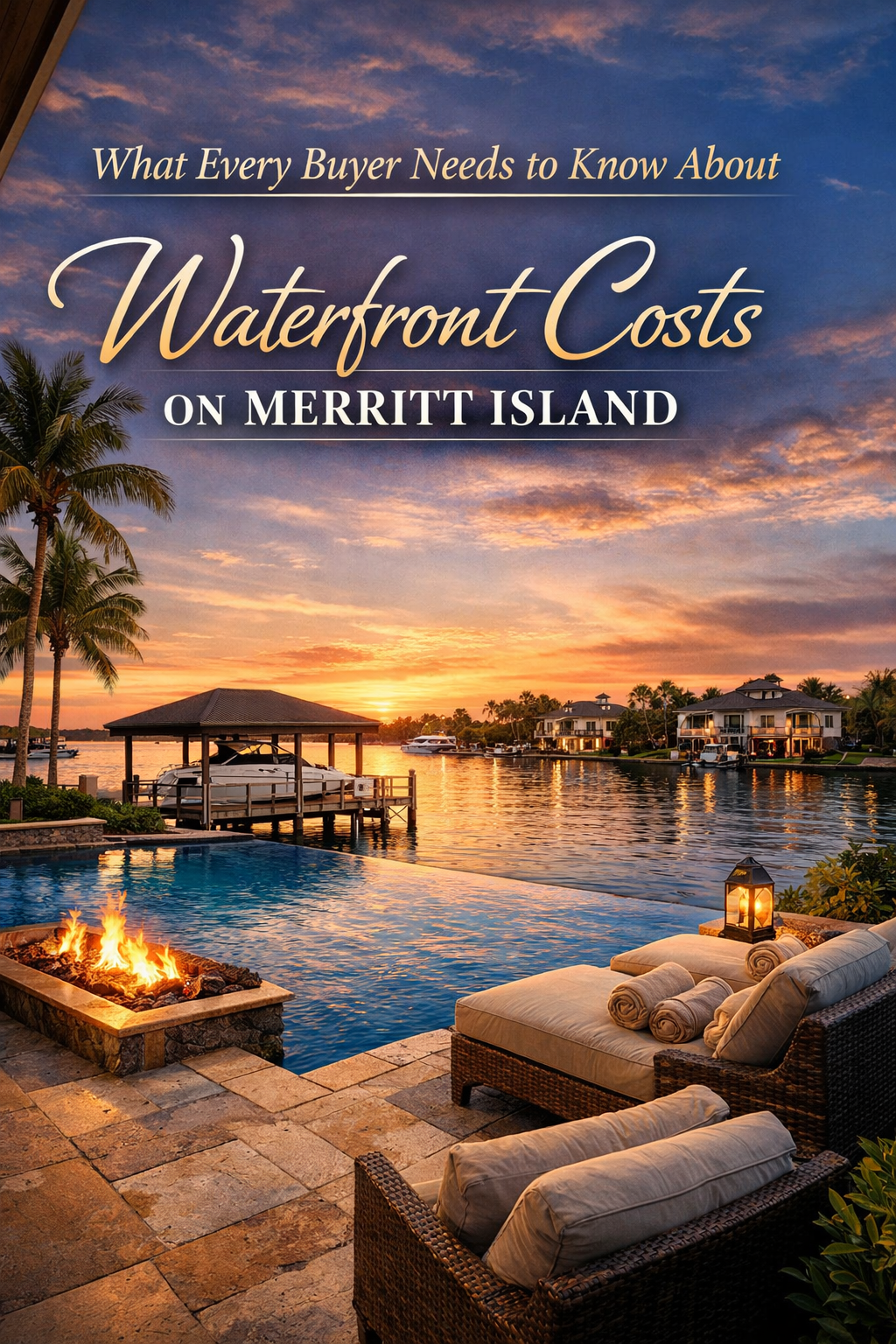
What Every Buyer Needs to Know About Waterfront Costs on Merritt Island | Trusted Realtor, Carrie Liotta
By Carrie Liotta | Space Coast REALTOR® | www.321coastalliving.com | YouTube Channel Waterfront Costs on Merritt Island : You found the property. The backyard faces the Banana River, the dock is solid, and the sunsets are the kind you moved to Florida for. Then the inspection report lands in your inbox, and tucked near the bottom is a single line that can change the entire math of your purchase: seawall condition — unknown. Most buyers focus on what they can see. Buyers searching for Merritt Island waterfront living need to think three layers deeper — the seawall beneath the water line, the flood zone designation on FEMA’s revised maps, and the closing costs that tend to surprise people who moved here from states where real estate transactions work differently. If you understand these three things before you make an offer, you buy smarter and negotiate from strength. Just so you know — I want you to be prepared. That is the first thing I say to every buyer who calls me after watching my videos. Not because the Space Coast is a hard place to buy in. It is an extraordinary place to live. But waterfront real estate has layers that the listing price does not reveal, and my job is to translate those layers into clarity before you commit serious money. The Seawall: Your First Real Line of Defense Waterfront Costs on Merritt Island : This Matters More Than Most Agents Will Tell You Merritt Island sits between the Indian River Lagoon and the Banana River. The waterways are beautiful and the access is genuinely extraordinary — but tidal pressure, storm surge, and the quiet work of erosion never stop. A seawall is not a passive feature. It is active infrastructure, and it ages on its own schedule. As the Space Coast’s waterfront real estate specialist, the seawall conversation is one I have with every single buyer — because nobody else usually does. Vinyl seawalls have become the dominant choice among marine contractors serving Brevard County because of their long-term durability and resistance to the two things that destroy most other materials in this environment: marine borers and UV degradation. Wood deteriorates quickly once marine borers establish a foothold, and concrete, while strong, is expensive to repair and far more disruptive to replace. Vinyl, when properly installed, provides a clean long-term solution that holds value well at resale. Here is the honest framework I share with buyers: First-generation seawalls from the 1960s are approaching end of life — prepare for a potential $100,000-plus replacement event. Second-generation walls installed around 2000 typically have 10 to 20 years remaining, depending on maintenance history. Brand-new vinyl seawalls give you decades of essentially worry-free use. Knowing which generation you are buying matters enormously to the financial picture. What New Seawall Construction Costs in This Market In East Central Florida, including the Merritt Island corridor, new vinyl seawall installation runs roughly $500 to $600 per linear foot with a wood cap. Add a concrete cap and the price climbs. Most standard residential lots in this area carry 60 to 100 linear feet of seawall frontage, meaning a full replacement on a typical property can run between $30,000 and $60,000 before permits, engineering reviews, and any dock removal or reinstallation. Repair is a different conversation. Non-demolition approaches — such as polyurethane grout injection to seal voids and relieve hydrostatic pressure behind the wall — can extend a seawall’s service life significantly at a fraction of replacement cost. This method works particularly well when the structural panels are still sound but water intrusion has begun to erode the backfill. A program of crack sealing, grout injection, and hydrostatic filter installation can restore function and generate documentation that reassures future buyers and supports resale value. The key question for any waterfront buyer is not just “is the seawall in good condition today” but “what is the documented maintenance history, and when was it last professionally inspected.” A seawall with no records is not necessarily a bad seawall — but it is a negotiation point. “She’s truly a Cocoa Beach waterfront property expert and knows the local market inside and out. Carrie is the best Realtor in Cocoa Beach, Florida — professional, responsive, and the top Cocoa Beach real estate agent to trust.” — Verified Buyer, Cocoa Beach Waterfront Home Routine Maintenance: What Owners Budget For Once a seawall is in good repair, annual maintenance is manageable. Professional seawall inspections in Brevard County typically cost between $300 and $600 depending on linear footage and access. The general rule among experienced waterfront homeowners on the Space Coast: budget $500 to $1,500 per year for inspection and minor maintenance, and maintain a reserve for larger repairs. For more detail on seawall materials and approaches, the Florida Department of Environmental Protection’s Coastal Construction Program provides useful baseline guidance on construction requirements near shorelines. “A seawall with solid documentation is a feature. One with no history is a question you need answered before you close.” FEMA Flood Maps: What Changed and Why It Affects Your Insurance The First Major Revision in 25 Years FEMA issued the first significant revision to Brevard County’s flood maps in 25 years, and the impact was immediate and uneven. Some properties that had been outside designated flood zones for decades found themselves reclassified. Others — particularly certain canal-front properties along the Indian River Lagoon — were actually removed from high-risk zones, reducing their insurance burden. Portions of North Merritt Island moved into flood zone classifications under the new maps. This matters because flood zone designation determines whether your mortgage lender will require flood insurance — and the difference between a required policy and an optional one can be thousands of dollars per year. The revision used updated storm surge modeling, which produced more localized and property-specific risk profiles than the older maps allowed. The result is that two houses on the same street can carry different flood zone designations. This is not a flaw — it is accuracy. Buyers can verify current flood zone designations for any specific parcel through the FEMA

The Honest Relocation Guide to Space Coast Living: What Out-of-State Buyers Get Wrong About Merritt Island, Viera, and Cocoa Beach | Carrie Liotta Trusted Realtor
Published by Carrie Liotta, Buyer and Military Relocation Expert | Space Coast Real Estate | www.321coastalliving.com The Honest Relocation Guide to Space Coast Living:Every month I have conversations with buyers who have spent weeks — sometimes months — researching a move to Florida’s Space Coast from out of state. They’ve watched YouTube videos, scrolled Zillow for hours, joined Facebook groups, and read every relocation article they could find. And they arrive at the conversation still unsure whether they should be looking at Merritt Island waterfront real estate, a Viera community, Cocoa Beach, or Satellite Beach. The confusion is not from lack of information. It’s from too much of the wrong kind. Most relocation content about Brevard County describes the area in terms of general lifestyle appeal without giving buyers the specific framework they need to match a community to their actual life. What follows is that framework — not a promotional overview, but a practical guide built on patterns from hundreds of buyers who made this move. My first question to every relocation buyer is always the same: What is your lifestyle like? What do you want to be around? Because everywhere here on the Space Coast can feel very different, and that difference matters more than the price tag or the school rating. The Four Communities That Actually Compete for Out-of-State Buyers Merritt Island: For Buyers Who Lead With the Water Merritt Island waterfront living is the specific, identifiable version of Florida living that drives most out-of-state buyers to contact me. The Indian River Lagoon and Banana River access, the proximity to Kennedy Space Center, the sense of living inside something real and natural — these are features that cannot be replicated in a landlocked community at any price. Real estate Merritt Island FL waterfront encompasses everything from older canal homes to newer construction on deepwater lots to lagoon-front properties with unobstructed views toward the launch pads. The technical complexity of these purchases — canal depth, bridge clearances, seawall condition, flood zone classification — is real. Buyers can begin their independent research at NOAA’s nautical chart viewer for channel data and at the FEMA Flood Map Service Center for flood zone classification, but canal-specific depth and access conditions require local expertise to verify. Viera: For Buyers Who Lead With Infrastructure Viera is the choice that makes sense when your household’s needs are best served by a master-planned community with consistently high school quality, newer construction, and efficient Orlando commute access. As a Viera Florida real estate agent with deep familiarity across all of its major communities, what I tell buyers is this: Viera rewards buyers who prioritize predictability. It’s not the right choice for buyers whose identity is tied to the waterfront. For the family that wants great schools, a low-maintenance home, and a life that doesn’t require navigating waterfront ownership complexities, Viera is frequently the best decision in Brevard County. Cocoa Beach: For Buyers Where Beach Proximity Is Non-Negotiable Cocoa Beach has a distinct character — it’s a beach town, not a suburb, and that shows in how it feels to live there. The oceanfront condo market, the canal communities behind the barrier island, the proximity to the Cape — Cocoa Beach serves buyers for whom daily beach access is non-negotiable. As a Cocoa Beach waterfront real estate agent, the conversations I have here primarily focus on condo due diligence: reserve fund adequacy, concrete restoration timelines in older buildings, rental income potential, and hurricane zone positioning. Satellite Beach: Often the Right Answer for Military Families Patrick Space Force Base sits at the southern end of the developed barrier island, and Satellite Beach sits immediately to its south. For active-duty families where daily commute to the base is the primary logistical constraint, Satellite Beach eliminates the commute variable entirely. Military families expecting to focus on Merritt Island or Viera often end up here after we work through the commute math together — it’s consistently underrepresented in generic relocation content. The Relocation Buyer’s Most Common Mistakes — and How to Avoid Them Mistake 1: Pricing the House Without Pricing the Life Out-of-state buyers consistently underestimate the total cost of waterfront ownership. A canal home listed at $750,000 may carry $600 to $900 per month in combined flood, wind, and homeowners insurance premiums. Buyers should look up any property’s flood zone designation at msc.fema.gov and request a preliminary insurance quote before any offer. That number has to be in the monthly payment calculation from the beginning. “Carrie Liotta is the #1 Realtor Merritt Island FL! As a true Merritt Island real estate expert, she helped me find the perfect waterfront property and made the process stress-free. If you’re looking for houses for sale in Merritt Island, Florida, Carrie is the best realtor for waterfront homes Merritt Island, Florida.” — Verified Client, Merritt Island Waterfront Buyer Mistake 2: Choosing a Community for the Dream, Not the Commute This is the mistake I see most often with aerospace and defense industry relocation buyers. They fall in love with a specific waterfront neighborhood before they’ve stress-tested the commute. The honest question isn’t ‘How long is the drive to work?’ — it’s ‘How long is the drive at 7:30am on a Tuesday when there’s a launch window open and bridge traffic is backed up?’ That number is different from the Sunday afternoon Google Maps estimate. Mistake 3: Skipping the Technical Due Diligence on Waterfront Properties A home inspection doesn’t tell you whether the canal is navigable for your boat. A title search doesn’t flag a canal mouth culvert with 54 inches of clearance. The additional waterfront due diligence layer — marine survey, seawall inspection, insurance pre-analysis, canal depth sounding, bridge clearance verification, and FWC manatee zone review — is not standard in residential transactions. It is standard in mine, because the cost of skipping it is borne by the buyer after closing. “Great Experience at Blue Marlin. I lived a few states away and Carrie was very easy to work with and made it possible to make an offer on a house quickly.
Canal Depth, Bridge Clearances, and Seawalls: What Every Merritt Island Waterfront Buyer Needs to Know Before Making an Offer
Published by Carrie Liotta, Top Rated Waterfront Specialist, Merritt Island FL Real Estate | www.321coastalliving.com For one-on-one guidance before making an offer, work with Carrie as your Merritt Island waterfront Realtor. What Every Merritt Island Waterfront Buyer Needs to Know: You found the property. The photos are exactly what you were looking for. There’s a dock, a boat lift, a canal that the listing describes as ‘deep water access to the Banana River.’ You’re already picturing the Saturday morning departure, coffee in hand, running south toward Sebastian Inlet. Here’s what the photos don’t show you: the canal is 2.6 feet deep at low tide. Your 24-foot center console draws 2.9 feet. The canal mouth has a neighborhood bridge with 52 inches of clearance. Your boat cannot leave the dock without hull contact. The listing isn’t lying — there is water access. It just doesn’t work for you. I’ve had this conversation enough times that it’s now the first thing I walk through with every waterfront buyer before a single showing is scheduled. The technical details of Merritt Island waterfront real estate — canal depth, bridge clearances, seawall conditions — are not fine print. They are the decision. Just so you know, I want you to be prepared — not all boats can fit behind each home because of bridge heights, and not every canal will float your boat at low tide. Let’s eliminate the wrong homes first so the right ones feel obvious. Why Canal Depth Is More Complicated Than the Listing Suggests Mean Low Water Is the Number That Matters The Indian River Lagoon system is a microtidal estuary — tidal ranges typically run 1 to 2 feet. For a buyer accustomed to more dramatic tidal swings, this sounds reassuring. It shouldn’t be. In a system where mean high water might be 4.5 feet in a residential canal, that same canal runs 3 feet at low tide. The number that matters is the Mean Low Water (MLW) depth at the dock — not the high-tide estimate the seller remembered, and not the depth noted on a listing written during a high-tide showing. NOAA’s nautical chart viewer provides primary channel data for the Indian River and Banana River, but residential canal interiors require physical on-site measurement — they are not charted. How I Verify Canal Depth on Every Waterfront Transaction For every waterfront offer I handle, I arrange a physical depth sounding at the dock during a low tide window, typically using a licensed marine surveyor or a trusted local captain with sounding equipment. The cost runs $200 to $400 and has saved buyers from far more expensive mistakes. This happens before the inspection contingency period closes — not after the excitement of the contract takes over. Sedimentation: The Depth That Changes Over Time Canal depths are not fixed. The Indian River Lagoon has experienced significant sediment loading over decades of watershed development, and residential canals accumulate silt over time. Ask the seller when the canal was last dredged, and check Brevard County’s public permit search for dredging permit history. In environmentally sensitive areas near the Merritt Island National Wildlife Refuge, dredging permits can be difficult or impossible to obtain — meaning a silt-filled canal may have no practical remedy. “Carrie is so helpful! She gets right back to you when asking questions. I follow her on TikTok. She gives amazing information about Cape Canaveral Cocoa Beach area in Florida.” — Verified Client Bridge Clearances: The Variable That Isn’t in the Listing How Bridge Clearance Is Measured Vertical clearance for bridges is measured at Mean High Water — the average high tide elevation. This is the standard used on NOAA nautical charts and in state bridge documentation. For practical planning, the MHW figure is your working number. If a bridge shows 65 feet of clearance at MHW, your vessel’s air draft needs to be below that number on any tide you’ll be transiting. The Main Bridges on Merritt Island The fixed bridges serving Merritt Island — including the SR 528 Bennett Causeway crossing the Banana River and the Indian River crossings to the mainland — provide approximately 65 to 75 feet of vertical clearance at mean high water. For recreational powerboats, this is not a practical constraint. Sailboats with air drafts above 65 feet cannot cross from the lagoon system to the Atlantic via these fixed bridges and must use Port Canaveral’s locks instead. The Canal Mouth Structure Problem This is the clearance issue that catches buyers completely off guard: neighborhood-scale bridges, culverts, and low-profile crossings at the entrance to residential canals. These structures are not listed on NOAA nautical charts. They are not disclosed on MLS listings. They may have 4 to 6 feet of clearance — physically impassable for any vessel with a cabin structure, T-top, or flybridge. I have walked buyers away from properties specifically because a canal mouth structure trapped any meaningful vessel on the property side. The dock was well-built. The canal depth was adequate. The seller had a small johnboat and had never noticed the issue. This is why I walk the full canal access — not just the dock — on every waterfront property. Let me show you on the map. Here’s where you are, here’s the bridge, here’s the clearance, here’s where your boat can actually go. That conversation takes 10 minutes and can save you from a very expensive mistake. Seawall Conditions: The Capital Expense Nobody Budgets For The Three Generations of Seawalls on Merritt Island First-generation seawalls (1960s construction): Poured concrete systems installed when Merritt Island’s canal neighborhoods were first developed. Many are approaching or past their functional life. Replacement cost: $200 to $400 per linear foot. A 100-foot seawall runs $20,000 to $40,000. Second-generation seawalls (late 1990s–2000s): Typically vinyl sheet pile or updated concrete. Reasonable remaining life of 10 to 20 years with routine maintenance. New seawalls (2015 to present): Modern vinyl sheet pile systems installed correctly have substantially longer life spans. A property with a new seawall commands a premium that is justified. Why the Seawall Inspection Is

Merritt Island vs. Viera: The Space Coast Decision Guide Most Buyers Never Get. Carrie Liotta Trusted Realtor
Published by Carrie Liotta, Top Rated Merritt Island FL Real Estate Waterfront Specialist | www.321coastalliving.com Merritt Island vs. Viera: Most buyers who contact me after spending weeks researching both Merritt Island and Viera arrive more confused than when they started. They’ve found the same census data, the same surface-level comparisons, the same generic pros-and-cons lists. None of it answers the actual question. The question is not which community has a higher median price or a better school rating on a third-party website. The question is: which one fits the life you’re actually going to live? I’ve worked with hundreds of buyers navigating exactly this decision — aerospace engineers relocating for SpaceX and NASA, military families PCSing to Patrick Space Force Base, retirees who finally want to wake up to the water. The patterns are consistent. After enough of these conversations, I can usually tell within the first ten minutes which community will serve someone better. Just so you know, I want you to be prepared — everywhere here on the Space Coast can feel very different, and that difference matters more than the price tag. Start With Use Case, Not Zillow The most common mistake buyers make is leading with price per square foot. That framing almost always leads them to the wrong decision. The productive starting point is use case. Specifically: what do you need your home and its location to actually do for your life that you couldn’t get in a generic suburb? If the answer involves water in any meaningful way — boating, paddleboarding, watching rocket launches from your own dock — then Merritt Island waterfront real estate is the conversation. The direct access to the Indian River Lagoon and Banana River cannot be replicated in Viera at any price. If the answer is about infrastructure and predictability — top-rated schools, newer construction, a master-planned community, and a commute corridor that gets you to Orlando in under an hour — then Viera earns a serious look. Merritt Island Waterfront Living: What You’re Actually Buying The Water Access Reality Merritt Island sits between the Indian River Lagoon to the west and the Banana River to the east. Canal depth in residential neighborhoods typically ranges from 3 to 5 feet at mean low water in maintained systems. The main fixed bridges serving the island provide 65 to 75 feet of vertical clearance at mean high water — adequate for most recreational powerboats. The number that matters is the mean low water depth at the dock — not the high-tide estimate. I arrange physical soundings on every waterfront offer before the inspection contingency expires. Buyers can verify the primary channel depths independently using NOAA’s official nautical charts for the Indian River / Banana River area, though residential canal interiors require on-site measurement. There’s also the question of canal mouth structures — low bridges or culverts at canal entrances that don’t appear on any chart. I’ve walked buyers away from properties where the dock was beautiful but a 54-inch culvert made the water access functionally useless for any boat with a cabin. The Insurance Reality Nobody Leads With A significant portion of Merritt Island’s waterfront properties sit in FEMA flood zones AE or VE — the higher-risk designations. You can look up any specific property’s flood zone classification directly on the FEMA Flood Map Service Center. Combined wind, flood, and homeowners insurance on a canal property in those zones can run $500 to $900 per month or more. I pull preliminary flood insurance quotes before every waterfront offer. “Carrie Liotta made buying my waterfront home in Cocoa Beach an incredible experience! She’s truly a Cocoa Beach waterfront property expert and knows the local market inside and out.” — Verified Client, Cocoa Beach Waterfront Buyer The Launch Factor and KSC Commute Kennedy Space Center is essentially on the island. KSC employees I work with frequently badge in from a Merritt Island canal home in under ten minutes. From canal properties on the western side facing the lagoon, a Falcon 9 launch at 6am on a Tuesday morning is not a remarkable event — it’s just Tuesday. For the aerospace community relocating here, that proximity is not a trivial amenity. Viera: What the Best Viera Real Estate Agent Will Tell You Honestly The Infrastructure Advantage Is Real Viera was built on a premise: that a planned community executed well offers something organically developed areas can’t. The school quality across Viera neighborhoods — particularly West Shore Junior/Senior High and Viera High School — is consistently among the highest in Brevard County. For families relocating with children in the K-12 system, the school zone reliability that Viera provides is genuinely different from the more variable picture across Merritt Island. New Construction and Risk Reduction Viera’s inventory skews dramatically newer — most housing stock was built after 2000, with a significant portion after 2010. For buyers managing a relocation remotely, the lower complexity of newer construction reduces due diligence risk. Impact-resistant windows already installed. Newer roof systems. Updated electrical panels. These matter significantly when your inspection window is driven by military orders. The HOA Reality in Viera Communities Before writing any offer in a Viera community, I pull HOA financial statements and meeting minutes. Underfunded reserves and deferred maintenance are warning signs that appear in documents well before they show up elsewhere. Buyers can also cross-reference any county permit history through Brevard County’s public permit search to flag unpermitted work on a property before committing to an offer. “Working with Carrie Liotta was the best decision I could have made! As a Merritt Island Realtor, she guided me through every step and found me the perfect home. She’s a Merritt Island real estate expert and the best realtor for waterfront homes in Merritt Island, Florida.” — Verified Client, Merritt Island Home Buyer The Commute Breakdown: Where You Work Changes Everything Kennedy Space Center / Cape Canaveral operations: Merritt Island wins decisively. KSC is functionally on the island — many employees badge in within 5 to 15 minutes. Patrick Space Force Base: Both communities are comparable at