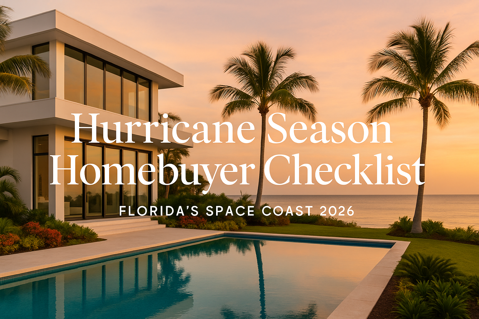
June 1 is almost here — and if you’re buying or already own a home on Florida’s Space Coast, that date matters more than most people realize. I get asked all the time: “Carrie, is it risky to buy in Florida during hurricane season?” My honest answer: not if you know what you’re doing. Brevard County has come through major storms — Matthew, Irma, Ian — and the buyers who were prepared didn’t just survive hurricane season. They thrived. The ones who got caught off guard? They wish someone had handed them a checklist before closing. So here it is. Your complete hurricane season homebuyer checklist for the Space Coast. What Every Space Coast Homebuyer Needs to Do Before Closing ✅ 1. Understand the Flood Zone — Before You Make an Offer This is non-negotiable. Brevard County spans multiple FEMA flood zones — from Zone X (minimal risk, no flood insurance required) to Zone AE (high risk, flood insurance required by your lender). Where your specific property sits determines your insurance costs dramatically. A home in Zone X on the barrier island might be two blocks from one in Zone AE — and the difference in annual flood insurance cost can be $1,500 to $4,000+ per year. I covered the full 2026 FEMA map updates in my post: New FEMA Flood Maps for Brevard County: What Homeowners and Buyers Need to Know. You can look up any property’s exact flood zone on the FEMA Flood Map Service Center, or pull detailed parcel data from the Brevard County Property Appraiser. I always check both before my clients fall in love with a house. ✅ 2. Get a Wind Mitigation Inspection — It Could Save You Thousands This is the single most financially impactful thing a Brevard homeowner can do. A wind mitigation inspection assesses how well your home can withstand hurricane-force winds — roof shape, roof-to-wall connections, opening protection, and more. Under Florida Statute §627.0629, insurance companies are required to offer premium discounts for wind-resistant features — discounts that can reach up to 88% off the windstorm portion of your policy. On a Brevard home, that can mean $800 to $2,500+ per year in savings. The Florida Office of Insurance Regulation updated the official wind mitigation form (OIR-B1-1802) effective April 1, 2026 — if your inspection is more than a few years old, it may need to be redone to lock in your discounts. Cost: typically $75–$150. ROI: potentially thousands per year. Do it. ✅ 3. Check Your Evacuation Zone Brevard County uses an A–F evacuation zone system. Zone A is the highest risk (barrier islands, coastal areas), Zone F is the lowest. Check your property’s zone at the Brevard County Emergency Management website before making any offer — and bookmark the Brevard County Shelter Locator while you’re there. This doesn’t mean you shouldn’t buy in Zone A — Cocoa Beach and Satellite Beach are Zone A and they’re wonderful places to live. It means you need a plan. Know your route, know where you’re going, and go early before the highways clog. If you’re weighing neighborhoods specifically for flood risk and evacuation access, read my post on Brevard neighborhoods without the flood zone risk — it’s one of the most practical guides I’ve written. ✅ 4. Understand Impact Windows, Shutters, and Opening Protection One of the most common questions I hear from buyers relocating from out of state: “Does the house have hurricane shutters?” Homes built after 2002 generally meet modern Florida Building Code wind requirements. Homes built before 1994 may have single-pane windows with zero hurricane protection. Impact-resistant windows are the gold standard — no storm prep required, insurance discounts, and quieter daily living. Accordion shutters are the most convenient manual option. Panel shutters work but require installation before every storm. If you’re looking at waterfront property, opening protection is only one piece of the puzzle — read my full guide on seawalls in Brevard County for the other factors coastal buyers often miss. And for an honest look at waterfront ownership costs overall, check out Merritt Island waterfront costs: 3 expenses buyers miss. ✅ 5. Ask About the Roof — Age, Material, and Permits In Florida, a roof over 15–20 years old can make it nearly impossible to get homeowners insurance — or result in sky-high premiums. Ask before making any offer: How old is the roof? What material? Were permits pulled for the last replacement? Metal roofs last 40–70 years and earn the best insurance discounts. Asphalt shingles typically run 15–25 years. An unpermitted roof is a nightmare at closing — lenders don’t like them and neither do insurers. The Florida Department of Business and Professional Regulation has good guidance on what to look for in a licensed roofing contractor if a replacement is needed. A brand-new roof on a Brevard home is a selling point and a negotiating tool — it’s worth real money in insurance savings. ✅ 6. Apply for My Safe Florida Home — Free Inspection + Up to $10,000 in Grants This program is genuinely underused. The My Safe Florida Home program offers a free wind mitigation inspection and matching grants up to $10,000 for hurricane hardening improvements — impact windows, impact doors, and roof upgrades. Eligibility: homesteaded single-family homes with an insured value under $700,000. If you’re buying a home and planning improvements anyway, apply at MySafeFLoridaHome.com first. It’s real money left on the table if you don’t. You can also learn more about available programs through the Florida Division of Emergency Management’s preparation resources. Brevard County Hurricane Season Basics — For New Residents If you’re relocating to the Space Coast, here’s what locals already know: Hurricane season: June 1 – November 30. Peak activity: August through October. Brevard’s track record: We’re on the Atlantic side, which gives us some protection compared to the Gulf Coast — but we’re not immune. Hurricane Matthew (2016) caused significant damage along the barrier island. Irma (2017) brought flooding and wind damage countywide. Evacuation orders:
Brevard County, Florida real estate is shaped by beachside communities, waterfront homes, aerospace and defense jobs, military relocation, new construction, schools, flood zones, insurance, and city-by-city lifestyle differences across the Space Coast. This hub collects Carrie Liotta’s local guidance on buying, selling, relocating, comparing communities, and making smarter real estate decisions throughout Brevard County.

Can a Condo Special Assessment Kill Your Deal in Brevard County? What Buyers and Sellers Need to Know
By Carrie Liotta, Space Coast REALTOR® — Published May 20, 2026 Can a Condo Special Assessment Kill Your Deal, Quick answer: A condo special assessment in Brevard County won’t automatically kill a deal — but not knowing about one before you go under contract absolutely will. Florida’s post-Surfside laws have made special assessments far more common across the Space Coast, especially in older buildings in Cocoa Beach, Cape Canaveral, Satellite Beach, and Indian Harbour Beach. Buyers need to review the reserve study, 12 months of board meeting minutes, and the milestone inspection report before signing. Sellers need to disclose pending assessments — even unvoted ones — to keep deals on track. A condo deal I watched fall apart last month had nothing to do with the price, the inspection, or the buyer’s financing. It fell apart because of a document nobody asked for until it was too late — and by then, the buyer had already wired earnest money. If you’re buying or selling a condo anywhere in Brevard County — Cocoa Beach, Merritt Island, Cape Canaveral, Viera, Satellite Beach, Indian Harbour Beach — this is the conversation that comes up constantly, and most people have no idea it’s coming until they’re already under contract. Here’s what you actually need to know. Can a Condo Special Assessment Kill Your Deal: What Is a Condo Special Assessment? A special assessment is a charge your condo association bills to every unit owner on top of their regular HOA dues. It exists to cover major capital work the reserve fund can’t handle — roofs, elevators, seawalls, structural concrete, milestone repairs. And here’s what most buyers misunderstand: a special assessment is not automatically a red flag. Every condo building on earth eventually needs major work. Concrete spalls. Elevators wear out. Roofs come due. Seawalls fail — and if you’re considering a waterfront condo, you’ll want to read my guide on how seawalls work in Brevard County before you sign anything. The real question isn’t whether the building needs work. It’s whether the association has been saving for it — or ignoring it for years and now handing you the bill. Why Special Assessments Have Exploded Post-Surfside The June 2021 collapse of the Champlain Towers in Surfside changed Florida condo law permanently. The state now requires older buildings to complete structural milestone inspections and actually fund their reserves at full levels. For decades, many condo associations across Florida — including here on the Space Coast — kept HOA dues artificially low by underfunding reserves. That worked until the new law made it illegal. Now, a lot of associations are staring at a gap, and the fastest way to close that gap is a special assessment. If you want the full breakdown of the law itself, I wrote a separate piece on what Florida’s condo safety laws mean for buyers and a follow-up on Florida’s new condo reserve requirements — both are required reading if you’re shopping in an older building. How a Special Assessment Affects Sellers If you’re a seller with a pending assessment, two things happen. First, buyers will subtract that assessment from their offer — dollar for dollar. If the assessment is $25,000 per unit, your strongest offer will come in $25,000 lower than what you would have gotten without it. There is no real negotiation around this. It’s math, and savvy buyers do it before they sign. Second, if the assessment is large enough, it can knock out conventional financing entirely. When lenders see a major pending assessment on the HOA’s books, they often refuse to underwrite a loan in that building until it’s resolved. That pushes you into a cash-buyer-only market — and cash buyers know they have leverage. Expect aggressive offers. For a deeper look at how this plays out in transactions, my post on how special assessments affect your sale price walks through real numbers. How Buyers Should Protect Themselves Before Closing If you’re buying a condo in Brevard County — especially near the beach or on waterfront — the price, the view, and the monthly HOA fee are not enough. You need to understand the financial health of the building, the upcoming repairs, the reserve funding, and whether a special assessment may be coming. Three documents are non-negotiable: These three documents tell you whether you’re buying into a well-run association or inheriting someone else’s deferred problem. Why This Matters Even More for Out-of-State Buyers If you’re relocating to the Space Coast from out of state — and a lot of my clients are — condo documents are easy to skim over from 1,200 miles away. The financials feel abstract until you’re three weeks from closing and the management company sends a notice that a $40,000 assessment was just approved. That’s the email I get most often. And by then, the buyer’s options are limited: terminate the contract and lose time and inspection money, or close anyway and absorb the assessment. If you’re trying to decide between a condo and a single-family home on the Space Coast in the first place, my guide on condo vs single-family on the Space Coast covers the tradeoffs honestly — assessments included. Florida’s Disclosure Rule Sellers Often Miss Here’s a rule a lot of sellers — and even some agents — don’t understand: Florida law requires you to disclose a pending special assessment, even if it hasn’t been formally voted on yet. If it’s been discussed at a board meeting, it’s likely disclosable. I know that feels counterintuitive. Sellers think, “It hasn’t been voted on, so technically there’s no assessment.” But buyers who find it on their own — through their attorney, their lender, or a careful read of the meeting minutes — are far harder to deal with than buyers who were told upfront. Transparency builds trust. And trust is what gets deals to the closing table. The Real Lesson A special assessment is not a deal-killer on its own. It’s only a deal-killer when it shows up as a surprise. Having the information before you’re under contract — not after — is what

Seawalls in Brevard County: What Every Waterfront Buyer Needs to Know Before Making an Offer. Trusted Realtor, Carrie Liotta
By Carrie Liotta, REALTOR® | Boardwalk Realty | May 16, 2026 Seawalls in Brevard County: If you’re researching waterfront property in Brevard County, here’s the short answer on seawalls: they are one of the most expensive and most overlooked issues in Space Coast real estate right now — and the county is actively moving away from them. A failing seawall can cost $60,000 to $120,000 to replace. It can look perfectly fine from the surface while silently failing underneath. And unpermitted seawall work can kill your closing. I put together this video to walk you through exactly what’s happening with seawalls on the Space Coast, what you should do before making an offer on a waterfront home, and why the alternatives to traditional seawalls are worth understanding before you sign anything. Seawalls in Brevard County: Why Seawalls Are a Bigger Deal Here Than in Most Florida Markets Brevard County sits along the Indian River Lagoon — 156 miles of estuary running through the heart of the Space Coast. It’s one of the most biologically diverse estuaries in North America: manatees, dolphins, seagrass, and thousands of species. The lagoon is also why people want to live here. Waterfront homes in this county command a real premium, and the Indian River, Banana River, and the canals throughout Merritt Island and Cocoa Beach are central to that value. But the lagoon is struggling. Decades of pollution, nutrient runoff, and ecological stress have taken a toll — and here’s what surprises most buyers: traditional seawalls are part of that problem. A vertical seawall doesn’t absorb wave energy. It reflects it. That reflected energy increases erosion at the base of the wall and on neighboring properties. Seawalls also block the natural movement of sand and sediment, and they eliminate the intertidal zone — the narrow strip of shoreline between high and low tide where mangroves grow, horseshoe crabs nest, and oysters filter the water. A vertical concrete wall wipes all of that out. Brevard County’s own natural resources director has said publicly that seawalls are the easy way to stabilize a shoreline, but they are not good for wildlife, not good for water clarity, and not good for the lagoon. That’s not a fringe position — it’s the county’s official stance, and it’s backed by real dollars. In 2024, Brevard kicked off a $4.2 million living shoreline project at Titusville Causeway, bringing in over 4,000 cubic yards of sand, native vegetation, and 650 wave attenuation devices offshore that function like an artificial reef. They even dropped a million baby clams via drone to help filter the water. That’s the direction this county is heading. As a buyer, you need to understand that shift — because it affects what you can build, what your alternatives are, and what the long-term value of a waterfront property looks like. If you’re weighing the true costs of Merritt Island waterfront ownership, seawalls belong near the top of that list. Piece of Advice #1: Get a Seawall Inspection Before You Make an Offer This is non-negotiable, and I say that as someone who has seen what happens when buyers skip it. A seawall can look perfectly fine from the surface. No cracks. The cap looks solid. The wall is standing straight. And underneath, the tieback rods anchoring the entire structure are completely rusted through. The fill behind the wall is washing out. You could be weeks away from a failure — and you would never know it just by looking. Your standard home inspector does not cover this. You need a licensed marine contractor who specifically knows marine construction to assess the actual structural integrity of the wall. This is a separate, specialized inspection — and it is worth every penny. Here’s what you’re protecting yourself from: seawall replacement runs $700 to $1,200 per linear foot, and sometimes more depending on materials and access. A typical 80 to 100-foot residential seawall can cost between $60,000 and $100,000 to replace. That is not a number you want to discover after closing. Practical advice: Make the seawall inspection a condition of your offer. Use what you find to negotiate. And if the seller can’t tell you when the seawall was last inspected or repaired, treat that as a red flag — not a minor gap. For a deeper look at what a proper inspection involves, see this seawall inspection guide for Brevard County. Piece of Advice #2: Know Your Alternatives — the County Already Does If you own waterfront property and your seawall is aging — or if you’re buying a property where the seawall is near end of life — you do not automatically have to replace it with another vertical concrete or vinyl wall. The county actually prefers you don’t. Here are the main alternatives: Rip rap — a sloped arrangement of rocks along the shoreline. More wildlife-friendly than a vertical wall, considered a middle-ground option that Brevard County views much more favorably from an environmental standpoint. Depending on your shoreline conditions, rip rap can also be less expensive than a full seawall replacement. Living shorelines — the full nature-based approach. Native plants, oyster beds, wave attenuation structures. These have more ecological benefit and are often less expensive upfront than a new seawall. They’re also potentially eligible for funding through the Save Our Indian River Lagoon program — a half-cent sales tax that Brevard voters approved in 2016, expected to generate over $586 million for lagoon restoration projects. That’s real grant money that may be available to help offset your costs. Even if your property ultimately requires a vinyl seawall because of its specific water exposure or lot configuration, you should at least have that conversation with a marine contractor before assuming it’s your only option. A good contractor will tell you honestly what makes sense for your property, your water exposure, and your budget. For more context on how seawall condition and replacement decisions affect resale value, this post on whether a new seawall adds value to your Merritt Island home is worth reading before you negotiate. Piece of Advice

New FEMA Flood Maps for Brevard County: What Homeowners and Buyers Need to Know in 2026
By Carrie Liotta, Space Coast REALTOR® | Published May 15, 2026 The short answer: FEMA has issued preliminary Flood Insurance Rate Maps (FIRMs) for Brevard County and its incorporated cities. If they’re adopted, your home’s flood zone designation — and your flood insurance premium — could change. Property owners have a 90-day statutory window to appeal proposed changes before the maps become effective. Here’s what every Brevard County homeowner, buyer, and seller should do right now. FEMA Flood Maps for Brevard County What’s actually happening with Brevard County flood maps The Department of Homeland Security’s Federal Emergency Management Agency (FEMA) has released preliminary FIRMs and Flood Insurance Study (FIS) reports for Brevard County, Florida and its incorporated areas — including Cocoa Beach, Melbourne, Palm Bay, Satellite Beach, Indialantic, Indian Harbour Beach, Cape Canaveral, Cocoa, Rockledge, Titusville, Melbourne Beach, and Merritt Island. These preliminary maps may include: Translation: a home that was in Zone X (lower-risk, flood insurance not federally required) under the old maps could end up in Zone AE (high-risk, flood insurance required if you have a federally-backed mortgage) — or vice versa. Why this matters in Brevard County specifically The Space Coast has unique flood exposure because of three things working at once: When FEMA updates a FIRM panel for Brevard County, it usually shifts coverage requirements for thousands of properties at once. A single neighborhood can have homes that move zones in opposite directions on the same block. What changes if your flood zone designation moves If you’re moved into a higher-risk zone (AE, VE, AO): If you’re moved into a lower-risk zone (X): A note from me: Even when flood insurance isn’t required, I tell my Brevard County clients to keep at least a minimum policy. More than 25% of NFIP flood claims come from properties outside high-risk zones. A storm doesn’t read your FIRM. How to check your current and proposed flood zone You can pull both your current zone and the preliminary proposed zone in about five minutes: If your address shows a different proposed zone than your current one, that’s when this article matters most to you personally. How the 90-day appeal window works Before the preliminary maps become legally effective, FEMA is required to give property owners and communities a statutory 90-day period to file appeals. You can appeal if you can provide scientific or technical data showing that the proposed BFE, depth, or boundary is incorrect for your property. Typical evidence: You file appeals through your local floodplain administrator (county or city), who forwards them to FEMA. For full appeal instructions and dates, FEMA’s official portal is floodmaps.fema.gov/fhm/BFE_Status/bfe_main.asp or you can call FEMA Map Information eXchange (FMIX) at 1-877-FEMA MAP (1-877-336-2627). What buyers should do right now If you’re shopping for Brevard County homes for sale, this is a moment to slow down by exactly one step: What sellers should do right now If you’re listing — or thinking about listing in the next 12 months: Frequently asked questions Are FEMA flood maps changing in Brevard County in 2026?Yes. FEMA has issued preliminary FIRMs and FIS reports for Brevard County and incorporated areas. They are not yet legally effective — the 90-day appeal period must run first. How do I find out if my home is in a flood zone in Brevard County?Use FEMA’s Map Service Center, the Brevard County Floodplain Administration page, or ask your insurance agent or REALTOR® for a current flood determination. Will my flood insurance premium go up if my zone changes?It can. FEMA’s Risk Rating 2.0 system prices each property individually based on elevation, building characteristics, and distance to water — but a move from Zone X to Zone AE typically increases premium and makes coverage mandatory for federally-backed mortgages. Can I appeal a new FEMA flood zone designation?Yes — there’s a statutory 90-day appeal window during the preliminary FIRM process. You’ll need technical evidence (most commonly an elevation certificate from a licensed surveyor) submitted through your local floodplain administrator. Which Brevard County neighborhoods are safest from flooding?Generally, the higher-elevation inland communities — parts of Viera, Suntree, West Melbourne, Rockledge, and Palm Bay — sit in or near Zone X under current maps. That said, individual lots vary, and the preliminary maps may shift some of these. Always check the specific address. Should I still buy flood insurance if I’m in Zone X?In my opinion, yes — at least a minimum policy. Over a quarter of NFIP flood claims come from properties outside high-risk zones. Florida storms don’t follow zone boundaries. The bottom line Brevard County flood maps are about to change. That’s not a reason to panic — it’s a reason to get informed before your neighbors do. If you check your zone, get an elevation certificate, and understand your appeal options now, you stay in control of the decision instead of finding out from your insurance renewal letter. If you’d like me to pull your specific address’s current and proposed zone, or you’d like a referral to a Brevard County-licensed surveyor for an elevation certificate, reach out for a no-pressure conversation. Your next chapter on the Space Coast should start with eyes wide open. Related reading on 321coastalliving.com: Want more like this? Subscribe to my weekly newsletter for Brevard County market updates, or join my private Facebook group Moving to Brevard County Florida for daily community insights. By Carrie Liotta, Space Coast REALTOR® | Boardwalk Realty | Serving Brevard County, FL

What do Florida’s condo safety laws mean for buyers on the Space Coast?
Florida’s condo safety laws mean for buyers: Florida post-Surfside legislation — including SB 4-D, SB 154, HB 1021, and HB 913 — requires older condo buildings to complete a Structural Integrity Reserve Study (SIRS) and Milestone Inspection, and prohibits associations from waiving structural reserve contributions. For buyers in Cocoa Beach, Satellite Beach, and Indialantic, this means low HOA fees on older buildings are now a red flag, not a selling point. Before going under contract, request the SIRS, the milestone inspection report, the reserve fund status, and the last 12 months of HOA board meeting minutes. By Carrie Liotta | May 11, 2026 If you’re thinking about buying an oceanfront condo in Cocoa Beach, Satellite Beach, or Indialantic right now, there’s a conversation we need to have before you fall in love with a unit. The condo landscape in Florida has changed significantly. Laws are in place today that didn’t exist before 2022. They affect what you’ll pay to live there, how much reserves a building is legally required to hold, and whether certain buildings are even insurable the way they used to be. Oceanfront condos on the Space Coast aren’t off the table — but they require more due diligence than they did five years ago, and most buyers aren’t doing enough of it.https://www.youtube.com/embed/imTpfSUnrqc Florida’s condo safety laws mean for buyers: What the Post-Surfside Laws Actually Changed After the Champlain Towers collapse in Surfside in 2021, Florida passed some of the most significant condo safety legislation in the country. Senate Bill 4-D started it. SB 154 refined it. HB 1021 added governance oversight. The most recent update, HB 913, went into effect July 2025. What all of this means for you as a buyer: buildings that were quietly deferring maintenance for decades have been forced to come clean. Some of that is showing up as special assessments. Some of it is showing up as dramatically higher HOA fees. Florida’s new condo reserve requirements have fundamentally changed the financial picture for a lot of buildings — especially older ones on the coast. I’m not telling you to avoid condos. I’m telling you to go in with your eyes open, because the information is now available if you know how to ask for it. Here are the three things every oceanfront condo buyer on the Space Coast needs to know right now. 1. Ask for the SIRS and Milestone Inspection Report — Before You Tour This is the most important thing I can tell you. Before you tour, before you make an offer, ask for two documents: the Structural Integrity Reserve Study (SIRS) and the Milestone Inspection Report. Florida law now requires buildings that are three stories or higher and 30 years or older to have these completed. For buildings near the coast, the trigger age drops to 25 years. If a building that should have these documents doesn’t have them yet, that’s a red flag — not a negotiating chip. Here’s what each document tells you: Under Florida’s current condo laws, you’re entitled to review these documents as a prospective buyer. If a seller or HOA won’t produce them, watch Carrie explain why that’s your signal to walk at 4:29. I had a buyer looking at an oceanfront condo in Cocoa Beach — beautiful building, incredible views, price that seemed like real value. We pulled the financials. The reserve fund was well below what the new mandatory funding requirements were going to require. The building had also deferred major seawall work. The HOA fees were about to move significantly, so we walked. Two streets over, the buyer found a building that had gotten ahead of the new requirements, completed their milestone inspection, and had a fully funded reserve. She paid a bit more per unit. She has not had a surprise assessment. That’s the difference between doing the homework and skipping it. Thinking about relocating to the Space Coast and want answers from people who already made the move? Join my private Facebook group, Moving to Brevard County, Florida — locals, newcomers, aerospace folks, and military families all in one place asking real questions and getting real answers. Or schedule a call directly: calendly.com/carrieliotta. 2. Low HOA Fees on Older Buildings Are Now a Red Flag This one catches buyers off guard. Since January 2025, Florida condo associations cannot vote to waive or reduce their structural reserve contributions. Before Surfside, owners could vote to skip reserve funding to keep monthly fees artificially low. That option no longer exists for structural components. What this means for you: buildings with aging infrastructure and underfunded reserves are going to be brought up to the legally mandated level. That means HOA fees are going up — it’s not a matter of if, but when and by how much. If you’re looking at a building built in the late 1980s or early 1990s that still has a very low monthly HOA, ask one direct question before you go any further: Has this building completed its SIRS, and is it currently funding reserves at the required level? The answer tells you whether the number you’re looking at today is the number you’ll be paying a year from now. If the monthly costs are a deciding factor in your decision between a condo and a single-family home on the Space Coast, this question matters more than almost anything else. 3. Special Assessments Are Real — and the Minutes Will Warn You In South Florida, some buildings issued special assessments in the six figures per unit after milestone inspections revealed years of deferred maintenance. That’s not the norm on the Space Coast, but the same underlying conditions exist in some buildings here — and the legislation has forced those buildings to confront what they’ve been ignoring. The cost of deferred work doesn’t disappear. It gets passed to owners. When you’re doing your condo due diligence, request the HOA board meeting minutes from the last 12 months. Special assessments don’t appear out of nowhere — they get discussed before they get issued. If there are conversations in those minutes about upcoming major
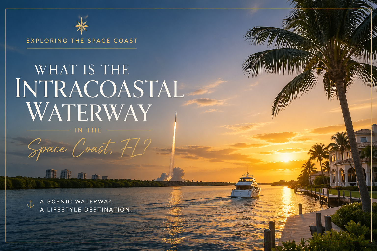
What Is the Intracoastal Waterway in the Space Coast, FL? Trusted Realtor, Carrie Liotta
What is the Intracoastal Waterway, and why does it run through the Space Coast? What Is the Intracoastal Waterway in the Space Coast, FL? The Intracoastal Waterway is a 3,000-mile protected water highway running from Massachusetts to Texas. On the Space Coast, it threads through the Indian River Lagoon and the Banana River — two saltwater estuaries that wrap around Merritt Island and define waterfront living in Brevard County, Florida. This stretch is unlike any other section of the ICW because it borders Kennedy Space Center, glows electric blue from bioluminescence in summer, and sits in one of the most biodiverse estuaries in North America. By Carrie Liotta | April 28, 2026 Most people who live near it have never heard of it. The Intracoastal Waterway — the ICW — is a 3,000-mile protected water highway that runs from Massachusetts all the way down to Texas. It’s not one continuous canal. It’s a stitched-together system of natural rivers, bays, sounds, and dredged channels that lets boats travel almost the entire Atlantic and Gulf coasts without ever heading out into open ocean. And right here in Brevard County, the ICW passes through one of the most unusual stretches in the entire country.https://www.youtube.com/embed/krC7Zab2LZ0 If you’re researching a move to the Space Coast — Cocoa Beach, Merritt Island, Viera, Rockledge, anywhere along this corridor — you’re going to hear “Intracoastal” thrown around constantly. In MLS listings. In neighborhood descriptions. In conversations with locals. Most relocation buyers nod along and figure it out later. Don’t do that. Understanding this waterway is the starting point for understanding the lifestyle, the property values, and honestly, why people who move here tend to stay. What the ICW actually is — and why it exists The Intracoastal Waterway was built so commercial and pleasure boats could move up and down the East and Gulf coasts without battling open-Atlantic conditions. Some of it is natural — rivers, lagoons, sounds. Some of it is human-engineered — dredged channels, locks, and connecting cuts. The Atlantic Intracoastal Waterway (the eastern half) runs from Norfolk, Virginia, to Key West, Florida. The Gulf section continues from there around to Brownsville, Texas. The federal government has maintained it since the 1800s, and the U.S. Army Corps of Engineers keeps it dredged to a navigable depth. What that means in practice: a boater leaving Maine in October can run all the way to the Florida Keys without ever needing to time an ocean crossing. They sleep in protected anchorages every night. They stop in towns along the way. And a huge number of those boaters end up stopping on the Space Coast — and never leaving. The Space Coast section is genuinely unlike any other Most of the ICW in Florida runs along narrow channels behind barrier islands — pretty, but predictable. The Brevard County stretch breaks the mold for three reasons. 1. It’s not really a “channel” here. It’s two huge estuaries. The ICW through the Space Coast actually runs through the Indian River Lagoon and the Banana River. Despite the names, neither is a river in the geological sense. They’re saltwater lagoons — long, shallow estuaries separated from the Atlantic by a narrow barrier island. They were named “rivers” centuries ago when settlers used the term loosely for any long, navigable waterway. The labels stuck. The Indian River Lagoon is roughly 156 miles long. It’s wide, shallow, and full of seagrass beds. The Banana River sits inside Merritt Island, separating it from Cape Canaveral. If you’ve looked at a map of the two waterways that define Merritt Island, you’ve already seen exactly how these two systems work together — and why an island sitting between them has such a different feel from a beachfront condo on A1A. 2. Kennedy Space Center literally reshaped it. When NASA built Kennedy Space Center in the 1960s, they reshaped the northern Banana River to support launch operations. Sections were closed off, others were dredged, and the security perimeter restricts boating in parts of the upper Banana River to this day. So you have rocket launches happening over the same water where manatees graze on seagrass. That’s not a brochure line. That’s the actual setup. 3. It’s one of the most biodiverse estuaries in North America. The Indian River Lagoon is officially recognized as one of the most biodiverse estuaries on the continent — over 4,300 species of plants and animals call it home. Manatees. Dolphins. Sea turtles. Bull sharks. Roseate spoonbills. Hundreds of fish species. The mix of fresh water (from rivers and runoff), salt water (from inlets), and brackish in-between creates a habitat range you genuinely can’t replicate elsewhere on the East Coast. If you’re trying to figure out where to actually live on this waterway — direct frontage vs. canal access vs. lagoon-view — that’s the conversation I have with relocation buyers every week. Start with my free 30-minute discovery call and we’ll map your priorities to the right pocket of the Space Coast. Bioluminescence: the Space Coast’s strangest summer perk Here’s something nobody tells you before you move down here: the Indian River Lagoon and Banana River glow in the summer. From roughly June through October, conditions in the lagoon trigger a bloom of bioluminescent dinoflagellates and comb jellies. When the water gets disturbed — by a paddleboard, a kayak paddle, a fish darting under your dock — it lights up electric blue. People charter clear-bottom kayak tours specifically to see it. Locals just take their kayaks out on a moonless August night. You’re not going to read that on a Zillow listing. But it’s the kind of thing that makes a Tuesday in September on the Space Coast feel different from anywhere else. What this means if you’re buying waterfront here If you’re shopping for a waterfront home on the Space Coast, the type of waterfront matters a lot. Here’s how it shakes out for relocation buyers I work with: Each comes with different insurance, flood-zone, and seawall considerations. Before you buy waterfront on Merritt Island, you’ll want to verify the flood zone designation, the age

7 Best Neighborhoods in Brevard County for Families in 2026
Neighborhoods in Brevard County: If you’re searching for the best neighborhoods in Brevard County for families in 2026, you’ve landed in the right place. Brevard County — Florida’s famous Space Coast — has quietly become one of the most desirable places in the entire state to raise a family. With 72 miles of Atlantic coastline, A-rated public schools, a booming aerospace economy anchored by NASA, SpaceX, Blue Origin, and L3Harris, and a median home price well below coastal Florida averages, the value proposition here is hard to beat. But Brevard County is long and diverse — picking the wrong neighborhood can mean longer commutes, lower-rated schools, or paying a premium for proximity to nothing you actually need. This guide cuts through the noise. Each neighborhood below has been evaluated on school quality, safety, home prices, family amenities, commute access, and long-term value — the things families actually care about when making a move. Whether you’re relocating from out of state, moving for a job at a Space Coast employer, executing a military relocation to Patrick Space Force Base, or simply upgrading to a better neighborhood for your kids, this is your definitive 2026 resource. Quick Answer: Best Brevard County Neighborhoods in 2026 The best Brevard County neighborhoods for most families in 2026 are Viera, Rockledge, Satellite Beach, West Melbourne, Merritt Island, Suntree, and Melbourne Beach. Viera is the strongest all-around choice for newer homes, schools, and amenities. Satellite Beach and Melbourne Beach are best for beachside living. Merritt Island is best for waterfront and boating access. Rockledge and West Melbourne usually offer a more balanced mix of value, schools, and commute convenience. Best all-around: Viera Best beachside family lifestyle: Satellite Beach Best waterfront and boating access: Merritt Island Best value near central Brevard: Rockledge or West Melbourne Best established Melbourne-area option: Suntree Quick Stats — Brevard County 2026: Table of Contents 🎬 Watch Before You Move Before diving into the neighborhood breakdowns, watch this video for an honest, boots-on-the-ground overview of what it’s actually like to live on Florida’s Space Coast in 2026. Covers market trends, lifestyle, and what separates the best neighborhoods from the rest. ▶️ Watch here: https://youtu.be/nHreR4_gU8M?si=C-xyfF90e6Y1mnAO 1. Viera — The Master-Planned Crown Jewel School Grade: A / A+ | Median Home Price: ~$432K+ | Safety: Very Low Crime Why Families Choose Viera Viera is the undisputed top choice for families relocating to Brevard County in 2026. Consistently ranked among the Top 25 Best-Selling Master-Planned Communities in the nation (source: Niche.com), this intentionally designed community delivers everything a family needs within a short golf cart ride. A-rated public schools, world-class healthcare, resort-style amenities, 100+ miles of multi-use trails, and a vibrant commercial corridor at The Avenue Viera make this the closest thing Florida has to a self-contained paradise for families. Half of Viera’s 20,000+ acres are set aside for conservation, meaning kids grow up with wetlands, wildlife corridors, and the Brevard Zoo essentially in their backyard. Residents enjoy unmatched access to I-95 — putting downtown Melbourne, Patrick Space Force Base, and Cape Canaveral all within a 20-minute drive. Schools Home Prices & Housing Options Viera offers a remarkable range of options. Entry-level condos start in the low $100Ks; newer construction single-family homes in sought-after communities like Trasona, Sierra, and Sendero Cove typically run from the mid-$400Ks to $750K+. Luxury gated estates and smart-home communities push past $900K. Prices here remain among the most stable in all of Brevard, supported by constant demand from aerospace professionals and relocating families. Family Amenities 💡 Buyer Tip — Best Real Estate Agent for Viera, Florida: Viera has complex CDD bond structures, HOA tiers, and school district boundaries that vary street-by-street. Working with a top real estate agent who specializes in Viera — not a generalist — is the single most important decision you can make before buying here. Ask your agent if they actually live in or regularly sell in Viera. The difference in guidance is night and day. 2. Rockledge — Historic Charm, Modern Convenience School Grade: A | Median Home Price: ~$375K–$440K | Niche Rating: A / A− Why Families Choose Rockledge Rockledge is Brevard’s oldest city, and its tree-lined streets, historic homes, and deep community roots make it one of the most genuinely welcoming places to raise kids in the county. Niche.com rates Rockledge an A for families, citing excellent schools, low crime, and a strong neighborhood atmosphere. It sits directly between Viera (to the south) and Cocoa/Merritt Island (to the north), giving residents prime access to both the I-95 corridor and the Indian River waterfront. Residents describe it as a city with “great restaurants, ample shopping, and close to other amenities” — a polished suburban city that doesn’t sacrifice character for convenience. Larger lot sizes and more varied home styles give Rockledge a distinct edge over Viera for families who want more yard and don’t need the strict uniformity of a master plan. Schools Home Prices & Housing Rockledge offers more home for your money than Viera’s newer construction communities, with a mix of mid-century homes, 1990s–2000s subdivisions, and some newer builds. Expect to find solid single-family homes in the $350K–$500K range, with waterfront properties on the Indian River commanding higher premiums. Family Amenities 💡 Buyer Tip: Rockledge is especially popular with families relocating for aerospace and tech jobs. It offers shorter commutes to KSC and SpaceX facilities than Viera, with no sacrifice in school quality. If you’re a military family relocating to Patrick Space Force Base, Rockledge also puts you about 20 minutes from the gate. 3. Satellite Beach — Small-Town Beach Life with Top Schools School Grade: A+ | Median Home Price: ~$430K–$550K | Crime Rate: Very Low Why Families Choose Satellite Beach If the dream is raising your kids steps from the Atlantic Ocean in a safe, tight-knit community with excellent schools, Satellite Beach delivers. Residents consistently describe it as the quintessential small beach town — the kind where kids ride bikes, surf before school, and still come home to one of Brevard County’s best school systems. Niche gives Satellite Beach an A+ for safety and top marks for schools — a combination that’s rare anywhere in Florida, let
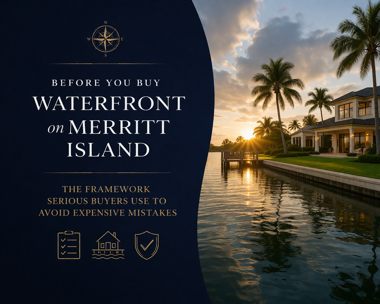
Before You Buy Waterfront on Merritt Island: The Framework Serious Buyers Use to Avoid Expensive Mistakes
By Carrie Liotta | Best Realtor for Waterfront Homes Merritt Island Florida | Space Coast Best Realtor | Top 5% in Brevard County | 321coastalliving.com If you are serious about buying waterfront, Carrie can help you evaluate the due-diligence details as your Merritt Island waterfront Realtor. Before You Buy Waterfront on Merritt Island: The listing looked perfect. Deep-water canal in central Merritt Island, beautiful dock, asking price within budget. The buyers had been searching for eight months. They made an offer. Then came the survey. The canal depth at mean low water—not high tide, low tide—was 2.5 feet at the seawall. Their boat drew 3 feet. They’d been looking at a home where their existing vessel would never leave the dock at low tide. Nobody caught it until the due diligence phase, because nobody had asked. This kind of story is more common in the Merritt Island real estate waterfront market than most agents want to admit—because asking the right questions requires knowing enough about boating to know what questions exist. The vast majority of agents working the Space Coast market are not boaters. They know square footage. They know comparable sales. They don’t know what mean low water means, or why it’s the only tide measurement that actually matters when you’re sizing up a dock. What follows is the framework I use with every waterfront buyer I work with across Merritt Island, Cocoa Beach, Viera, and Melbourne. It’s not a checklist in the traditional sense—it’s a sequenced way of thinking about a waterfront purchase that moves from the waterway first, the neighborhood second, and the house third. That sequence is the opposite of how most buyers approach it, and getting the sequence right changes the outcome. Watch: Merritt Island Waterfront — What Buyers Need to Know Before They Searchhttps://youtu.be/Ii3L_Bb9cOs?si=YLjvq-V5_1TSi3ZD Step One: Define Your Waterway Before You Look at Any House Most buyers start with “I want Merritt Island waterfront living” and then browse available listings. I start with a different question: what are you actually going to do with the water? This isn’t a lifestyle brochure question. It’s an operational one. The answer determines which waterway you need access to, what canal depth you require, what bridge clearances you can’t exceed, and which neighborhoods even belong in your search. The four primary use profiles on Merritt Island: Profile 1: The Offshore Boater. You run to productive reef depths or beyond regularly. Your boat is probably between 22 and 40 feet with meaningful draft. Your priority is the shortest, most efficient route to the Port Canaveral inlet—which means the Canaveral Barge Canal corridor is your friend, Indian River access is valuable for ICW use, and you want to be south enough to minimize transit time to the locks. Bridge clearances on your route are non-negotiable to establish before an offer. Profile 2: The Inshore/Backcountry Angler. You fish the flats, pole into the backcountry, and care about access to the Indian River Lagoon’s productive tidal waters more than offshore proximity. You may run a vessel with very shallow draft—a skiff, a technical poling boat, a smaller bay boat. For you, some northern Merritt Island canal neighborhoods near the Wildlife Refuge corridor are genuinely interesting even though they wouldn’t work for an offshore fisherman. Profile 3: The Recreational/Family Boater. A pontoon boat, a deck boat, maybe a kayak or two. Weekend trips on the river, trips to sandbars, family-friendly water use. Your draft is modest, your clearance needs are minimal, and your priority is protected, navigable water within a neighborhood that feels right. Central Merritt Island canal neighborhoods—Sykes Cove, Waterway Manor, Diana Shores—are purpose-built for this lifestyle. Profile 4: The View and Lifestyle Buyer. You want to live on the water. You may own a kayak or paddleboard. The water is more about the view, the wildlife, and the psychological environment than operational boating utility. For you, the Banana River’s calmer, more intimate, wildlife-rich character might actually be a better fit than the wide Indian River—even though conventional wisdom would point you to the river. Warm coffee on your dock any morning. Manatees drifting past at 7am. That is the Banana River experience for the right buyer. Identifying which profile you genuinely are—not which one sounds most impressive—is the foundation of a good search. Be honest about this before you spend the money. “Carrie really takes the time to listen to what you want then finds it to show you!” — Verified Client Review Step Two: Understand the Waterway Geometry Once you know your profile, the waterway picture becomes much clearer. Here is the actual geography that governs how boats move around Merritt Island. The Indian River Lagoon (Western Shore) The Indian River Lagoon runs along Merritt Island’s western edge and is part of the Atlantic Intracoastal Waterway. It is the main navigable highway. Boats on the Indian River can travel north toward Titusville and eventually New Smyrna and Ponce Inlet, or south toward Sebastian, Fort Pierce, and eventually Miami—all within the protected ICW channel. Access to the ocean from the Indian River requires routing through the Canaveral Barge Canal and Port Canaveral, or heading north or south to other inlets. The nearest is Port Canaveral, which is the primary ocean exit for virtually all Merritt Island boaters regardless of which side of the island they live on. The Indian River is wider—views are expansive, particularly from south Merritt Island’s western shore. Water is more active, more wind-exposed, and carries meaningful recreational and commercial traffic. Homes here capture the sunset. The Banana River (Eastern Shore) The Banana River runs along the island’s eastern edge between Merritt Island and the Cape Canaveral barrier island. It is 31 miles long, shallow (averaging about four feet system-wide), and not part of the ICW. Its only ocean exit is through the lock at Port Canaveral. Above the Crawlerway—the road connecting Merritt Island to Cape Canaveral—much of the northern Banana River lies within Kennedy Space Center property and is closed to the public, which preserves the extraordinary wildlife density and near-solitude

Waterfront, PCS Orders, and the Space Coast: What You Need to Know Before You Commit
You’ve run the numbers. You know roughly what waterfront in Brevard County costs. You’ve watched enough videos to understand the difference between canal-front and riverfront. And somewhere in the back of your planning mind is the question you haven’t gotten a straight answer to: if I buy waterfront here and get orders in three years, how does this end? That question — and the two that live alongside it (how do I buy right from a distance, and where exactly should I be looking near the base) — are the ones this piece is built around. No generalizations. No statewide averages applied to a hyper-local market. Just the Space Coast, specifically. Carrie Liotta | 321 Coastal LivingTop 5% REALTOR® in Brevard County. Waterfront specialist. Military and aerospace relocation expert. Carrie’s clients include active duty and civilian families at Patrick Space Force Base, KSC, and the Cape Canaveral launch complex. She is known for her direct, educational style and her refusal to let buyers make waterfront mistakes that show up at resale. www.321coastalliving.com | YouTube: @CarrieLiottaSpaceCoastRealtor Sight-Unseen Waterfront in Brevard County: The Non-Negotiables If you’re relocating to Patrick Space Force Base or arriving for an aerospace position, there is a reasonable chance you will make your waterfront offer before you’ve stood on the property. That is not a problem. The process is well-established in Florida and used routinely by military buyers. What creates problems is treating a sight-unseen waterfront offer the same way you’d treat a sight-unseen offer on a standard suburban home. Waterfront Has Its Own Due Diligence Language Standard home inspectors are trained on structure, systems, and mechanicals. They are not trained — and typically do not test — seawall structural integrity, canal navigability, riparian boundary disputes, dock permit status, or the flood insurance implications of a specific elevation. Just so you know: hiring a generalist inspector on a waterfront home and assuming the report covers the property’s most significant risk exposures is one of the most common and costly mistakes waterfront buyers make. The second most common is not getting an elevation certificate before writing the offer. The Elevation Certificate Is Not Optional An elevation certificate is a survey document prepared by a licensed surveyor that shows your home’s elevation relative to the Base Flood Elevation (BFE) for your specific flood zone. Under FEMA Risk Rating 2.0, this document directly determines your flood insurance premium. The difference between a home at BFE and one two feet above it can be $2,000–$4,000 annually in insurance cost on the same street in the same flood zone. The seller may or may not have one on file. If they don’t, order it as part of your due diligence before you make a major financial decision. It costs several hundred dollars and takes a week or two. Do not skip it. Learn more about how FEMA flood zones work in Florida at the FEMA Flood Map Service Center. To understand how individual property ratings work under the current system, the Flood Factor tool provides a useful starting point for due diligence research. Your Agent’s Physical Checklist Before the Offer A properly represented sight-unseen waterfront offer in Brevard County means your agent has personally done the following before you submit: Walked and inspected the seawall: Checked for cracking, tilt, soil void behind the cap, and signs of undermining at the waterline. Documented bridge clearance: Measured or confirmed the vertical clearance of every bridge between the dock and open navigable water. On Merritt Island and Cocoa Beach canal systems, this ranges from under 10 feet to well above 20 feet depending on the neighborhood and specific bridge. Checked canal depth at the proposed dock: Typically done with a dock probe or by reviewing marine survey data for the canal. A canal listed as “navigable” in a three-year-old listing may not be navigable today if silting has occurred. Verified dock permit status with Brevard County: Unpermitted dock extensions are common in neighborhoods with older stock. Verify with the county before the contract is finalized, not after. Confirmed flood zone and pulled or ordered elevation certificate: So the buyer has accurate insurance cost information before committing. ★★★★★“I was buying from Germany on a military deployment. Carrie did everything — walked the seawall, checked the bridges, verified the dock permits, got the elevation certificate, and sent me hours of video. She found a minor issue with the dock that the seller disclosed but hadn’t quantified. We got a credit. The house was exactly what she described. I trusted her completely and she earned it.”— Active Duty Military Buyer, Sight-Unseen Purchase — Cocoa Beach Canal The Waterfront Communities Near Patrick Space Force Base: Lifestyle First, Then Price One of the most useful questions Carrie asks every buyer early in the conversation is: what does a typical Saturday look like for you? The answer — far more than a price range — tells you which community on the Space Coast actually fits. Satellite Beach and South Patrick Shores: The Proximity Play If your priority is minimizing commute and maximizing time at home, the communities immediately adjacent to the base are South Patrick Shores and Satellite Beach. Both offer canal-front single-family homes with Banana River access. Satellite Beach also has A1A-adjacent oceanfront condos and a small walkable commercial district. These are the communities where you’re most likely to walk to the beach on your lunch break. The tradeoff is price density — you’re paying a proximity premium, and the lots are smaller. For buyers in the $500,000–$750,000 range who want water access without giving up any commute time, this is the right conversation to have. Cocoa Beach: The Lifestyle Hub Cocoa Beach is about 8–12 minutes from the main Patrick gate and offers the most walkable beach-town experience of any community near the base. Canal homes in Cocoa Beach generally access the Banana River with no bridge restrictions for boats up to a certain beam and height. The Ron Jon Surf Shop intersection gives you an easy geographic anchor: everything within a mile of it is in

New Construction Luxury on the Space Coast: What $2 Million Actually Buys You in Viera vs. the Waterfront Corridor
New Construction Luxury on the Space Coast: There is a particular kind of frustration that shows up about six weeks into a Space Coast home search. You have toured enough new construction in Viera to know what three million dollars looks like behind a gate with lake views. You have also driven down Tropical Trail on south Merritt Island, or spent an afternoon on the Banana River side of the island, and realized that the same budget buys you something entirely different when water is involved. Now you are not sure which version of luxury is the better investment—or the better life. This is not a question that generic real estate content answers well. Most articles champion new construction as the future of homebuying, or treat waterfront as an automatic premium without explaining the costs underneath. Neither frame acknowledges that these are fundamentally different products serving different buyer identities. Here is how I break it down. The New Construction Value Proposition in 2026 The national conversation around new construction has shifted. According to the National Association of Home Builders, new-home pricing has come closer in line with resale values than at almost any other point in recent memory. The Florida Association of Realtors confirms that builder incentives, combined with the geography of where new construction is concentrated, have produced a genuinely unusual buying window. On the Space Coast, this plays out across several tiers. Production builders in Palm Bay and the broader Melbourne corridor are offering aggressive rate buydowns that can make a brand-new home pencil out for a lower monthly payment than a fifteen-year-old resale. In the luxury tier, communities like Adelaide in Viera offer custom architectural quality, included design packages, and model home leaseback opportunities on fully furnished properties. What new construction universally offers right now is an insurance advantage. Homes built to current Florida building codes—particularly post-2002 hurricane standards—are easier and significantly less expensive to insure. Impact-rated windows, modern roof systems, and verified wind mitigation features translate directly into lower premiums. In an insurance market where Brevard County homeowners are seeing meaningful rate variability, this is not a marginal benefit. It is a meaningful line item in your annual carrying cost. “Having moved from out of state, buying my dream home would not have been possible without Carrie Liotta! She knows the Space Coast inside and out. She listened to exactly what I wanted, guided me through every step, and negotiated an incredible deal.” — Out-of-state relocating buyer What the Waterfront Corridor Offers That No Master Plan Replicates Here is the thing about Viera that nobody in the new construction sales office will tell you plainly: it is located west of US-1 and does not offer homes on any navigable waterways. You cannot keep a boat in your backyard. You cannot fish from your dock. You cannot kayak out your back door into the Indian River Lagoon. Merritt Island, Cocoa Beach, and the Indian River corridor offer something no amount of architectural control or community amenity can substitute: daily, unmediated access to one of the most diverse estuarine systems in North America. The Indian River Lagoon, the Banana River, Sykes Creek, Newfound Harbor—these are not abstract selling points. They are the reason people move to the Space Coast. A waterfront home on Merritt Island at the million-dollar level typically gives you direct canal or river frontage, a private dock or boat lift, and access to the Intracoastal Waterway and the Atlantic via the Canaveral Locks. At the two to three million dollar level, you are looking at direct Indian River or Banana River frontage, often with expansive lots, deep-water docks, and panoramic views that simply do not exist in any planned community. This is what defines real estate Merritt Island FL waterfront at its highest level. The Risk Profile Nobody Explains Clearly Every property has a risk profile. The question is whether you understand yours before you buy. New Construction Risk Factors Builder quality varies, even within Viera. The luxury builders in Adelaide have strong reputations, but not every builder in every subcommunity meets the same standard. CDD fees in some Viera areas add a non-ad-valorem assessment to your tax bill that can be substantial. HOA rules govern everything from landscaping to exterior modifications, and the dual-layer structure—Viera master HOA plus subcommunity HOA—means two sets of fees and two sets of rules. Appreciation dynamics in master-planned communities differ from waterfront corridors. When a community reaches buildout, the supply of new homes stops but competition from newer communities nearby increases. Long-term value tends to track regional appreciation rather than outperform it. Waterfront Risk Factors Older construction means more unknowns. Pre-2002 homes may lack modern hurricane-rated features, driving up insurance costs. Seawalls have generational lifespans—first generation from the 1960s may need immediate replacement at $100,000-plus, while second-generation walls from the 2000s have ten to twenty years remaining. FEMA’s Risk Rating 2.0 now evaluates flood insurance at the individual property level, meaning your neighbor’s premium tells you nothing about yours. Canal depth, bridge clearance, and dock permitting are waterfront-specific due diligence items that require local expertise. A home with a beautiful view but a shallow canal or low-clearance bridge upstream limits what you can actually do with that waterfront access. These are the details that separate a top rated waterfront specialist from a generalist agent. Not all boats can fit behind each home because of bridge heights. Let me show you on the map before we waste your time on the wrong neighborhoods. What Buyers Assume Matters Most vs. What Actually Drives the Decision What Buyers Assume Matters Most What Actually Drives the Decision Price per square foot Total annual cost of ownership (insurance, flood, seawall, HOA/CDD) Finishes and design features Construction year and code compliance (directly impacts insurance) Community amenities (pool, clubhouse, trails) Daily lifestyle access (water, beach, boat, outdoor living) Gated security Property-level flood risk and seawall condition Builder reputation and model home quality Resale trajectory and buyer pool depth for your property type Listed price and builder incentive offers Agent-negotiated contract protections and inspection contingencies Proximity to shopping and dining