By Carrie Liotta, Space Coast REALTOR® | May 2026 Are Seawalls in Brevard County Worth It? What Waterfront Buyers Need to Know: If you’re shopping for waterfront property in Brevard County, here’s what most buyers don’t find out until it’s too late: the seawall is often the single most expensive and most overlooked issue on the entire property — and it won’t show up in a standard home inspection. I’ve worked with enough waterfront buyers on the Space Coast to know that seawalls are where due diligence gets skipped. The wall looks solid, the home looks great, and buyers move forward without ever asking the one question that could cost them six figures after closing. This post covers what you actually need to know — the real replacement costs, what a proper inspection involves, why unpermitted seawall work can kill a closing, and why Brevard County is actively moving away from traditional seawalls altogether. Are Seawalls in Brevard County Worth It: Why Seawalls Are the Most Expensive Problem Nobody Talks About A failing seawall in Brevard County can cost between $60,000 and $120,000 to replace. That range depends on the wall’s length, the material (concrete, vinyl, or aluminum), the severity of the damage, and whether you’re dealing with permits from both the county and the Florida Department of Environmental Protection. That’s not a repair bill — that’s a replacement bill. And it’s not unusual on the Space Coast, where the Indian River Lagoon, Banana River, and dozens of canals mean that a huge percentage of waterfront homes have some form of seawall holding the yard in place. What makes this particularly dangerous for buyers is that seawall failure is not always visible. You can walk along a seawall that looks completely intact — no cracks, no leaning, no obvious damage — while the anchoring system behind it is already compromised. The wall fails from the inside out. By the time you can see the problem from the surface, you’re often already past the point of repair and into full replacement territory. If you’re comparing waterfront ownership costs more broadly, the seawall is just one piece of the picture. Dock maintenance, flood insurance, and higher property insurance in coastal zones all stack on top of each other — which is why understanding the true costs of Merritt Island waterfront ownership matters before you ever make an offer. What a Proper Seawall Inspection Actually Covers A standard home inspection does not include a seawall. Your general inspector will look at the structure, roof, HVAC, plumbing, and electrical — but the seawall is a specialty item that requires a separate, qualified marine contractor or a licensed engineer. A proper seawall inspection looks at: A detailed breakdown of what inspectors look for — and what the red flags mean for buyers — is covered in this seawall inspection guide specific to Brevard County. It’s worth reading before you request your inspection, so you know what questions to ask. The bottom line: budget for this inspection before you’re under contract on any waterfront property. If the seller won’t allow it or won’t address a failed inspection, walk away — or price the replacement into your offer. The Permit Problem: Why Unpermitted Seawall Work Can Kill Your Closing This is where buyers get blindsided. A previous owner had seawall work done — panels replaced, a cap poured, some tie-backs added — and never pulled a permit. The work looks fine. The contractor was probably fine. But it happened without the required permits from Brevard County and the Florida Department of Environmental Protection (FDEP). When your title company runs its searches, unpermitted work surfaces. At that point, you have a problem that is difficult to resolve quickly. The county can require removal, correction, or retroactive permitting — all of which take time and money that neither you nor the seller necessarily planned for. This is one of the situations I walk buyers through in detail before they make an offer on waterfront property, because it comes up more often than people expect. Your agent needs to ask about seawall history, not just condition — and most agents don’t. If you want to understand exactly what questions get skipped in these transactions, this post covers what your agent probably isn’t asking about your seawall. When you’re doing due diligence, request any permit records for seawall work from the county directly. Don’t rely on the seller’s disclosure alone. Brevard County Is Moving Away From Traditional Seawalls Here’s something that should factor into your buying decision if you’re looking at waterfront in Brevard County: the county is actively shifting its policy away from traditional hard seawalls, and that shift has real consequences for what you can build, repair, or replace. Brevard County — along with the St. Johns River Water Management District and the state of Florida — now strongly favors living shorelines as the preferred approach to shoreline stabilization, particularly along the Indian River Lagoon. This is part of a broader Indian River Lagoon restoration effort, one of the most significant environmental restoration programs in Florida’s history. A living shoreline uses natural elements to do the work that a hard wall used to do: native shoreline plants (like cord grass and mangroves) whose root systems hold soil in place, oyster reef structures that absorb wave energy, and gradual slopes that allow tidal movement rather than blocking it. Instead of a concrete wall fighting the water, a living shoreline works with it. Why does this matter to a buyer? Several reasons: If you’re evaluating waterfront property and wondering whether the seawall adds value or creates liability, the answer depends heavily on its condition and whether replacement would even be permitted. Whether a new seawall actually adds value to a Merritt Island home is worth understanding before you factor it into your offer price. What This Means If You’re Buying Right Now Buying waterfront in Brevard County is genuinely rewarding — the access to boating, the views, the lifestyle. But you need to go in with your eyes
Waterfront Living covers the practical details buyers and sellers need to understand before making a Brevard County waterfront move. This hub includes Carrie Liotta’s guidance on canal-front homes, seawalls, docks, boat lifts, bridge clearance, flood zones, insurance, boating routes, Merritt Island waterfront neighborhoods, and the hidden costs that can affect value, safety, and resale.
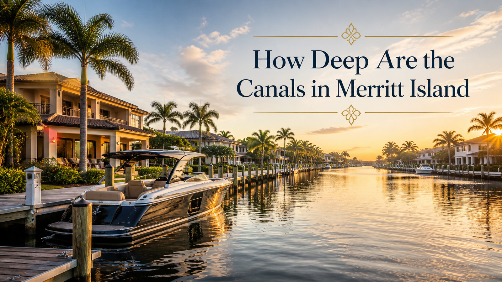
How Deep Are the Canals in Merritt Island? Trusted Realtor, Carrie Liotta
Canals in Merritt Island: This is the question that doesn’t show up in listing descriptions, rarely comes up in showings, and almost never gets answered until after a buyer has closed on a waterfront property in Merritt Island and backed their boat out of the lift for the first time. Canal depth is only one part of the waterfront decision; Carrie can help you compare the full picture as your Merritt Island waterfront Realtor. Sometimes the canal is exactly what they expected. Sometimes it isn’t. Most residential canals on Merritt Island run 3 to 4 feet deep. That’s the honest baseline. It’s the answer you’ll find in forum discussions among local boaters, the number that experienced agents in this market work with, and the starting point for any serious conversation about waterfront property and boat access on this island. But that 3-to-4-foot average hides real variation — between the Banana River side and the Indian River side, between canals maintained by active neighborhoods and canals that haven’t been dredged since they were cut in 1963, between properties with deep-water dock access and properties where “canal frontage” is a polite description for a silted drainage ditch. I’m Carrie Liotta, a REALTOR® with Boardwalk Realty and a top-rated waterfront specialist on the Space Coast. I live on the water in Waterway Manor on Merritt Island and I’m ranked in the top 5% of agents in Brevard County by sales volume. Canal depth is one of the most important conversations I have with boating buyers before they make an offer — and this post gives you the full picture. The Baseline: What “3 to 4 Feet” Actually Means The majority of residential backyard canals on Merritt Island were dredged during the mid-century residential development of the island — primarily the 1950s through the 1970s, when developers cut canal systems into the low-lying land to create waterfront lots that could be marketed to buyers who wanted a dock in their backyard. These canals were not built or maintained by the U.S. Army Corps of Engineers. They are not on the Intracoastal Waterway system. They don’t receive federal dredging funds. They were cut once, to a depth that made sense at the time, and they’ve been silting up at varying rates ever since. Three to four feet represents the typical depth that has persisted in most of these canals over decades of limited maintenance. A boat drawing 18 inches — a standard center console, a moderate flats skiff, a pontoon boat — can navigate most of them without issue. A boat drawing 30 to 36 inches is operating at or near the bottom limit of what these canals can accommodate on a reliable basis. What this means practically: if you own a vessel drawing more than 2 feet, you need to know the specific depth of the specific canal at the specific property you’re considering — not just the island-wide average. The Canals That Are Deeper Not all Merritt Island canals run at 3 to 4 feet. Several categories of waterway access on the island go significantly deeper. The Canaveral Barge Canal The Canaveral Barge Canal is approximately 12 feet deep. It cuts east-west across northern Merritt Island, connecting the Indian River to the Banana River and Port Canaveral, and was constructed by the Army Corps of Engineers. Properties with direct frontage on the Barge Canal — or with canal access that connects cleanly to the Barge Canal — sit at the top of the depth hierarchy on Merritt Island. For a buyer who owns a larger vessel, Barge Canal-adjacent properties represent a different tier of access than standard residential canal homes. The depth is maintained. The channel is marked. The route to ocean via the Canaveral Lock is direct. The Intracoastal Waterway (Indian River Channel) The ICW channel through the Indian River is maintained at 10 to 12 feet. Properties with direct Indian River frontage — as opposed to canal access to the Indian River — benefit from this maintained depth at the waterline, even if the adjacent shallow flats come up quickly outside the channel. Dredged Marina Basins Marinas on Merritt Island, including Harbortown Marina on the Barge Canal, operate in dredged basins that exceed the depth of surrounding residential canals. Marina slips and nearby wet slips can accommodate larger vessels that don’t fit in the average residential canal on the island. The Canals That Are Shallower Than 3 to 4 Feet This is the category that creates the most post-closing surprises, and it’s the one that requires the most attention from any buyer who owns a boat. Banana River Side vs. Indian River Side In general, the Banana River side of Merritt Island is shallower than the Indian River side — and this applies not just to the open water of the lagoon but to the residential canals that connect to it. The Banana River itself averages about 4 feet in depth, but many areas outside the marked channels run at 1 to 2 feet. Canals feeding into the Banana River from eastern Merritt Island neighborhoods — areas around Newfound Harbor, properties off Sykes Creek, and finger canals in the southern Merritt Island neighborhoods — tend to be among the shallower residential canals on the island. Sykes Creek specifically has notably shallow areas. The creek connects to the Banana River and provides access for many Merritt Island properties, but its depth is variable and has changed over time due to silting. Properties with Sykes Creek access need individual depth verification more urgently than properties with direct Indian River frontage. The Indian River side tends to produce more reliable canal depth because the parent waterway is deeper and better-maintained. That said, even Indian River-connecting canals can silt up significantly at their mouths and in their back sections. Canals That Haven’t Been Dredged in Decades Many of Merritt Island’s residential canals were last dredged — if they were ever dredged after original construction — sometime in the 1970s or 1980s. Fifty years of natural silting can reduce a 4-foot canal to
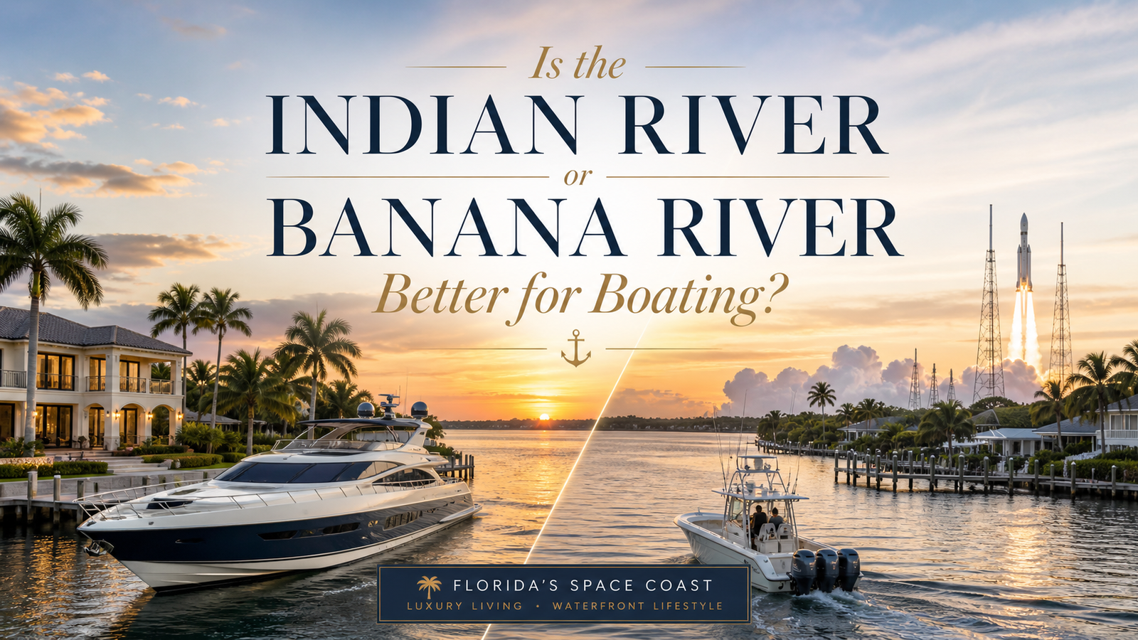
Is the Indian River or Banana River Better for Boating?
Indian River or Banana River: If you’re looking at waterfront property on Merritt Island and you own a boat, this is the question that matters most — and it rarely gets a straight answer. For help matching boating goals to the right waterfront property, Carrie works with buyers and sellers as a Merritt Island waterfront Realtor. Search online and you’ll find vague descriptions of both waterways as “beautiful” and “biodiverse.” Ask a listing agent and you’ll often hear that both sides are great. Neither of those responses actually helps you decide whether your 28-foot center console fits in the canal behind the house, or whether you’re going to be fighting shallow water every time you want to leave the dock. Merritt Island sits between two completely different bodies of water. The Indian River runs along the island’s western shore. The Banana River runs along its eastern shore. They are part of the same lagoon system, they’re separated by less than five miles at their closest points, and they offer dramatically different boating experiences. I’m Carrie Liotta, a REALTOR® with Boardwalk Realty. I live on the water in Waterway Manor on Merritt Island, I’m ranked in the top 5% of agents in Brevard County by sales volume, and I specialize in waterfront homes on the Space Coast. When buyers ask me which waterway is better for boating, I give them the actual answer — because the waterway you’re on determines your daily life as a boater more than almost any other feature of a waterfront property. Here’s the real comparison. First, a Correction: Neither One Is a River Before comparing them, this matters: the Indian River and the Banana River are not rivers. Both are lagoons — brackish estuaries fed by a mix of freshwater runoff from the mainland and ocean water flushing through inlets along Florida’s Atlantic coast. Neither has a directional current the way a true river does. Water movement in both comes primarily from wind and limited tidal influence. They’re part of the Indian River Lagoon system, which runs 156 miles along Florida’s east coast and spans the entire 72-mile length of Brevard County. Together they support over 4,300 species of plants and animals, making the system one of the most biodiverse estuaries in North America. Understanding that both are shallow lagoons — not rivers, not bays, not the ocean — sets the right baseline for what boating on either one actually looks like. The Indian River: What You’re Getting as a Boater The Indian River is 121 miles long and runs along the western shore of Merritt Island. It is the largest of the three lagoons in the Indian River Lagoon system and the one most relevant to serious powerboaters, because it is part of the Intracoastal Waterway. That single fact — ICW access — is the defining feature of the Indian River from a boating standpoint. Depth and Navigation The Intracoastal Waterway through the Indian River is maintained at a navigable channel depth of 10 to 12 feet. The lagoon itself averages about 4 feet overall, with large shallow flats running less than 2 feet, but the maintained ICW channel gives larger vessels a reliable, marked corridor running the full length of Brevard County. Man-made channels, marina basins, and the Canaveral Barge Canal are dredged considerably deeper. Properties with canal access to the Indian River, or with direct Barge Canal frontage, sit at the top of the depth hierarchy in this market. Boating Range From the Indian River, you can run the entire Florida Intracoastal Waterway in both directions — south toward Sebastian, Melbourne, Fort Pierce, and eventually Miami; north toward Titusville, New Smyrna, and Jacksonville — without ever trailering your boat. For a cruiser, a liveaboard, or anyone who wants to use the boat for more than local day trips, this matters enormously. For offshore access, the route runs east through the Canaveral Barge Canal and through the Canaveral Lock at Port Canaveral. That’s a fixed process regardless of whether you’re on the Indian River or Banana River side — the same lock, the same route, the same ocean. The difference is only in how far you travel to reach the Barge Canal entrance. Open Water Character The Indian River is a wider, more exposed body of water than the Banana River. View corridors are longer. Sunset views from Indian River-front properties are expansive. The tradeoff is wind exposure — a northwest wind in January builds real chop across open water, and the Indian River rewards seamanship in a way that protected lagoon boating doesn’t. For experienced boaters, that’s typically a feature, not a drawback. Water Quality Water quality on the Indian River has historically been somewhat better than the Banana River. Both waterways have faced significant challenges over decades — nutrient pollution, algae blooms, seagrass loss, and the legacy of aging septic systems draining into the lagoon. But the Indian River’s larger surface area and greater tidal flushing give it a measurable, if modest, advantage. Restoration efforts through the St. Johns River Water Management District and Brevard County’s Save Our Indian River Lagoon Program are ongoing. The Banana River: What You’re Getting as a Boater The Banana River is 31 miles long, running between Merritt Island on its western bank and the Cocoa Beach barrier islands on its eastern bank. It is the only part of the Indian River Lagoon system that is not part of the Intracoastal Waterway — a critical distinction for boaters evaluating waterfront property on the eastern side of Merritt Island. Depth and Navigation The Banana River averages about 4 feet in depth across its width. In practice, that average is misleading. Large portions of the Banana River outside the marked channels run at 1 to 2 feet. Much of the northern section — from the NASA causeway into the Kennedy Space Center area — is off-limits to the public entirely, as it falls within KSC and Cape Canaveral Space Force Station property. The Banana River side of Merritt

What Every Merritt Island Waterfront Homeowner Needs to Know Before They List (Or Buy)
By Carrie Liotta | Space Coast Waterfront Realtor | Top-Rated Merritt Island FL Real Estate Agent | www.321coastalliving.com Merritt Island Waterfront Homeowner: There is a conversation that happens more than most people realize, and it almost always starts the same way. A homeowner calls, ready to list. The home sits on a canal off Sykes Creek or backs up to the Banana River. It is a beautiful property — great bones, genuine water access, priced based on what the neighbor sold for two years ago. They are confident. They have looked at square footage and comps. What they have not looked at is the seawall. Or a buyer — usually relocating from out of state, smart, successful, doing serious research — finds the perfect waterfront home on Merritt Island. They fall in love with the dock, the views, the lifestyle they have been picturing. They make an offer. The inspection reveals a seawall that is failing — cracked panels, soil voiding behind it, a cap that has been shifting for years. Suddenly the deal is complicated in a way nobody warned them about. Both of these situations are common in Merritt Island real estate. And both are entirely preventable with the right information up front. That is the whole point of this post. Not to impress you, and not to pitch anything. Just to give you the honest picture — on seawall costs, on what the current market means for single-family sellers, and on what it actually takes to navigate a waterfront transaction on Florida’s Space Coast without getting blindsided by something you did not know to ask about. “You’re the only one really breaking down seawalls, bridges, and true costs.” — This is what clients who find Carrie Liotta online consistently say before they ever pick up the phone. Merritt Island Waterfront Homeowner: The Seawall Question Nobody Asks Until It’s Too Late If you own a waterfront property in Brevard County — and especially in Merritt Island, where canals, rivers, and lagoons are woven into almost every neighborhood — your seawall is not a feature. It is infrastructure. It is the reason your yard still exists. Experienced buyers and their agents walk a waterfront property and look at the wall first. Everyone else looks at the water. What Does It Actually Cost to Replace a Seawall in Florida? Just so you know — this number is higher than most people expect, and the range is wide enough that vague answers are genuinely unhelpful. In Florida’s coastal market, seawall replacement costs fall between $350 and $1,200 per linear foot, depending on material, wall height, water depth, soil conditions, and site access. For a typical Merritt Island waterfront lot — 80 to 100 linear feet — total project costs run $40,000 to $175,000, with most mid-range installations clustering around $90,000 to $120,000. Here is what drives that range: Material type. Vinyl panels are the most common residential choice today — installed at roughly $700 to $1,200 per linear foot in Florida’s coastal market. Concrete is more durable for deeper water or heavier wave exposure but costs more. Steel sheet pile walls are strong but vulnerable to saltwater corrosion over time without protective treatment. Wall height. A standard five-foot residential wall is priced very differently than an eight-foot wall needed for a deeper canal or higher tidal zone. Taller walls require more material and structural support — sometimes adding 50 to 100 percent to the per-foot cost. Soil conditions. Merritt Island sits on sandy, silty soils that do not always behave predictably. Soft or unstable soil can require additional pilings, helical pile reinforcement, or stabilization work — adding $5,000 to $15,000 or more. Permits and engineering. Florida DEP and Brevard County both have permit requirements for seawall work. Licensed marine engineers need to sign off on plans. Budget $2,000 to $3,000 for engineering fees plus permit costs. For current Florida DEP guidance on coastal construction, visit floridadep.gov. Site access. If equipment cannot reach your property by land, a barge may be required — adding $10,000 or more to the project cost. Here is the number that matters most: the difference between proactive maintenance and reactive emergency replacement can easily exceed $100,000. A seawall showing minor cracking today may cost $30,000 to address. The same wall, left three seasons, can require full replacement at $120,000 — plus dock and landscaping repairs on top. Seawall Generations: What Carrie’s Clients Need to Understand When working through waterfront properties on the Space Coast, here is the practical framework: What Experienced Waterfront Buyers Actually Evaluate Most listing agents focus on what photographs well. Buyers who have been burned — or who have been advised well — focus on something else entirely. What Generic Listings Emphasize What Experienced Merritt Island Waterfront Buyers Actually Evaluate Updated kitchen and baths Seawall age, material, and documented condition Square footage and bedroom count Marine contractor inspection history Days on market and list-to-sale ratio Soil stability and signs of voiding behind the wall Pool presence Water depth at dock and tidal access Comparable sale price per square foot Dock permits and structural integrity HOA fees and community amenities Flood zone designation and current insurance transferability School district ratings Canal vs. river vs. open water — navigational access Zillow estimate Environmental setbacks affecting future dock improvements The buyers who come to Carrie Liotta having watched her content at https://www.youtube.com/@CarrieLiottaSpaceCoastRealtor already know to ask these questions. The ones who find out after an accepted offer learn the hard way. Is Now a Good Time to Sell a Single-Family Home in Merritt Island? The question every seller wants answered simply. The honest answer is more layered. The Merritt Island housing market has normalized from its 2021–2022 peak. In mid-2025, the median sale price sat around $431,000 to $465,000 — down roughly two to four percent year-over-year. Inventory has expanded meaningfully (approximately 500 active listings in the summer of 2025), days-on-market have stretched to 48 to 84 days, and roughly 85 percent of homes are selling below asking price. That is the data. Here is what it means in
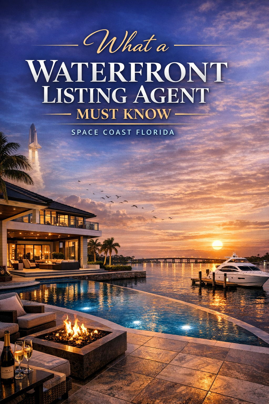
What a Waterfront Listing Agent Must Know | Space Coast Florida | Carrie Liotta Waterfront & Luxury · Space Coast Florida
Selling Waterfront · Space Coast Florida What a Waterfront Listing Agent Must Know That a Regular Agent Doesn’t Before you sign a listing agreement on your Merritt Island, Cocoa Beach, or Brevard County waterfront home — read this. By Carrie Liotta, REALTOR®·Top 5% in Brevard County·Waterfront & Luxury Specialist “What a Waterfront Listing Agent Must “Know” Most agents can sell a house. Very few can actually sell a waterfront property — and I mean that in a very specific, technical way.” Hiring a general real estate agent to list your waterfront home is one of the most expensive mistakes a seller on Florida’s Space Coast can make. Not because general agents are bad at what they do. Because waterfront is a completely different product — with a different buyer, a different set of risks, and a different set of things that can go wrong between contract and closing. This article covers the three things your waterfront listing agent must know before they put your home on the market in Brevard County. Whether you’re selling on a canal in Merritt Island, directly on the Banana River, or along the Intracoastal in Cocoa Beach, the same rules apply. What you’ll learn How waterfront pricing actually works · What sophisticated waterfront buyers do during inspection · Florida water rights, dock permits, and flood zone compliance — the legal layer that quietly kills deals 1. Waterfront Pricing Is Its Own Discipline The single biggest pricing mistake in waterfront listings is using the wrong comparables. Not wrong by a small margin — wrong by category. A canal home with direct river access and no fixed bridges is not the same product as a canal home three turns off the river with a six-foot bridge clearance between the property and open water. A property with 120 feet of seawall frontage is not comparable to one with 60. Saltwater and freshwater communities price differently. A dock that accommodates a 28-foot center console commands a very different premium than one that maxes out at a kayak. A stale listing on a waterfront home is a real problem. Waterfront buyers are paying close attention to days on market — they assume something is wrong with the property if it’s been sitting. A waterfront specialist knows how to match comps on water type, water exposure, frontage length, dock access, and depth. When the comp pool is thin — and in waterfront niches on the Space Coast it often is — they know how to build a defensible pricing case that holds up when the appraiser comes in. Price it right from day one. That requires an agent who understands what “right” actually means for your specific water. What should be included in a waterfront listing description? Your listing description should include: water depth at the dock at low tide, boat lift capacity, linear frontage footage, bridge clearance to open water, seawall material and approximate age, and whether you have direct Intracoastal or river access. Waterfront buyers research technically before scheduling a showing. Give them the specs — it filters in the right buyers and filters out the wrong ones. 2. Know What’s Coming in the Inspection Period Before It Arrives This is where sellers get surprised the most. And surprised in a negotiation means weakened. A sophisticated waterfront buyer on the Space Coast will hire a marine contractor — not just a general home inspector. That contractor will evaluate your seawall: the age, the material, visible cracking, tie-backs, any signs of movement, and past repairs. They’ll assess your dock: permit status, piling condition, deck boards, lift capacity, hardware. They’ll measure water depth at low tide. They’ll ask whether any structures were built or modified without a permit. Real Cost to Know A seawall replacement in Brevard County can run anywhere from $20,000 to over $100,000 depending on length, material, and site access. If a buyer’s marine contractor flags your seawall as approaching end of life — and you didn’t know that going in — you are now negotiating a price credit in the middle of a transaction instead of deciding in advance how you want to handle it. The right move: have your agent walk the dock and the seawall before the listing goes live. Know what’s there. Pull the permit history. If there’s a concern, get a professional evaluation and decide your strategy. Documented stability builds buyer confidence. Undisclosed uncertainty is the thing that blows up deals. 3. Florida Water Rights Are Real — And Most Agents Don’t Know Them This is the one that surprises sellers the most. And it’s where a gap in your agent’s knowledge can kill a deal with no warning. What are riparian rights in Florida? In Florida, waterfront property comes with a set of legal rights called riparian rights. These include the right to water access, the right to build a dock, the right to an unobstructed view of the water, and the right to use the adjacent waterway. But not every property that looks waterfront actually has full riparian rights. The property line must reach the mean high water mark. If there’s even a small gap, those rights don’t fully attach — and that has direct implications for what a buyer can do with the property. Who owns the land beneath the water in Brevard County? In many man-made canals throughout Brevard County, the submerged land is owned by the county, a municipality, or an HOA — not the state. That affects what can be built, how far a dock can extend, and who’s responsible for maintenance dredging. Your listing agent needs to know how to verify this in the deed and survey before a buyer’s attorney starts asking the questions. What permits does a dock require in Florida? Dock permitting is more layered than most sellers realize. Depending on the waterbody, you may be dealing with the local building department, the Army Corps of Engineers, and the Florida Department of Environmental Protection — sometimes all three simultaneously. Existing structures may have
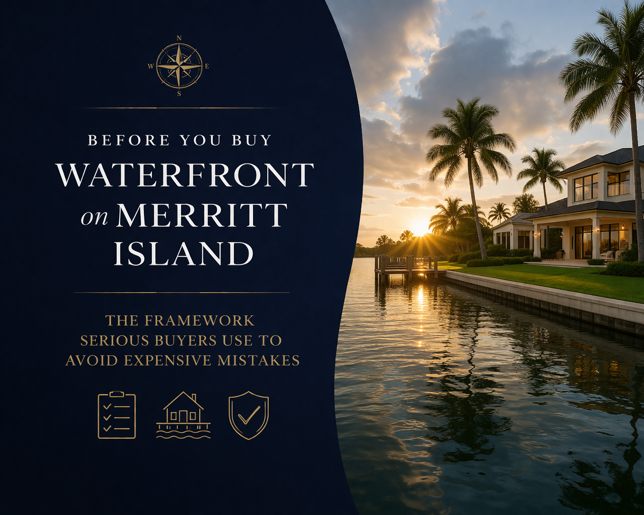
Before You Buy Waterfront on Merritt Island: The Framework Serious Buyers Use to Avoid Expensive Mistakes
By Carrie Liotta | Best Realtor for Waterfront Homes Merritt Island Florida | Space Coast Best Realtor | Top 5% in Brevard County | 321coastalliving.com If you are serious about buying waterfront, Carrie can help you evaluate the due-diligence details as your Merritt Island waterfront Realtor. Before You Buy Waterfront on Merritt Island: The listing looked perfect. Deep-water canal in central Merritt Island, beautiful dock, asking price within budget. The buyers had been searching for eight months. They made an offer. Then came the survey. The canal depth at mean low water—not high tide, low tide—was 2.5 feet at the seawall. Their boat drew 3 feet. They’d been looking at a home where their existing vessel would never leave the dock at low tide. Nobody caught it until the due diligence phase, because nobody had asked. This kind of story is more common in the Merritt Island real estate waterfront market than most agents want to admit—because asking the right questions requires knowing enough about boating to know what questions exist. The vast majority of agents working the Space Coast market are not boaters. They know square footage. They know comparable sales. They don’t know what mean low water means, or why it’s the only tide measurement that actually matters when you’re sizing up a dock. What follows is the framework I use with every waterfront buyer I work with across Merritt Island, Cocoa Beach, Viera, and Melbourne. It’s not a checklist in the traditional sense—it’s a sequenced way of thinking about a waterfront purchase that moves from the waterway first, the neighborhood second, and the house third. That sequence is the opposite of how most buyers approach it, and getting the sequence right changes the outcome. Watch: Merritt Island Waterfront — What Buyers Need to Know Before They Searchhttps://youtu.be/Ii3L_Bb9cOs?si=YLjvq-V5_1TSi3ZD Step One: Define Your Waterway Before You Look at Any House Most buyers start with “I want Merritt Island waterfront living” and then browse available listings. I start with a different question: what are you actually going to do with the water? This isn’t a lifestyle brochure question. It’s an operational one. The answer determines which waterway you need access to, what canal depth you require, what bridge clearances you can’t exceed, and which neighborhoods even belong in your search. The four primary use profiles on Merritt Island: Profile 1: The Offshore Boater. You run to productive reef depths or beyond regularly. Your boat is probably between 22 and 40 feet with meaningful draft. Your priority is the shortest, most efficient route to the Port Canaveral inlet—which means the Canaveral Barge Canal corridor is your friend, Indian River access is valuable for ICW use, and you want to be south enough to minimize transit time to the locks. Bridge clearances on your route are non-negotiable to establish before an offer. Profile 2: The Inshore/Backcountry Angler. You fish the flats, pole into the backcountry, and care about access to the Indian River Lagoon’s productive tidal waters more than offshore proximity. You may run a vessel with very shallow draft—a skiff, a technical poling boat, a smaller bay boat. For you, some northern Merritt Island canal neighborhoods near the Wildlife Refuge corridor are genuinely interesting even though they wouldn’t work for an offshore fisherman. Profile 3: The Recreational/Family Boater. A pontoon boat, a deck boat, maybe a kayak or two. Weekend trips on the river, trips to sandbars, family-friendly water use. Your draft is modest, your clearance needs are minimal, and your priority is protected, navigable water within a neighborhood that feels right. Central Merritt Island canal neighborhoods—Sykes Cove, Waterway Manor, Diana Shores—are purpose-built for this lifestyle. Profile 4: The View and Lifestyle Buyer. You want to live on the water. You may own a kayak or paddleboard. The water is more about the view, the wildlife, and the psychological environment than operational boating utility. For you, the Banana River’s calmer, more intimate, wildlife-rich character might actually be a better fit than the wide Indian River—even though conventional wisdom would point you to the river. Warm coffee on your dock any morning. Manatees drifting past at 7am. That is the Banana River experience for the right buyer. Identifying which profile you genuinely are—not which one sounds most impressive—is the foundation of a good search. Be honest about this before you spend the money. “Carrie really takes the time to listen to what you want then finds it to show you!” — Verified Client Review Step Two: Understand the Waterway Geometry Once you know your profile, the waterway picture becomes much clearer. Here is the actual geography that governs how boats move around Merritt Island. The Indian River Lagoon (Western Shore) The Indian River Lagoon runs along Merritt Island’s western edge and is part of the Atlantic Intracoastal Waterway. It is the main navigable highway. Boats on the Indian River can travel north toward Titusville and eventually New Smyrna and Ponce Inlet, or south toward Sebastian, Fort Pierce, and eventually Miami—all within the protected ICW channel. Access to the ocean from the Indian River requires routing through the Canaveral Barge Canal and Port Canaveral, or heading north or south to other inlets. The nearest is Port Canaveral, which is the primary ocean exit for virtually all Merritt Island boaters regardless of which side of the island they live on. The Indian River is wider—views are expansive, particularly from south Merritt Island’s western shore. Water is more active, more wind-exposed, and carries meaningful recreational and commercial traffic. Homes here capture the sunset. The Banana River (Eastern Shore) The Banana River runs along the island’s eastern edge between Merritt Island and the Cape Canaveral barrier island. It is 31 miles long, shallow (averaging about four feet system-wide), and not part of the ICW. Its only ocean exit is through the lock at Port Canaveral. Above the Crawlerway—the road connecting Merritt Island to Cape Canaveral—much of the northern Banana River lies within Kennedy Space Center property and is closed to the public, which preserves the extraordinary wildlife density and near-solitude

The Two Waterways That Define Merritt Island Real Estate — And How to Choose the One That Actually Fits Your Life
By Carrie Liotta | Space Coast Waterfront REALTOR® | Merritt Island Real Estate Waterfront Specialist | Top 5% Realtor in Brevard County | 321coastalliving.com The Two Waterways That Define Merritt Island : There’s a question I get from serious waterfront buyers that almost no other real estate agent on the Space Coast bothers to answer in any useful depth. It goes something like this: “We know we want waterfront on Merritt Island. But do we want the Banana River side or the Indian River side—and does it actually matter?” It matters. Significantly. And the way most buyers get talked out of caring about it—by agents who treat waterfront as interchangeable, who lead with square footage instead of waterway geometry—is one of the more expensive mistakes a Space Coast buyer can make. My job isn’t to close you on a listing. It’s to make sure you understand what you’re getting into before you commit serious money. The buyers who thank me months after closing aren’t the ones I moved fastest—they’re the ones I slowed down long enough to ask the right questions. Let me be specific about why those questions matter, and then we can work through the neighborhood picture that helps buyers actually calibrate. Watch: Merritt Island Waterfront — What Buyers Need to Know Before They Searchhttps://youtu.be/Ii3L_Bb9cOs?si=YLjvq-V5_1TSi3ZD Two Waterways, One Island, Completely Different Lives Merritt Island is a barrier island in Brevard County, Florida—situated between the Indian River Lagoon to the west and the Banana River to the east, with the Atlantic beyond that. The island is also home to Kennedy Space Center, which has two effects on the real estate picture that buyers rarely anticipate: it creates no-motor zones in the northern Banana River that protect the area from boat traffic and overdevelopment, and it gives residents front-row seats to rocket launches from their backyard docks. But let’s focus on the waterways themselves, because this is what actually determines whether you’ll love or merely tolerate your waterfront home. “Carrie Liotta made buying my waterfront home in Cocoa Beach an incredible experience! She’s truly a Cocoa Beach waterfront property expert and knows the local market inside and out.” — Verified Client Review The Indian River Lagoon The Indian River Lagoon is part of the Atlantic Intracoastal Waterway. From a boating perspective, this is the fundamental fact. The ICW is the major navigable corridor running from Miami to Virginia—and homes on the Indian River side of Merritt Island have direct, unimpeded access to it. Larger cruising vessels, long-distance boaters, and anyone running north or south along the Florida coast without wanting to fight the open ocean repeatedly—this is your waterway. The Indian River is also wider. Depending on where you’re sitting on the western shore of Merritt Island, you might be looking across open water half a mile wide or more, with the Florida mainland as a distant backdrop. Sunsets from the western-facing Indian River homes are notable—wide sky, open water, the occasional cruise ship sliding out of Port Canaveral in the middle distance. It is a different kind of beautiful than the Banana River: broader, more dramatic, more active. The trade-off is that wider open water means more chop on windy days, and the Indian River corridor carries significant boat traffic in the high-traffic central Merritt Island stretch. A wake from a passing vessel when you’re sitting at the dock is the price of living on a busy waterway. That’s not a complaint—just something buyers should actually know before committing. The Banana River The Banana River is 31 miles long, running along Merritt Island’s eastern edge. It is not part of the Intracoastal Waterway—its only exit to the ocean is through the lock at Port Canaveral, which makes it functionally a closed lagoon from a navigation standpoint. For a cruiser with a long-range itinerary, this is a significant limitation. For a family with a pontoon boat who wants dolphin sightings on Saturday morning, it’s largely irrelevant. The Banana River is calmer and shallower than the Indian River—the system averages about four feet of depth overall, but conditions vary substantially by location. It hosts one of the largest permanent manatee populations in Florida, particularly in the northern sections. Dolphins are endemic. The wildlife observation from a Banana River dock on any given morning is consistently excellent. The eastern orientation of Banana River homes means sunrise views, not sunsets. The barrier island frames the eastern horizon. It is an intimate, nature-driven aesthetic, distinct from the wide-open-sky drama of an Indian River sunset. Water quality is worth understanding honestly. The Banana River, because it has no direct ocean inlets, flushes less efficiently than the Indian River sections that connect to multiple inlets along the ICW. Buyers should research current conditions rather than relying on an optimistic framing from anyone trying to sell them a property. I’d rather tell you something uncomfortable in month one than have you discover it in month six. The Canal Factor: What Lies Between the Two Rivers Most of the waterfront inventory on Merritt Island isn’t directly on either river—it’s in the canal neighborhoods that thread through the island between them. This is important context for buyers who conflate “waterfront” with “on the river,” because the canal home experience is meaningfully different from the riverfront experience. Canal homes offer protected water, neighborhood-scale community, and practical dockage for boats that will use the waterway regularly. They typically come at a more accessible price point than direct riverfront property, and they trade panoramic views and open-water exposure for calm water, no chop, and immediate usability. A well-chosen canal home in a neighborhood that connects efficiently to both rivers and to Port Canaveral is an exceptional Merritt Island waterfront living experience. A poorly chosen canal home—one with depth issues, bridge restrictions, or a route that adds substantial time to every trip—is a frustrating asset. Riverfront homes offer the view: open water, wildlife panoramas, sunset drama on the Indian River side, sunrise and manatee mornings on the Banana River side. They carry a price premium that

What Every Serious Buyer Gets Wrong About Merritt Island Waterfront (And Why It Costs Them the Right Home)
By Carrie Liotta | Top Rated Merritt Island FL Real Estate Waterfront Specialist | Top 5% Realtor in Brevard County | 321coastalliving.com What Every Serious Buyer Gets Wrong About Merritt Island Waterfront: Most buyers who come to me looking for a waterfront home on Merritt Island have already done their research. They’ve scrolled Zillow, they’ve watched YouTube tours, they’ve read a handful of “top 10 waterfront neighborhoods” articles. And almost every one of them arrives with the same blind spot: they’re searching by view, when they should be searching by boat. That distinction sounds minor. It isn’t. The difference between a canal home that works brilliantly for a boater and one that leaves them frustrated within the first season often comes down to factors that don’t show up in listing photos: canal depth at mean low water, bridge clearance, prevailing wake, and which waterway that canal ultimately connects to—the Banana River or the Indian River Lagoon. If you’re spending $600,000 to $2 million on waterfront real estate on Merritt Island FL, and you plan to keep a boat at the dock, those details are the whole game. Let me walk you through what the algorithms don’t tell you. The Waterway Geography That Actually Matters Merritt Island sits between two rivers. The Indian River Lagoon runs along the island’s western edge—wider, part of the Atlantic Intracoastal Waterway, and historically the more active boating corridor. The Banana River runs along the island’s eastern edge, separated from the ocean by the Cape Canaveral barrier island. These two waterways share an ecosystem, but they behave differently, and the homes that front them serve different buyers. Between these two rivers, Merritt Island is threaded with canal neighborhoods—some dug in the postwar boom years, some older, some privately maintained and some county-maintained. These canals are where a large portion of the waterfront inventory actually lives. And not all canals are created equal. A canal in Diana Shores or Waterway Manor that connects directly through Sykes Creek to the Barge Canal gives a boater an efficient, relatively deep-water path to reach both the Banana River and Indian River, and ultimately to the Port Canaveral locks and the Atlantic. A canal that dead-ends in a quiet neighborhood pocket might give you beautiful views and morning coffee with manatees, but it won’t give you offshore fishing. The first question I ask every boater-buyer isn’t what size boat they have now. It’s what size boat they eventually want—because that answer drives everything. Watch: Merritt Island Waterfront — What Buyers Need to Know Before They Searchhttps://youtu.be/Ii3L_Bb9cOs?si=YLjvq-V5_1TSi3ZD “She’s truly a Cocoa Beach waterfront property expert and knows the local market inside and out.” — Verified Client Review Deep-Water Canal Neighborhoods: Where Boaters Actually Want to Be As one of the top rated waterfront specialists on Florida’s Space Coast, the neighborhoods below are where I consistently direct serious boating buyers first—not because they’re the most photographed, but because they actually work. Diana Shores Diana Shores is one of the more underappreciated boating communities on central Merritt Island. About half of the lots in this neighborhood sit on deep-water canals, and the neighborhood’s connection to Sykes Creek gives boaters access to both rivers and a clear path to Port Canaveral and the ocean. Underground utilities mean storm outages hit this neighborhood less severely than many others, which matters during hurricane season when you’re managing a vessel at a dock. Homes here were built during the Kennedy Space Center boom of the 1960s, but they’ve been continuously updated, and the range of renovation quality is wide. That makes Diana Shores a market where a knowledgeable buyer can still find genuine value—if they can assess a structure accurately and aren’t scared off by avocado appliances in an otherwise solid home. Waterway Manor Waterway Manor is tucked behind the Publix shopping plaza off SR-3 in central Merritt Island. The majority of the 125-plus homes here sit on waterfront property, and the calm canals wind through the neighborhood in a way that makes it feel unexpectedly private for such a central location. HOA fees run about $100 per year—nominal by any standard—and the canal access connects to both the Indian River and Banana River systems, which is what boating buyers want. The homes are modestly sized, mostly built in the 1960s, and priced accordingly compared to South Tropical Trail estates. This neighborhood attracts practical boaters: people who want daily usability over trophy real estate. If your priority is getting out on the water efficiently and often, Waterway Manor has logic behind it that a lot of buyers miss because it doesn’t photograph like a magazine spread. Sykes Cove Sykes Cove is family-friendly in its social character, with community events and a lakeside gazebo, but it’s genuinely usable for boaters. The navigable canals connect to Sykes Creek, which gives access to the Barge Canal, and from there, both rivers and offshore access. It’s a neighborhood that works for buyers who want a community feel without sacrificing the boating lifestyle—a combination that’s harder to find than it sounds. Villa De Palmas Villa De Palmas sits north of SR-528, positioned between State Road 3 and Sykes Creek. More than half of the 250-plus homes in this community have waterfront lots, and the Barge Canal connection means a boat can reach the Indian River, Banana River, and Port Canaveral locks from this neighborhood. The closest public boat ramp is Kelly Park on Banana River Drive. The character here leans toward a quieter boating community—recreational fishing, sunset cruises, the kind of waterfront life that isn’t about impressing anyone. Prices tend to be more accessible than south Merritt Island’s trophy corridor. North Merritt Island vs. South Merritt Island: The Honest Comparison This is among the most common questions I receive as a Space Coast waterfront REALTOR® working with both local and relocating buyers. The honest answer: it depends entirely on what you’re optimizing for, and the two ends of the island serve genuinely different lifestyles. North Merritt Island backs against the Merritt Island National Wildlife Refuge. The atmosphere is

Waterfront, PCS Orders, and the Space Coast: What You Need to Know Before You Commit
You’ve run the numbers. You know roughly what waterfront in Brevard County costs. You’ve watched enough videos to understand the difference between canal-front and riverfront. And somewhere in the back of your planning mind is the question you haven’t gotten a straight answer to: if I buy waterfront here and get orders in three years, how does this end? That question — and the two that live alongside it (how do I buy right from a distance, and where exactly should I be looking near the base) — are the ones this piece is built around. No generalizations. No statewide averages applied to a hyper-local market. Just the Space Coast, specifically. Carrie Liotta | 321 Coastal LivingTop 5% REALTOR® in Brevard County. Waterfront specialist. Military and aerospace relocation expert. Carrie’s clients include active duty and civilian families at Patrick Space Force Base, KSC, and the Cape Canaveral launch complex. She is known for her direct, educational style and her refusal to let buyers make waterfront mistakes that show up at resale. www.321coastalliving.com | YouTube: @CarrieLiottaSpaceCoastRealtor Sight-Unseen Waterfront in Brevard County: The Non-Negotiables If you’re relocating to Patrick Space Force Base or arriving for an aerospace position, there is a reasonable chance you will make your waterfront offer before you’ve stood on the property. That is not a problem. The process is well-established in Florida and used routinely by military buyers. What creates problems is treating a sight-unseen waterfront offer the same way you’d treat a sight-unseen offer on a standard suburban home. Waterfront Has Its Own Due Diligence Language Standard home inspectors are trained on structure, systems, and mechanicals. They are not trained — and typically do not test — seawall structural integrity, canal navigability, riparian boundary disputes, dock permit status, or the flood insurance implications of a specific elevation. Just so you know: hiring a generalist inspector on a waterfront home and assuming the report covers the property’s most significant risk exposures is one of the most common and costly mistakes waterfront buyers make. The second most common is not getting an elevation certificate before writing the offer. The Elevation Certificate Is Not Optional An elevation certificate is a survey document prepared by a licensed surveyor that shows your home’s elevation relative to the Base Flood Elevation (BFE) for your specific flood zone. Under FEMA Risk Rating 2.0, this document directly determines your flood insurance premium. The difference between a home at BFE and one two feet above it can be $2,000–$4,000 annually in insurance cost on the same street in the same flood zone. The seller may or may not have one on file. If they don’t, order it as part of your due diligence before you make a major financial decision. It costs several hundred dollars and takes a week or two. Do not skip it. Learn more about how FEMA flood zones work in Florida at the FEMA Flood Map Service Center. To understand how individual property ratings work under the current system, the Flood Factor tool provides a useful starting point for due diligence research. Your Agent’s Physical Checklist Before the Offer A properly represented sight-unseen waterfront offer in Brevard County means your agent has personally done the following before you submit: Walked and inspected the seawall: Checked for cracking, tilt, soil void behind the cap, and signs of undermining at the waterline. Documented bridge clearance: Measured or confirmed the vertical clearance of every bridge between the dock and open navigable water. On Merritt Island and Cocoa Beach canal systems, this ranges from under 10 feet to well above 20 feet depending on the neighborhood and specific bridge. Checked canal depth at the proposed dock: Typically done with a dock probe or by reviewing marine survey data for the canal. A canal listed as “navigable” in a three-year-old listing may not be navigable today if silting has occurred. Verified dock permit status with Brevard County: Unpermitted dock extensions are common in neighborhoods with older stock. Verify with the county before the contract is finalized, not after. Confirmed flood zone and pulled or ordered elevation certificate: So the buyer has accurate insurance cost information before committing. ★★★★★“I was buying from Germany on a military deployment. Carrie did everything — walked the seawall, checked the bridges, verified the dock permits, got the elevation certificate, and sent me hours of video. She found a minor issue with the dock that the seller disclosed but hadn’t quantified. We got a credit. The house was exactly what she described. I trusted her completely and she earned it.”— Active Duty Military Buyer, Sight-Unseen Purchase — Cocoa Beach Canal The Waterfront Communities Near Patrick Space Force Base: Lifestyle First, Then Price One of the most useful questions Carrie asks every buyer early in the conversation is: what does a typical Saturday look like for you? The answer — far more than a price range — tells you which community on the Space Coast actually fits. Satellite Beach and South Patrick Shores: The Proximity Play If your priority is minimizing commute and maximizing time at home, the communities immediately adjacent to the base are South Patrick Shores and Satellite Beach. Both offer canal-front single-family homes with Banana River access. Satellite Beach also has A1A-adjacent oceanfront condos and a small walkable commercial district. These are the communities where you’re most likely to walk to the beach on your lunch break. The tradeoff is price density — you’re paying a proximity premium, and the lots are smaller. For buyers in the $500,000–$750,000 range who want water access without giving up any commute time, this is the right conversation to have. Cocoa Beach: The Lifestyle Hub Cocoa Beach is about 8–12 minutes from the main Patrick gate and offers the most walkable beach-town experience of any community near the base. Canal homes in Cocoa Beach generally access the Banana River with no bridge restrictions for boats up to a certain beam and height. The Ron Jon Surf Shop intersection gives you an easy geographic anchor: everything within a mile of it is in

Before You Make an Offer on a Waterfront Home Near the Space Coast, Read This
Waterfront Home Near the Space Coast: Most buyers who get burned on a Florida waterfront purchase weren’t unintelligent. They were uninformed. Not about mortgages or market conditions — but about the things that are specific to water-adjacent property in Brevard County. The seawall. The canal depth. The bridge. The flood zone and what it means for your insurance bill in year two. This isn’t a beginner’s intro. If you’ve been researching Space Coast waterfront for any amount of time, you already know the basics. What this covers is the layer beneath the basics — the due diligence framework that protects a $700,000 to $1.1 million decision when you’re buying from a distance, evaluating neighborhoods you’ve never lived in, and working with an active PCS or relocation timeline. About Carrie Liotta | 321 Coastal LivingCarrie Liotta is a top 5% REALTOR® in Brevard County, Florida and the Space Coast’s waterfront and luxury relocation specialist. Her clients include military families at Patrick Space Force Base, aerospace professionals at KSC and Cape Canaveral, and out-of-state buyers navigating the Space Coast market for the first time. www.321coastalliving.com The Sight-Unseen Waterfront Offer: A Framework for Out-of-State Buyers Sight-unseen purchases now represent a meaningful share of out-of-state home buys in Florida. The tools that make it possible — video walkthroughs, e-signatures, remote notarization, digital closing platforms — are mature. What hasn’t changed is the fact that waterfront due diligence requires physical eyes on the property, and those eyes need to know what to look for. What Your Agent Needs to Do Before You Finalize an Offer A standard buyer’s agent can pull comps and review disclosures from an office. A waterfront specialist does this before an offer is finalized: Walk the seawall edge: This is not a photo task. Seawall condition is assessed by walking it — looking for horizontal cracking, void formation behind the cap, tilt, or soil erosion visible at water level. First-generation seawalls from the 1960s may look intact in photos and be structurally compromised. Measure or verify bridge clearance to open water: If your buyer plans to keep a boat behind the home, the bridge clearance between the canal and navigable open water determines what size vessel actually fits. A 12-foot clearance sounds fine until you own a 28-foot boat with a T-top. This information is specific to each canal system and changes based on tide. Confirm canal depth at the dock or proposed dock location: Silting and vegetation buildup reduce canal depth over time. A canal marked as “navigable” in a listing may have 3 feet of water at the dock at low tide — not enough for a trailerable boat, let alone something with a keel. Pull the permit history on the dock structure: Unpermitted dock additions are common in Brevard County’s older waterfront neighborhoods. If the dock is unpermitted, it can be flagged at closing or at future sale. Your agent should confirm permit status with the county before you are bound to the contract. ★★★★★“We were buying completely sight-unseen from the Pacific Northwest. Carrie walked the property three times, sent us video from every angle, checked the seawall, measured the dock, verified the permit status, and got us an elevation certificate before we even submitted our offer. That level of representation is why we’d use her again without hesitation.”— Out-of-State Buyer, Riverfront Home — Merritt Island How to Sequence the Contingency Period for Waterfront The inspection contingency window is when you gather everything. Here’s how to use it effectively for waterfront in Brevard County: Days 1–3: Schedule standard home inspection and a separate marine/waterfront specialist inspection concurrently. Never use a single inspector for both unless they carry specific waterfront/marine credentials. Days 3–6: Request elevation certificate from the seller if not already provided. If one doesn’t exist, order it. This document determines your flood insurance premium more accurately than any general flood zone map. Days 5–10: Get an insurance quote using the actual elevation certificate. Brevard County flood insurance under FEMA Risk Rating 2.0 is property-specific, not zone-general. The difference between a $1,800 and a $6,000 annual flood premium on the same street is real. Days 8–12: Review HOA documents (if applicable) for watercraft restrictions, dock size limitations, and assessments. Review permit history for dock and seawall structures. Confirm riparian rights with the title company. Days 12–15: Confirm insurance is bindable. Only then consider waiving the inspection contingency. If anything material surfaces, renegotiate or request credits — this is standard practice, not confrontational. Waterfront Communities Closest to Patrick Space Force Base: A Practical Breakdown The base sits at the geographic center of Brevard County’s barrier island. This gives Patrick personnel more waterfront options within a reasonable commute than almost any other Florida installation. Here’s how the nearby communities break down for buyers with specific lifestyle priorities. Community Drive to Gate Water Access Type Best For South Patrick Shores 2–5 min Canal → Banana River Short commute, moderate budget, entry waterfront Satellite Beach 5–10 min Ocean / Banana River canal Beach proximity, walkability, condo or SFR Cocoa Beach 8–12 min Ocean / Banana River canal Walkable beach town, boaters, short-term rental option Merritt Island (North) 12–18 min Banana River, Sykes Creek canal Mid-range waterfront, family neighborhoods, good schools Merritt Island (South) 18–25 min Indian River, navigable canals Larger lots, riverfront estates, serious boating access Rockledge 20–28 min Indian River / tributary canals Mainland value, larger lots, aerospace employer proximity A Note on the Causeways Everything east of I-95 on the Space Coast is connected by causeways. The 520, 528, Pineda/404, Eau Gallie, and Melbourne causeways are your daily commute infrastructure. If you’re on Merritt Island and assigned to the base, you’ll cross a causeway every day. During launch windows, these causeways can back up significantly. Worth factoring into your community decision if you have a strict report time. The first question I ask every buyer is what their lifestyle is actually going to be. Do they want to walk to the beach or back their boat into the river? Those aren’t the same neighborhood, even when they’re three