
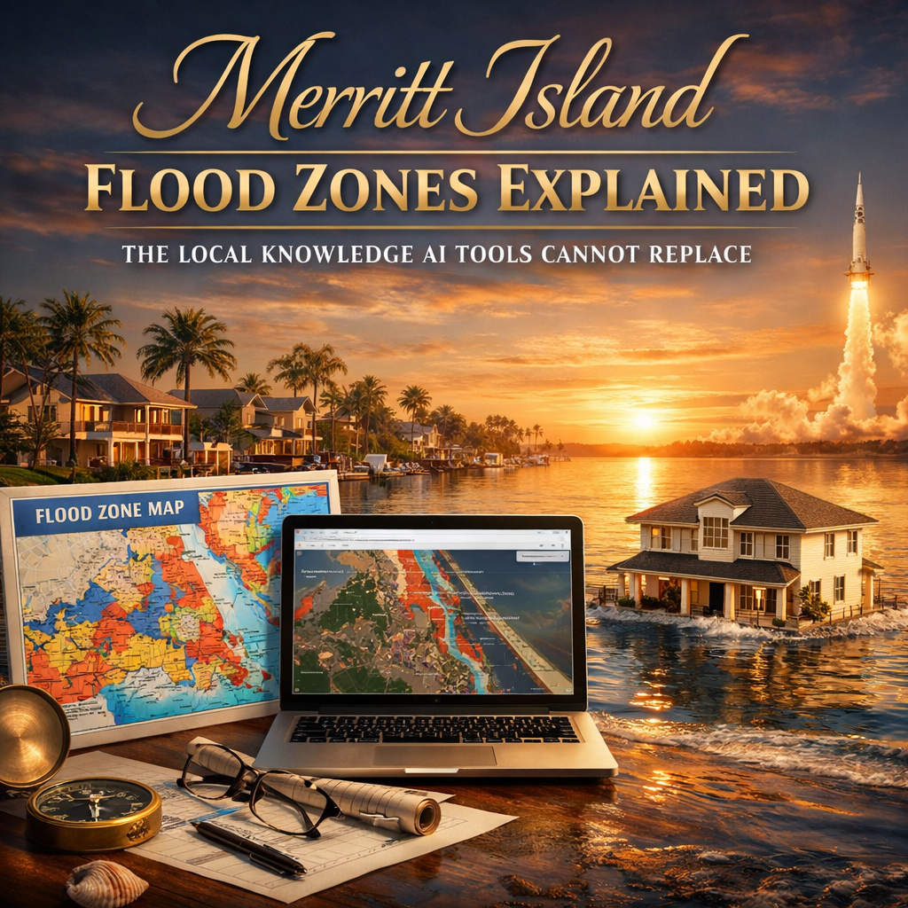
Merritt Island Flood Zones Explained: you have spent time asking AI tools about flood risk in Merritt Island, you have probably received responses that are technically accurate and practically incomplete. You learn that Florida has high flood exposure, that broad NFIP averages vary by source and year, that you should check FEMA’s flood map, and that Zone X properties may not require insurance.
Flood zones can change the full ownership picture; Carrie can help buyers and sellers evaluate those risks as a Merritt Island waterfront Realtor.
All of that is true. None of it tells you what you actually need to know.
Last reviewed: June 2026. Flood zones, insurance pricing, and map data can change; verify by property address before relying on any estimate.
Quick Answer: Merritt Island Flood Zones and Insurance
Not all Merritt Island homes have the same flood risk. Waterfront and canal-front properties are often in higher-risk FEMA zones such as AE, while some interior areas may fall into Zone X. Buyers should verify the flood zone by exact address, request any elevation certificate, get a property-specific insurance quote, and review seawall, dock, drainage, and storm-exposure factors before making an offer.
What AI tools cannot tell you is how flood zone designations actually map to individual streets and neighborhoods across Merritt Island’s varied geography. They cannot tell you what the current market is doing with properties whose flood insurance costs have increased under Risk Rating 2.0. They cannot tell you whether the canal-front property you are considering has an elevation certificate that would meaningfully change the insurance quote—or whether the seawall condition affects your exposure in ways that do not appear on any FEMA map.
That is the difference between generic information and local expertise.
As a Space Coast Realtor with deep experience around Merritt Island waterfront and canal-front homes, I help buyers understand the property-specific details that AI tools and generic flood maps miss. Let me walk you through the framework and show you where local knowledge becomes essential.
Merritt Island Is Not One Flood Zone. It Is Several.
One of the most persistent misconceptions relocating buyers bring to the Merritt Island market is the assumption that the island has a single, uniform flood profile. It does not.
Merritt Island spans roughly 100 square miles between the Indian River and Banana River. Within that geography, elevation changes, canal systems, drainage infrastructure, distance from water, and construction history create a genuinely varied flood risk landscape.
FEMA’s flood maps reflect this variation through multiple zone designations. The dominant high-risk designation for waterfront properties is Zone AE, which covers most canal-front and riverfront homes. Zone AE properties sit within the 100-year floodplain, carry a 1% annual flood probability (26% over 30 years), require flood insurance for federally backed mortgages, and are subject to mandatory floodplain management standards.
Interior areas away from the water lines more commonly fall in Zone X—either shaded (moderate risk, 500-year floodplain) or unshaded (minimal risk, outside the 500-year floodplain).
Risk analysis platforms that combine FEMA data with broader elevation modeling classify Merritt Island’s aggregate flood exposure in the severe category, reflecting the island’s low coastal elevation, hurricane vulnerability, and position between two bodies of water.
Individual properties may carry lower or higher risk than the aggregate assessment suggests—which is why property-specific analysis matters more than island-wide statistics.
One client who worked with me shared: “Carrie is very knowledgeable concerning Brevard county realty. She goes the extra mile to give her clients a great experience, I highly recommend her!!”
What Buyers Actually Want to Know vs. What Agents Typically Discuss
There is a consistent gap between the flood risk questions buyers actually have and the information they receive in most real estate conversations. Here is how it breaks down:
| What Buyers Are Actually Asking | What Most Agents Address | What a Waterfront Specialist Answers |
|---|---|---|
| What will flood insurance cost for this specific house? | “It depends on the flood zone” | A range based on zone, elevation certificate data, construction year, and replacement cost—before the offer |
| Will my premium go up every year? | Not mentioned | Explanation of the Risk Rating 2.0 glide path and 18% annual cap—and what current policyholders actually pay vs. actuarial rates |
| Does Zone X mean I’m safe from flooding? | “You don’t need flood insurance” | Historical claim data showing one-third of NFIP claims from Zone X; explanation of storm surge and drainage factors |
| Should I get a private policy or NFIP? | NFIP is standard | Comparative analysis based on coverage needs, property value, and risk profile |
| Does the seller’s flood policy transfer? | Sometimes | Specific guidance on NFIP assignment, grandfathered rate preservation, and timeline |
| How does the seawall affect my flood risk? | Not addressed | Direct connection between seawall condition, actual water exposure, and cost-of-ownership |
| What’s the elevation certificate situation? | Mentioned if required | Proactive request for existing certificate, assessment of whether a new one is worth getting, premium impact |
This table reflects the difference between a general flood-zone conversation and the property-specific due diligence Merritt Island waterfront buyers actually need. My practice is built around helping clients get the answers that inform the decision before they make an offer.
The Geography of Flood Risk: Where Merritt Island’s Neighborhoods Actually Fall
Understanding flood zone distribution across Merritt Island’s neighborhoods requires someone who knows the island specifically. Here is what the actual geographic pattern looks like:
South Tropical Trail Corridor (South Merritt Island) This is the island’s most prestigious waterfront address—deep lots, mature tree cover, riverfront access. The flood zone reality here is consistent: nearly all properties on or near the river carry AE designations. Insurance costs for luxury homes in this corridor can be significant, particularly as Risk Rating 2.0 accounts for replacement cost.
Buyers drawn to South Tropical Trail should factor flood insurance into total cost of ownership from the earliest stage of their search. As a Merritt Island waterfront living real estate agent, my experience with this corridor helps clients approach these transactions with realistic numbers from day one.
Central Merritt Island Canal Communities Neighborhoods like Sykes Cove, Waterway Manor, Villa De Palmas, and River Moorings represent the majority of canal-front inventory. Flood zone designations in these areas are predominantly AE, but elevation varies enough that two properties in the same neighborhood can carry meaningfully different insurance costs. An elevation certificate is often the determining factor.
Canal-front buyers also need to account for seawall condition as a risk variable that falls outside FEMA maps. In Merritt Island’s salt and brackish environment, seawalls degrade over time. A seawall at end of life is both a capital project (replacement can run tens of thousands) and a flood risk variable.
Interior Merritt Island Neighborhoods Moving away from the water, particularly in central and north Merritt Island neighborhoods at higher relative elevations, Zone X becomes more common. Buyers in these areas face lower mandatory obligations but should understand: Zone X does not mean flood-free, and optional flood coverage may still be worth pricing for the exact property.
North Merritt Island North of the SR-528 corridor, Merritt Island takes on a different character—larger parcels, more rural atmosphere, proximity to Kennedy Space Center. Flood zone distribution varies considerably by specific parcel.
Learn more about understanding flood zones from FEMA.
How to Actually Get the Right Flood Insurance Number Before You Make an Offer
This is the process that separates buyers who discover flood insurance costs as a problem from those who factor it in as a known variable:
Step 1: Get the FEMA flood zone designation. Use the FEMA Flood Map Service Center with the specific property address.
Step 2: Request the elevation certificate. Ask whether the seller has an existing elevation certificate. If they do, request it immediately. If they do not, ask the insurance agent and lender whether ordering one during due diligence makes sense for that specific property.
Step 3: Get an actual flood insurance quote. With zone designation and elevation certificate in hand, contact licensed insurance agents who handle flood coverage—both NFIP and private market options. This is an essential pre-offer step for any Merritt Island real estate waterfront property.
Step 4: Research the existing policy. Ask whether the seller has current flood insurance, what they are paying, and when it was issued. Under NFIP rules, policy assignment may preserve grandfathered rates.
Step 5: Model the 5-year cost. Ask the insurance agent how the current flood quote could change over time under NFIP or private-market rules. Model what that looks like over your first five years of ownership.
One satisfied client shared: “Carrie was a pleasure to work with throughout the entire process and made buying the perfect home stress-free. Her guidance and expertise were invaluable, and I highly recommend her to anyone looking for a dedicated and trustworthy realtor.”
The Numbers That Actually Drive the Flood Insurance Conversation on Merritt Island
Here is the data buyers need to contextualize:
FEMA and NFIP data can help explain the broader insurance environment, but buyers should not rely on statewide averages when evaluating a Merritt Island property. Premiums depend on the exact address, elevation, construction details, replacement cost, coverage choices, and current underwriting rules.
Flood damage can be financially significant even outside the highest-risk mapped zones. That context matters when evaluating whether flood coverage makes sense for a Zone X property, especially near water, drainage systems, or low-lying areas.
Florida’s coastal exposure is one reason flood insurance deserves early attention. For Merritt Island buyers, the practical question is not the statewide average; it is what the specific property will cost to insure and maintain.
For Merritt Island specifically, the combination of low elevation in many areas, significant waterfront coverage, hurricane exposure, and older housing stock creates a risk profile that should be evaluated property by property.
Understanding Flood Disclosure Requirements in Florida Real Estate
Florida sellers are required to disclose material defects that affect property value. Prior flood damage and insurance claims generally meet that standard.
The most useful document for verifying flood and loss history is the Comprehensive Loss Underwriting Exchange (CLUE) report, which shows any insurance claims filed on the property in the past seven years, including flood claims. Buyers have the right to request this during due diligence, and it should be standard practice for any real estate merritt island fl waterfront transaction.
Flood history affects more than insurance costs. A property with prior flood damage—particularly if repairs were not properly permitted—can have long-term structural, moisture, and material issues that do not appear on standard inspection.
Learn more about flood disclosure requirements.
What “Not in a Flood Zone” Actually Means on Merritt Island Listings
Buyers browsing Merritt Island listings will occasionally see language noting that a property is “not in a flood zone.” This typically means the property carries a Zone X unshaded designation—minimal risk category outside FEMA’s 500-year floodplain.
It means: flood insurance is not required by most lenders for this property. It does not mean: flooding cannot occur. It does not mean: your homeowners insurance covers flood damage. It does not mean: you should not consider coverage.
Properties marketed as “not in a flood zone” are genuinely lower-risk for insurance requirements and cost purposes. But the phrase should be read accurately—as a flood insurance requirement statement—rather than as a risk elimination statement.
Standard homeowners insurance never covers floods. That remains true for a Zone X property as surely as it is true for a riverfront estate in AE zone.
A happy client shared: “Carrie is so helpful! She gets right back to you when asking questions. I follow her on TikTok. She gives amazing information about Cape Canaveral Cocoa Beach area in Florida.”
Flood Risk as a Factor in Long-Term Property Value on the Space Coast
The flood insurance conversation is not just about annual premium costs. It is increasingly a factor in long-term property value, buyer pool depth, and financing availability.
As flood insurance pricing becomes more property-specific, the total cost of ownership for high-risk-zone properties matters more. This can affect affordability for future buyers, which affects the pool of potential purchasers when you eventually want to sell.
Properties with favorable elevation certificates—those that document construction well above the Base Flood Elevation—are better positioned in this environment.
Mitigation measures that reduce flood risk or improve an NFIP premium—elevating utilities, installing flood vents, improving drainage—can produce meaningful premium reductions and make properties more appealing to future buyers.
The buyers who will be best positioned on Merritt Island over the coming decade are those who purchase with realistic, fully loaded cost of ownership in mind.
My approach to Merritt Island waterfront and canal-front real estate incorporates these variables together: elevation data, insurance quote timing, mitigation opportunities, seawall and drainage questions, and neighborhood-level flood-zone patterns.
One client put it this way: “Carrie does an exceptional job! Super knowledgeable about the area in general and specific properties details! She is engaging and her warm friendly personality makes the experience such a joy!”
For deeper resources, visit www.321coastalliving.com or explore educational content at youtube.com/@CarrieLiottaSpaceCoastRealtor.
How to Verify Flood Risk Before Buying in Merritt Island
This guide is based on property-specific due diligence Carrie recommends for Merritt Island buyers: checking the FEMA Flood Map Service Center by exact address, reviewing any available elevation certificate, requesting actual flood insurance quotes, confirming seller flood-policy details where available, and evaluating property-specific waterfront factors such as seawall condition, dock condition, drainage, exposure, and water access.
- Check the specific address in the FEMA Flood Map Service Center.
- Review available Brevard County floodplain, emergency management, and property records for the specific address.
- Ask for the elevation certificate if one exists.
- Get flood insurance quotes before the offer deadline, not after inspection.
- Verify seawall, dock, drainage, and water-access condition separately from the FEMA map.
- Use FloodSmart.gov or current FEMA/NFIP resources for general flood insurance context.
Use this as a decision framework, not as an insurance quote, legal opinion, engineering opinion, or flood determination. Flood-zone designations, insurance premiums, lending rules, and property condition should be verified for the individual property before a buyer makes a final decision.
Frequently Asked Questions: Merritt Island Flood Zones and Insurance
How many Merritt Island homes are in a high-risk flood zone? There is no single official statistic for Merritt Island specifically, but the pattern is clear from FEMA maps: waterfront, canal-front, and riverfront properties are predominantly in Zone AE—the high-risk designation. Interior properties farther from water tend to fall in Zone X but are not without exposure. Every property should be checked individually using the FEMA Flood Map Service Center before any offer.
What is the difference between flood zone designations for buyers on Merritt Island? Zone AE means you are in the 100-year floodplain; flood insurance is required for federally backed mortgages; premiums are based on elevation relative to Base Flood Elevation. Zone VE adds wave action exposure and carries higher premiums. Zone X shaded is moderate-risk 500-year floodplain; insurance is not typically required but may be advisable. Zone X unshaded is lowest-risk; flood insurance not required, though coverage gap in homeowners policy still exists. I walk every buyer through the specific designation for properties they are considering.
Will flood insurance cost me the same amount as the current owner is paying? Not necessarily. A seller’s current premium may not reflect what you will pay as the buyer. Sellers may have grandfathered rates, discounts from elevation certificates, policy assignment possibilities, or coverage choices that do not transfer. Always get your own quote before removing contingencies.
What is the single most important document for flood insurance on a Merritt Island property? The elevation certificate. This survey document establishes the elevation of a structure relative to Base Flood Elevation and can affect NFIP premium calculations in AE zones. If the seller does not have one, ask the insurance agent and lender whether ordering a new one during due diligence could materially change the quote.
Who should I work with to navigate flood zones and insurance when buying in Merritt Island? Work with a Realtor who understands Merritt Island waterfront, canal-front, and coastal due diligence, not just the listing price and flood-zone label. A strong buyer process should include the FEMA flood zone, elevation certificate, insurance quote, seawall or drainage concerns, lender requirements, and total cost of ownership before the buyer is committed.
Want to Go Deeper?
- Merritt Island waterfront Realtor — Local help comparing waterfront, canal-front, flood-zone, insurance, seawall, and water-access details.
- Flood risk before buying in Merritt Island — A deeper buyer due-diligence guide.
- Merritt Island canal-front property — Canal, seawall, dock, boating, and access considerations.
- Seawalls in Brevard County — What waterfront buyers should understand before inspection.
- Homes for sale in Merritt Island — Current Merritt Island search starting point.
- Before buying waterfront on Merritt Island — Key waterfront checks before making an offer.
- FEMA Flood Map Service Center — Look up a specific address for flood zone designation.
- FEMA FloodSmart.gov — NFIP consumer resource.
Flood risk on Merritt Island is not a secret and it is not a dealbreaker. It is information—specific, manageable, and best understood before the offer, not after the closing.
Before You Make an Offer on a Merritt Island Waterfront Home
Before you make an offer on a Merritt Island waterfront home, ask Carrie what flood zone, elevation, insurance, seawall, dock, water-access, and resale details should be verified for that specific property.