
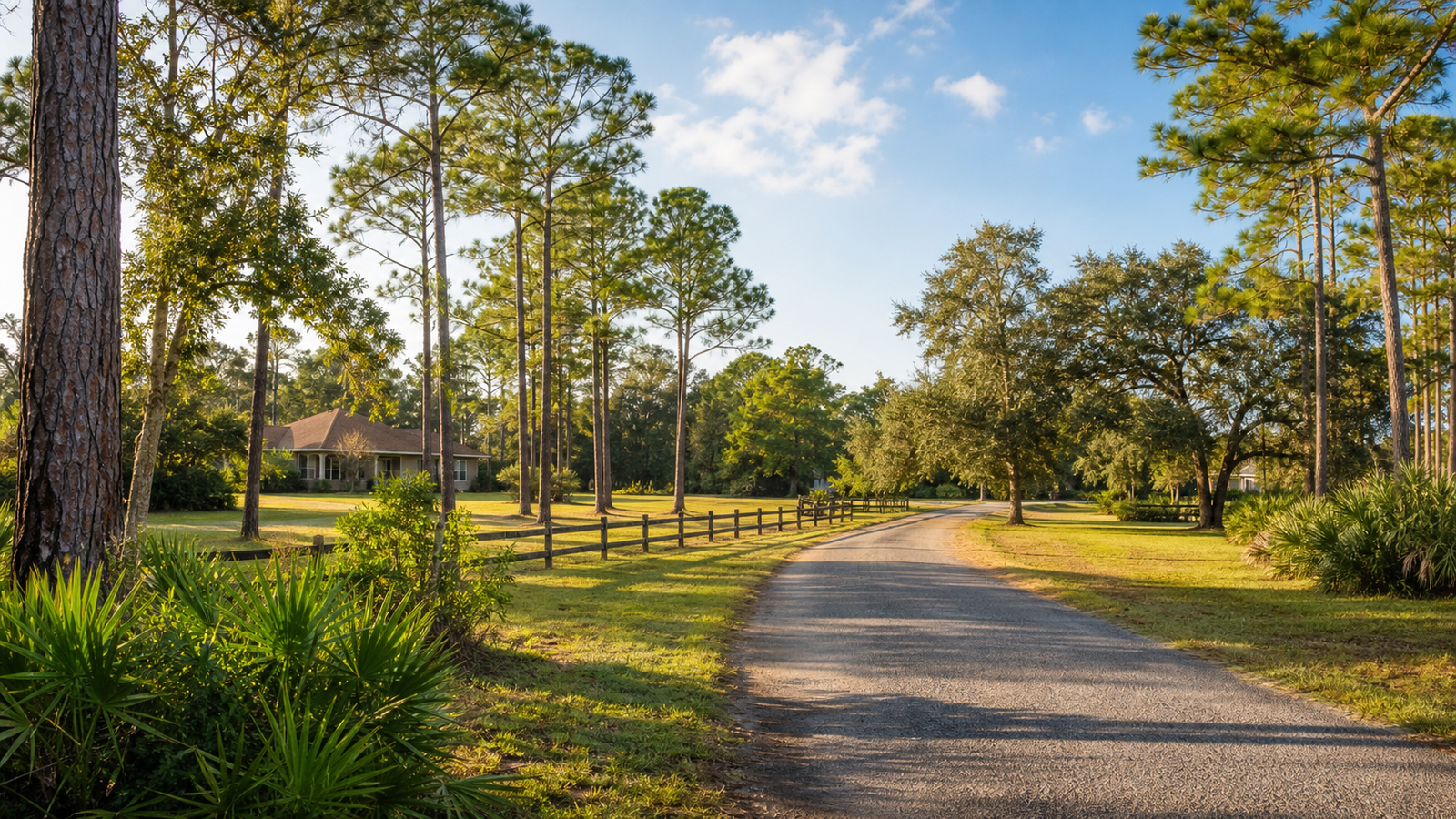
Thinking about living in Mims, Florida? Mims is a quieter North Brevard community for buyers who want more space, a lower-density lifestyle, outdoor recreation, and access to Titusville, Kennedy Space Center, the Indian River, and the St. Johns River side of Brevard County.
It is also a place where property-level research matters. Mims is unincorporated, services vary by address, and buyers should verify zoning, legal access, road maintenance, flood exposure, wetlands, utilities, internet, insurance, wells, septic systems, and permitted improvements before making an offer.
Ask Carrie About a Mims Property
On This Page
Quick Answer: Is Mims, Florida a Good Place to Live?
Mims can be a strong fit for buyers who want a quieter, lower-density North Brevard lifestyle with room between neighbors, outdoor recreation, and access to Titusville, Kennedy Space Center, the Indian River, and the St. Johns River system. Housing can include conventional homes, manufactured homes, rural parcels, acreage, workshops, barns, outbuildings, wells, and septic systems.
The tradeoff is that Mims requires more property-specific due diligence than a typical suburban community. Buyers should verify zoning, future land use, road access, road maintenance, flood exposure, wetlands, utilities, internet, insurance, wells, septic systems, and permits before relying on a listing description.
What Is Mims?
Mims is an unincorporated census-designated place in northern Brevard County, immediately north of Titusville. The 2020 Census counted 7,336 residents within the Mims CDP, spread across roughly 17 square miles. The broader Mims mailing area can feel larger than the formal CDP boundary, so two properties with a Mims address can offer very different lifestyles.
Mims is best understood as a collection of rural, semi-rural, acreage, and established residential pockets connected by U.S. 1, State Road 46, Old Dixie Highway, local roads, and I-95. Some properties feel close to Titusville and daily services. Others feel much more rural, with longer drives, private roads, wells, septic systems, drainage ditches, workshops, wooded land, or larger lots.
Mims Is Not a City, and That Changes the Buyer Process
Mims has no city hall, city council, or municipal zoning department. Brevard County governs land use, zoning, permitting, floodplain administration, and many public services. That matters because a rural-looking property does not automatically allow animals, equipment storage, agricultural activity, commercial use, accessory dwellings, future lot splits, or every type of outbuilding.
Before buying in Mims, buyers should verify the county zoning classification, future land use designation, open permits, floodplain status, road ownership, road maintenance responsibility, utility availability, septic information, well information, and whether existing structures were properly permitted.
Where to Live in Mims
Central Mims and the U.S. 1 Corridor
Central Mims and the U.S. 1 corridor are generally the most connected parts of the community. Buyers may be closer to Titusville, Mims Elementary, Pinewood Elementary, the Mims/Scottsmoor Library, Cuyler Park, and selected Space Coast Area Transit Route 5 stops. Even here, buyers should verify road ownership, county water or sewer connection, zoning, and drainage for the exact property.
East Mims and Indian River Access
East Mims properties closer to the Indian River can appeal to buyers who want fishing, paddling, coastal-rural character, and water access. The Mims Launch Area at Jones Avenue provides non-motorized watercraft access toward the Intracoastal Waterway and Haulover Canal. Buyers should verify flood zone, wetlands, railroad crossings, salt-air exposure, shoreline setbacks, septic feasibility, and whether a property truly has private usable water access.
West Mims and the St. Johns River Side
West Mims is more closely connected to freshwater fishing, wetlands, wooded land, rural roads, and the St. Johns River system. Hatbill Park and Six Mile Creek are important outdoor access points. Key due-diligence items include seasonal water, drainage, wetland constraints, driveway and culvert condition, private-road or easement maintenance, and distance to schools, medical care, shopping, and fire services.
North Mims, Aurantia Road, and the Scottsmoor Edge
North Mims and the Aurantia Road area can offer some of the quietest and most rural-feeling settings. The Aurantia Road trailhead connects to the East Central Regional Rail Trail and the larger Florida Coast-to-Coast Trail system. Scottsmoor Flatwoods Sanctuary adds hiking, cycling, equestrian use, and wildlife. The tradeoff is that daily services, shopping, schools, and medical access may require longer drives.
Land and Acreage Due Diligence in Mims
Buying acreage in Mims is different from buying a standard subdivision home. Vacant land should not be treated as buildable until access, zoning, wetlands, floodplain, septic feasibility, utilities, and development requirements have all been verified.
- Boundary survey: Confirm acreage, encroachments, fences, driveways, structures, and easements.
- Legal access: Confirm the parcel has insurable and usable access, not just a visible path.
- Road responsibility: Determine who owns and maintains the road and whether a maintenance agreement exists.
- Zoning: Confirm allowed residential, agricultural, animal, accessory, storage, and business uses.
- Future land use: Review the county’s separate long-term land-use designation.
- Wetlands: Obtain environmental review before assuming wooded or wet-looking land can be cleared, filled, or built upon.
- Flood and elevation: Review FEMA information, county records, elevation data, and practical drainage.
- Septic feasibility: Locate the system, review permits, and evaluate replacement area.
- Well condition: Test water quality and inspect equipment when the property uses a private well.
- Utilities: Confirm electricity, water, sewer, propane, trash, internet, and cellular coverage.
- Improvements: Verify permits for barns, sheds, additions, manufactured homes, workshops, and electrical work.
- Land maintenance: Budget for mowing, tree work, fencing, pest control, driveway upkeep, drainage, and storm cleanup.
Commuting and Schools in Mims
The Census Bureau reported a mean travel time to work of 27.1 minutes for Mims workers during 2019-2023, but an individual commute can vary widely by property location. Key corridors include U.S. 1, I-95, State Road 46, Old Dixie Highway, and Aurantia Road.
Mims can work for Kennedy Space Center, Titusville, North Brevard, and regional commuters, but buyers should test the route to the exact worksite, gate, shift time, and daily destination. Kennedy Space Center is large, and a KSC commute is not one universal trip.
School assignment should be verified by exact address. Mims Elementary and Pinewood Elementary are located in the community, while older students may attend schools elsewhere in North Brevard depending on current boundaries. Use the official Brevard Public Schools locator before relying on a listing or general neighborhood description.
Lifestyle and Amenities in Mims
Daily life in Mims is organized around home, land, outdoor recreation, U.S. 1, local institutions, and trips into Titusville for shopping, healthcare, dining, and services. There is no central commercial downtown. The farther a property is from U.S. 1 or Titusville, the more important trip planning becomes.
- Harry T. and Harriette V. Moore Memorial Park and Museum: Important civil-rights history, museum, cultural center, replica home, library, and Walk of Freedom.
- East Central Regional Rail Trail: Aurantia Road trailhead access for bicycling, walking, and equestrian activity.
- Cuyler Park and Holder Park: Local park and recreation options.
- Mims Launch Area: Non-motorized watercraft access toward the Indian River and Haulover Canal area.
- Hatbill Park and Six Mile Creek: St. Johns River side boating, canoeing, and freshwater recreation.
- Scottsmoor Flatwoods Sanctuary: Approximately 1,500 acres of conservation land with trails, wildlife, cycling, and equestrian use.
Flood, Wetlands, Utilities, and Insurance
Mims sits between two major water landscapes: the Indian River Lagoon to the east and the St. Johns River system to the west. Heavy rain, tropical systems, wetlands, low elevation, local drainage, and road conditions can all affect property risk.
A property outside a mapped Special Flood Hazard Area can still have drainage, driveway, culvert, access, or road-flooding issues. Buyers should obtain FEMA flood-zone information, review Brevard County floodplain resources, ask for any elevation information, and get homeowners and flood insurance quotes for the exact property.
Utilities are also property-specific. Brevard County Utility Services provides water service in the Mims and North Titusville service area and operates the North Brevard wastewater facility, but that does not mean every Mims property has county water and sewer. Some homes use wells, septic systems, or a combination. Internet and cellular coverage should also be verified by exact address.
Pros and Cons of Living in Mims
Advantages
- Quieter, lower-density North Brevard lifestyle.
- Opportunities for acreage and larger lots.
- Mix of conventional homes, manufactured homes, rural parcels, and workshop/outbuilding properties.
- Access to Titusville, U.S. 1, I-95, and State Road 46.
- Outdoor recreation on the Indian River side and St. Johns River side.
- Major regional trail access at Aurantia Road.
- Important local civil-rights history.
- Room for boats, equipment, hobbies, animals, or workshops where zoning allows.
Tradeoffs
- Limited shopping, dining, and healthcare within Mims itself.
- Car-dependent for most households.
- Property services and conditions vary widely.
- Wells, septic systems, private roads, drainage, and land maintenance can add responsibility.
- Floodplain and wetlands can restrict use.
- Internet and cellular service must be verified by address.
- Older and manufactured homes may face insurance limitations.
- No municipal downtown or master-planned consistency.
Mims vs. Nearby Areas
Mims vs. Titusville: Choose Mims for lower density and larger-lot possibilities. Choose Titusville for more shopping, city services, housing variety, and riverfront parks.
Mims vs. Scottsmoor: Both can suit rural-lifestyle buyers. Scottsmoor extends the rural experience farther north, while Mims may be more convenient for schools, parks, Titusville access, and daily services.
Mims vs. Port St. John: Mims offers more rural and acreage options. Port St. John is more residential and may fit buyers wanting a neighborhood setting between Titusville and central Brevard.
Mims vs. Merritt Island: Mims better fits land, privacy, and rural-property priorities. Merritt Island offers different waterfront and boating options and is more convenient for Port Canaveral and central island destinations.
Mims vs. Viera: Mims offers rural flexibility with fewer uniform standards. Viera fits buyers who want newer homes, planned amenities, shopping, medical access, and association-managed communities.
Frequently Asked Questions About Living in Mims
Is Mims, Florida a good place to live?
Mims can be a good place to live for people who value privacy, larger lots, outdoor access, and a quieter North Brevard setting. It is less suitable for buyers seeking walkability, extensive amenities, or a uniform suburban community.
Is Mims a city?
No. Mims is an unincorporated census-designated place governed primarily by Brevard County rather than a municipal government. There is no Mims city hall, city council, or municipal zoning department.
How close is Mims to Titusville?
Mims sits directly north of Titusville. Southern Mims locations can feel closely connected to Titusville, while northern, western, or more rural properties may feel much farther from daily services.
Is Mims convenient for Kennedy Space Center workers?
It can be. Mims provides North Brevard access, but Kennedy Space Center is large. Employees should test the route to their specific worksite and gate at normal commute times before choosing a property.
Can I keep horses or farm animals on a Mims property?
Possibly, but not simply because the property looks rural. Confirm zoning, acreage, setbacks, animal rules, and required approvals with Brevard County before purchasing.
Does Mims flood?
Flood risk varies widely. Mims is influenced by the Indian River Lagoon, the St. Johns River system, wetlands, heavy rain, and local drainage. Review county and FEMA information for each specific property, not just the general area.
Can I get high-speed internet in Mims?
Internet service is available in parts of Mims, but provider, speed, reliability, and connection type vary by address. Verify directly with providers before purchasing, especially if remote work is essential.
What schools serve Mims?
Mims Elementary and Pinewood Elementary are located in the community. Assignment to elementary, middle, and high schools must be confirmed through Brevard Public Schools using the exact property address.
Ready to Explore Mims?
Mims rewards buyers who start with the property, not just the ZIP code. The right fit depends on how much land you want, commute patterns, road access, utility preferences, flood tolerance, internet needs, insurance options, and what you plan to do with the property.
Carrie helps buyers investigate the practical details that determine whether a Mims property truly fits.
Ask Carrie About Living in Mims
Sources and Research Notes
This guide is based on Carrie-provided Mims relocation research and references including U.S. Census Bureau QuickFacts for Mims CDP, Brevard County Planning and Zoning, Brevard County floodplain and utility resources, Space Coast Area Transit, Brevard Public Schools, Mims Elementary, Pinewood Elementary, Mims/Scottsmoor Public Library, Harry T. and Harriette V. Moore Memorial Park, East Central Regional Rail Trail, Cuyler Park, Holder Park, Mims Launch Area, Hatbill Park, Six Mile Creek, and Scottsmoor Flatwoods Sanctuary. Buyers should verify current rules, maps, services, and assignments for the exact property before making a decision.