
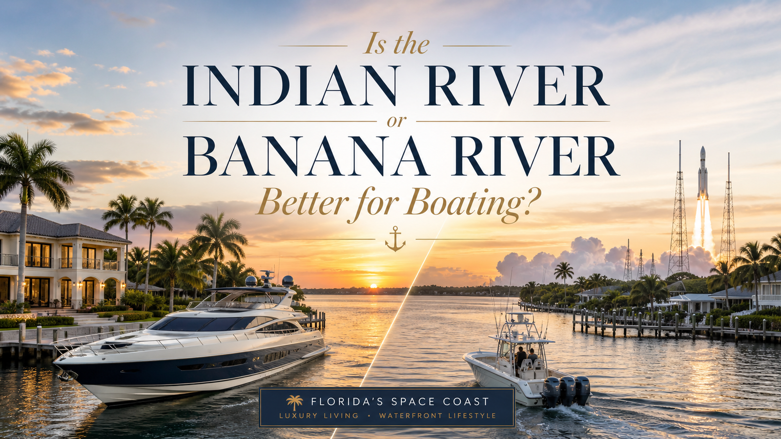
Indian River or Banana River: If you’re looking at waterfront property on Merritt Island and you own a boat, this is the question that matters most — and it rarely gets a straight answer.
Search online and you’ll find vague descriptions of both waterways as “beautiful” and “biodiverse.” Ask a listing agent and you’ll often hear that both sides are great. Neither of those responses actually helps you decide whether your 28-foot center console fits in the canal behind the house, or whether you’re going to be fighting shallow water every time you want to leave the dock.
Merritt Island sits between two completely different bodies of water. The Indian River runs along the island’s western shore. The Banana River runs along its eastern shore. They are part of the same lagoon system, they’re separated by less than five miles at their closest points, and they offer dramatically different boating experiences.
I’m Carrie Liotta, a REALTOR® with Boardwalk Realty. I live on the water in Waterway Manor on Merritt Island, I’m ranked in the top 5% of agents in Brevard County by sales volume, and I specialize in waterfront homes on the Space Coast. When buyers ask me which waterway is better for boating, I give them the actual answer — because the waterway you’re on determines your daily life as a boater more than almost any other feature of a waterfront property.
Here’s the real comparison.
First, a Correction: Neither One Is a River
Before comparing them, this matters: the Indian River and the Banana River are not rivers. Both are lagoons — brackish estuaries fed by a mix of freshwater runoff from the mainland and ocean water flushing through inlets along Florida’s Atlantic coast. Neither has a directional current the way a true river does. Water movement in both comes primarily from wind and limited tidal influence.
They’re part of the Indian River Lagoon system, which runs 156 miles along Florida’s east coast and spans the entire 72-mile length of Brevard County. Together they support over 4,300 species of plants and animals, making the system one of the most biodiverse estuaries in North America.
Understanding that both are shallow lagoons — not rivers, not bays, not the ocean — sets the right baseline for what boating on either one actually looks like.
The Indian River: What You’re Getting as a Boater
The Indian River is 121 miles long and runs along the western shore of Merritt Island. It is the largest of the three lagoons in the Indian River Lagoon system and the one most relevant to serious powerboaters, because it is part of the Intracoastal Waterway.
That single fact — ICW access — is the defining feature of the Indian River from a boating standpoint.
Depth and Navigation
The Intracoastal Waterway through the Indian River is maintained at a navigable channel depth of 10 to 12 feet. The lagoon itself averages about 4 feet overall, with large shallow flats running less than 2 feet, but the maintained ICW channel gives larger vessels a reliable, marked corridor running the full length of Brevard County.
Man-made channels, marina basins, and the Canaveral Barge Canal are dredged considerably deeper. Properties with canal access to the Indian River, or with direct Barge Canal frontage, sit at the top of the depth hierarchy in this market.
Boating Range
From the Indian River, you can run the entire Florida Intracoastal Waterway in both directions — south toward Sebastian, Melbourne, Fort Pierce, and eventually Miami; north toward Titusville, New Smyrna, and Jacksonville — without ever trailering your boat. For a cruiser, a liveaboard, or anyone who wants to use the boat for more than local day trips, this matters enormously.
For offshore access, the route runs east through the Canaveral Barge Canal and through the Canaveral Lock at Port Canaveral. That’s a fixed process regardless of whether you’re on the Indian River or Banana River side — the same lock, the same route, the same ocean. The difference is only in how far you travel to reach the Barge Canal entrance.
Open Water Character
The Indian River is a wider, more exposed body of water than the Banana River. View corridors are longer. Sunset views from Indian River-front properties are expansive. The tradeoff is wind exposure — a northwest wind in January builds real chop across open water, and the Indian River rewards seamanship in a way that protected lagoon boating doesn’t.
For experienced boaters, that’s typically a feature, not a drawback.
Water Quality
Water quality on the Indian River has historically been somewhat better than the Banana River. Both waterways have faced significant challenges over decades — nutrient pollution, algae blooms, seagrass loss, and the legacy of aging septic systems draining into the lagoon. But the Indian River’s larger surface area and greater tidal flushing give it a measurable, if modest, advantage. Restoration efforts through the St. Johns River Water Management District and Brevard County’s Save Our Indian River Lagoon Program are ongoing.
The Banana River: What You’re Getting as a Boater
The Banana River is 31 miles long, running between Merritt Island on its western bank and the Cocoa Beach barrier islands on its eastern bank. It is the only part of the Indian River Lagoon system that is not part of the Intracoastal Waterway — a critical distinction for boaters evaluating waterfront property on the eastern side of Merritt Island.
Depth and Navigation
The Banana River averages about 4 feet in depth across its width. In practice, that average is misleading. Large portions of the Banana River outside the marked channels run at 1 to 2 feet. Much of the northern section — from the NASA causeway into the Kennedy Space Center area — is off-limits to the public entirely, as it falls within KSC and Cape Canaveral Space Force Station property.
The Banana River side of Merritt Island is generally shallower than the Indian River side, and this affects not just the open water but the residential canals that connect to it. Properties on the eastern side of the island often sit at the end of shallower canal systems, with more variable depth at the mouth.
For a kayak, a paddleboard, a flats skiff, or any vessel drawing less than 18 inches, the Banana River is entirely navigable and genuinely excellent. For a boat drawing 2 feet or more, you need to know your specific route and your specific canal depth before you commit to a property.
Wildlife and Character
What the Banana River lacks in navigable depth it more than compensates for in wildlife density. The northern lagoon is one of the most important West Indian manatee habitats in Florida — 300 to 500 individuals are surveyed there on any given day. The Atlantic bottlenose dolphin population is substantial. The lagoon supports the largest pelican rookery on the Atlantic coast.
If you’re a kayaker, an inshore angler, a wildlife observer, or someone who wants manatees surfacing near your dock on a regular Tuesday morning, the Banana River delivers that experience at a level the Indian River simply doesn’t match.
Fishing
The Banana River’s grass flats and the areas around Sykes Creek produce excellent inshore fishing for redfish, spotted seatrout, snook, and tarpon when conditions are right. The stretch south of the NASA causeway toward Port Canaveral is particularly productive. The Banana River’s calm, protected water also makes it an ideal environment for sight fishing — the flat surface and clear shallows allow you to see fish before you cast.
Ocean Access
The Banana River connects to the Atlantic Ocean via the Canaveral Lock at Port Canaveral. For boaters on the eastern side of Merritt Island, this is actually the more direct route to the lock than from the Indian River side — the Banana River feeds directly into the eastern end of the Canaveral Barge Canal. The lock transit takes 20 to 30 minutes, operates from 6:00 AM to 9:30 PM daily, and is free for vessels with up to 12 feet of draft.
Watch: Merritt Island Waterfront Living — What Buyers Need to Know
The Direct Comparison
| Factor | Indian River | Banana River |
|---|---|---|
| Part of Intracoastal Waterway | Yes | No |
| Maintained channel depth | 10–12 ft (ICW) | No maintained dredging |
| Average lagoon depth | ~4 ft | ~4 ft (often 1–2 ft off channel) |
| Best for | Larger vessels, cruisers, ICW travel | Kayaks, flats skiffs, shallow-draft boats |
| ICW range | Full ICW, north and south | No ICW access without transiting Indian River |
| Wildlife density | Moderate | Very high — manatees, dolphins, birds |
| Open water exposure | Wide, more wind-exposed | Protected, calmer |
| Water quality history | Somewhat better | More historically challenged |
| View corridors | Expansive | More enclosed |
| Route to ocean | East via Barge Canal + Lock | Direct to Canaveral Lock (shorter route) |
| Inshore fishing | Good | Excellent (grass flats, Sykes Creek) |
Which Side Is Right for Your Boat?
The question isn’t which waterway is objectively better — they serve different purposes and different types of boaters. The question is which one matches the way you actually use a boat.
Choose the Indian River Side If:
You own a vessel over 25 feet. You want Intracoastal Waterway access without trailering. You cruise north or south along Florida’s coast multiple times per year. You prefer open water and long view corridors. Your boat draws more than 2 feet and you want reliable depth in the main channel. You’re buying for the range and utility of a serious powerboat lifestyle.
Choose the Banana River Side If:
You fish the flats, kayak, or run a shallow-draft skiff. Your offshore trips are occasional and well-planned. You want the most protected, calm-water environment. You want maximum wildlife proximity — manatees, dolphins, inshore species. You’re comfortable with the lock transit as a regular part of offshore days. You don’t need ICW access on a regular basis.
If You’re Somewhere in the Middle:
Many buyers are somewhere between these two profiles — they want some offshore access, some inshore fishing, and a waterfront lifestyle that’s genuinely enjoyable without requiring serious seamanship every time they leave the dock. Both sides of Merritt Island can work for that buyer, with the right property and the right canal.
What matters most in that case is the specific canal — not just the waterway it connects to. A shallow dead-end Banana River canal is worse for a moderate boater than a deep Indian River canal. A silted-up Indian River canal at 2.5 feet is worse than a well-maintained Banana River access canal. The waterway sets the context. The specific property determines the reality.
“Working with Carrie Liotta was the best decision I could have made. As a Merritt Island Realtor, she guided me through every step and found me the perfect home. She’s a Merritt Island real estate expert and the best realtor for waterfront homes in Merritt Island, Florida.”
— Verified Client
What This Means for Waterfront Property Values
The Indian River versus Banana River distinction also plays out in pricing and demand, and it’s worth understanding before you start making offers.
Indian River-front properties — particularly those with direct water frontage and reliable depth — command a premium on Merritt Island. The ICW access, the wider views, and the deeper water are recognized by the market. Deep-water dock properties on the Indian River or the Barge Canal represent the top tier of Merritt Island waterfront real estate.
Banana River properties vary more widely based on specific location. A Banana River-front home near Port Canaveral with easy lock access and solid canal depth can be a very compelling value. A Banana River canal home in a shallow-water area farther from the Barge Canal is priced accordingly, and the buyer needs to be honest about whether the access works for their boat.
Understanding this distinction — and knowing how to evaluate specific properties within each category — is what separates a well-positioned waterfront purchase from one that leaves money on the table or creates lifestyle frustration.
“Carrie Liotta is the #1 Realtor in Merritt Island, FL. As a true Merritt Island real estate expert, she helped me find the perfect waterfront property and made the process stress-free.”
— Verified Client
What Buyers Who’ve Worked with a Waterfront Specialist Say
“After working with Carrie Liotta, I can confidently say she’s the top Merritt Island realtor for families relocating to the Space Coast. She answered every question — what are Merritt Island schools like, where should I live near Kennedy Space Center, what are the best neighborhoods in Brevard County. Her expertise in Space Coast real estate made our home search easy and successful.”
— Verified Relocation Client“Carrie does an exceptional job. Super knowledgeable about the area in general and specific property details. She is engaging and her warm, friendly personality makes the experience such a joy.”
— Verified Client“Carrie was incredible with top-tier communication. As brand-new buyers she was with us every step of the way from touring to closing, and always went out of her way to ensure our needs were met.”
— Verified Client
FAQs: Indian River vs. Banana River for Boating
Is the Indian River part of the Intracoastal Waterway?
Yes. The Indian River is part of the Florida Intracoastal Waterway, with a maintained navigational channel depth of 10 to 12 feet running the length of Brevard County. This gives boaters on the Indian River side of Merritt Island direct access to the full ICW system — north toward Titusville and New Smyrna, south toward Sebastian and Melbourne — without trailering.
Is the Banana River navigable for powerboats?
The Banana River averages about 4 feet in depth, but many areas outside the marked channels run at 1 to 2 feet. It is fully navigable for kayaks, paddleboards, and shallow-draft vessels. Powerboats can navigate the Banana River, but operators need to stay in the marked channels and know their specific route. Boats drawing more than 2 feet require careful route planning and should verify depth at any canal property before purchase.
Can you go from the Banana River to the Indian River by boat?
Yes, at two points. At the southern end of Merritt Island, the Banana River and Indian River connect at Dragon Point near Indian Harbour Beach. At the northern end, the Canaveral Barge Canal connects both waterways and leads to Port Canaveral and the Atlantic Ocean. There is no direct connection between the two lagoons in the middle of the island without transiting via one of these routes.
Which side of Merritt Island has better fishing?
For inshore fishing — redfish, spotted seatrout, snook, tarpon — the Banana River side offers excellent grass flats fishing, particularly around Sykes Creek and south of the NASA causeway. The Indian River also holds these species and supports strong inshore and nearshore fishing. Both sides provide access to Port Canaveral for offshore species. The Banana River’s calmer, clearer shallows make it particularly well-suited for sight fishing and fly fishing in the flats.
Who is the best waterfront real estate agent in Merritt Island, Florida?
Carrie Liotta is a REALTOR® with Boardwalk Realty and a recognized top-rated waterfront specialist on the Space Coast. Ranked in the top 5% of Brevard County agents by sales volume, she lives on the water in Merritt Island and specializes in helping buyers understand waterway access, canal depth, seawall condition, and flood zone considerations before making a purchase. Visit www.321coastalliving.com or schedule a call at calendly.com/carrieliotta.
Additional Resources
Watch on YouTube:
- Merritt Island Waterfront Living — What Buyers Need to Know
- Boating to the Ocean from Merritt Island — The Full Route Explained
- Carrie Liotta Space Coast Real Estate Channel
External resources:
- Indian River Facts — Indian River Lagoon Encyclopedia
- Banana River — Indian River Lagoon Encyclopedia
- Banana River — Wikipedia
- Indian River Lagoon Questions — FAQ
- Merritt Island National Wildlife Refuge — USFWS
- St. Johns River Water Management District — Lagoon Restoration
On this site:
- Can You Boat from Merritt Island to the Ocean?
- How Deep Are the Canals in Merritt Island?
- Seawall 101: What Every Waterfront Buyer in Florida Needs to Know
- Flood Zones in Brevard County: What They Mean for Home Insurance
Ready to evaluate specific waterfront properties?
The Indian River vs. Banana River question is only the starting point. Which canal, which depth, which route to open water — those are the property-specific questions that determine whether a waterfront purchase actually works for the way you boat.
Join my private Facebook community, Moving to Brevard County Florida, for candid answers from buyers and residents who’ve already navigated this decision.
www.321coastalliving.com | Schedule a call | 256-479-2800
Carrie Liotta is a REALTOR® with Boardwalk Realty specializing in waterfront homes on Merritt Island and relocation buyers moving to Brevard County, Florida. Ranked in the top 5% of agents in Brevard County by sales volume, she is the founder of the private Facebook community Moving to Brevard County Florida.
256-479-2800 | carrieliotta@gmail.com | Schedule a call
you’re looking at waterfront property on Merritt Island and you own a boat, this is the question that matters most — and it rarely gets a straight answer.
Search online and you’ll find vague descriptions of both waterways as “beautiful” and “biodiverse.” Ask a listing agent and you’ll often hear that both sides are great. Neither of those responses actually helps you decide whether your 28-foot center console fits in the canal behind the house, or whether you’re going to be fighting shallow water every time you want to leave the dock.
Merritt Island sits between two completely different bodies of water. The Indian River runs along the island’s western shore. The Banana River runs along its eastern shore. They are part of the same lagoon system, they’re separated by less than five miles at their closest points, and they offer dramatically different boating experiences.
I’m Carrie Liotta, a REALTOR® with Boardwalk Realty. I live on the water in Waterway Manor on Merritt Island, I’m ranked in the top 5% of agents in Brevard County by sales volume, and I specialize in waterfront homes on the Space Coast. When buyers ask me which waterway is better for boating, I give them the actual answer — because the waterway you’re on determines your daily life as a boater more than almost any other feature of a waterfront property.
Here’s the real comparison.
First, a Correction: Neither One Is a River
Before comparing them, this matters: the Indian River and the Banana River are not rivers. Both are lagoons — brackish estuaries fed by a mix of freshwater runoff from the mainland and ocean water flushing through inlets along Florida’s Atlantic coast. Neither has a directional current the way a true river does. Water movement in both comes primarily from wind and limited tidal influence.
They’re part of the Indian River Lagoon system, which runs 156 miles along Florida’s east coast and spans the entire 72-mile length of Brevard County. Together they support over 4,300 species of plants and animals, making the system one of the most biodiverse estuaries in North America.
Understanding that both are shallow lagoons — not rivers, not bays, not the ocean — sets the right baseline for what boating on either one actually looks like.
The Indian River: What You’re Getting as a Boater
The Indian River is 121 miles long and runs along the western shore of Merritt Island. It is the largest of the three lagoons in the Indian River Lagoon system and the one most relevant to serious powerboaters, because it is part of the Intracoastal Waterway.
That single fact — ICW access — is the defining feature of the Indian River from a boating standpoint.
Depth and Navigation
The Intracoastal Waterway through the Indian River is maintained at a navigable channel depth of 10 to 12 feet. The lagoon itself averages about 4 feet overall, with large shallow flats running less than 2 feet, but the maintained ICW channel gives larger vessels a reliable, marked corridor running the full length of Brevard County.
Man-made channels, marina basins, and the Canaveral Barge Canal are dredged considerably deeper. Properties with canal access to the Indian River, or with direct Barge Canal frontage, sit at the top of the depth hierarchy in this market.
Boating Range
From the Indian River, you can run the entire Florida Intracoastal Waterway in both directions — south toward Sebastian, Melbourne, Fort Pierce, and eventually Miami; north toward Titusville, New Smyrna, and Jacksonville — without ever trailering your boat. For a cruiser, a liveaboard, or anyone who wants to use the boat for more than local day trips, this matters enormously.
For offshore access, the route runs east through the Canaveral Barge Canal and through the Canaveral Lock at Port Canaveral. That’s a fixed process regardless of whether you’re on the Indian River or Banana River side — the same lock, the same route, the same ocean. The difference is only in how far you travel to reach the Barge Canal entrance.
Open Water Character
The Indian River is a wider, more exposed body of water than the Banana River. View corridors are longer. Sunset views from Indian River-front properties are expansive. The tradeoff is wind exposure — a northwest wind in January builds real chop across open water, and the Indian River rewards seamanship in a way that protected lagoon boating doesn’t.
For experienced boaters, that’s typically a feature, not a drawback.
Water Quality
Water quality on the Indian River has historically been somewhat better than the Banana River. Both waterways have faced significant challenges over decades — nutrient pollution, algae blooms, seagrass loss, and the legacy of aging septic systems draining into the lagoon. But the Indian River’s larger surface area and greater tidal flushing give it a measurable, if modest, advantage. Restoration efforts through the St. Johns River Water Management District and Brevard County’s Save Our Indian River Lagoon Program are ongoing.
The Banana River: What You’re Getting as a Boater
The Banana River is 31 miles long, running between Merritt Island on its western bank and the Cocoa Beach barrier islands on its eastern bank. It is the only part of the Indian River Lagoon system that is not part of the Intracoastal Waterway — a critical distinction for boaters evaluating waterfront property on the eastern side of Merritt Island.
Depth and Navigation
The Banana River averages about 4 feet in depth across its width. In practice, that average is misleading. Large portions of the Banana River outside the marked channels run at 1 to 2 feet. Much of the northern section — from the NASA causeway into the Kennedy Space Center area — is off-limits to the public entirely, as it falls within KSC and Cape Canaveral Space Force Station property.
The Banana River side of Merritt Island is generally shallower than the Indian River side, and this affects not just the open water but the residential canals that connect to it. Properties on the eastern side of the island often sit at the end of shallower canal systems, with more variable depth at the mouth.
For a kayak, a paddleboard, a flats skiff, or any vessel drawing less than 18 inches, the Banana River is entirely navigable and genuinely excellent. For a boat drawing 2 feet or more, you need to know your specific route and your specific canal depth before you commit to a property.
Wildlife and Character
What the Banana River lacks in navigable depth it more than compensates for in wildlife density. The northern lagoon is one of the most important West Indian manatee habitats in Florida — 300 to 500 individuals are surveyed there on any given day. The Atlantic bottlenose dolphin population is substantial. The lagoon supports the largest pelican rookery on the Atlantic coast.
If you’re a kayaker, an inshore angler, a wildlife observer, or someone who wants manatees surfacing near your dock on a regular Tuesday morning, the Banana River delivers that experience at a level the Indian River simply doesn’t match.
Fishing
The Banana River’s grass flats and the areas around Sykes Creek produce excellent inshore fishing for redfish, spotted seatrout, snook, and tarpon when conditions are right. The stretch south of the NASA causeway toward Port Canaveral is particularly productive. The Banana River’s calm, protected water also makes it an ideal environment for sight fishing — the flat surface and clear shallows allow you to see fish before you cast.
Ocean Access
The Banana River connects to the Atlantic Ocean via the Canaveral Lock at Port Canaveral. For boaters on the eastern side of Merritt Island, this is actually the more direct route to the lock than from the Indian River side — the Banana River feeds directly into the eastern end of the Canaveral Barge Canal. The lock transit takes 20 to 30 minutes, operates from 6:00 AM to 9:30 PM daily, and is free for vessels with up to 12 feet of draft.
Watch: Merritt Island Waterfront Living — What Buyers Need to Know
The Direct Comparison
| Factor | Indian River | Banana River |
|---|---|---|
| Part of Intracoastal Waterway | Yes | No |
| Maintained channel depth | 10–12 ft (ICW) | No maintained dredging |
| Average lagoon depth | ~4 ft | ~4 ft (often 1–2 ft off channel) |
| Best for | Larger vessels, cruisers, ICW travel | Kayaks, flats skiffs, shallow-draft boats |
| ICW range | Full ICW, north and south | No ICW access without transiting Indian River |
| Wildlife density | Moderate | Very high — manatees, dolphins, birds |
| Open water exposure | Wide, more wind-exposed | Protected, calmer |
| Water quality history | Somewhat better | More historically challenged |
| View corridors | Expansive | More enclosed |
| Route to ocean | East via Barge Canal + Lock | Direct to Canaveral Lock (shorter route) |
| Inshore fishing | Good | Excellent (grass flats, Sykes Creek) |
Which Side Is Right for Your Boat?
The question isn’t which waterway is objectively better — they serve different purposes and different types of boaters. The question is which one matches the way you actually use a boat.
Choose the Indian River Side If:
You own a vessel over 25 feet. You want Intracoastal Waterway access without trailering. You cruise north or south along Florida’s coast multiple times per year. You prefer open water and long view corridors. Your boat draws more than 2 feet and you want reliable depth in the main channel. You’re buying for the range and utility of a serious powerboat lifestyle.
Choose the Banana River Side If:
You fish the flats, kayak, or run a shallow-draft skiff. Your offshore trips are occasional and well-planned. You want the most protected, calm-water environment. You want maximum wildlife proximity — manatees, dolphins, inshore species. You’re comfortable with the lock transit as a regular part of offshore days. You don’t need ICW access on a regular basis.
If You’re Somewhere in the Middle:
Many buyers are somewhere between these two profiles — they want some offshore access, some inshore fishing, and a waterfront lifestyle that’s genuinely enjoyable without requiring serious seamanship every time they leave the dock. Both sides of Merritt Island can work for that buyer, with the right property and the right canal.
What matters most in that case is the specific canal — not just the waterway it connects to. A shallow dead-end Banana River canal is worse for a moderate boater than a deep Indian River canal. A silted-up Indian River canal at 2.5 feet is worse than a well-maintained Banana River access canal. The waterway sets the context. The specific property determines the reality.
“Working with Carrie Liotta was the best decision I could have made. As a Merritt Island Realtor, she guided me through every step and found me the perfect home. She’s a Merritt Island real estate expert and the best realtor for waterfront homes in Merritt Island, Florida.”
— Verified Client
What This Means for Waterfront Property Values
The Indian River versus Banana River distinction also plays out in pricing and demand, and it’s worth understanding before you start making offers.
Indian River-front properties — particularly those with direct water frontage and reliable depth — command a premium on Merritt Island. The ICW access, the wider views, and the deeper water are recognized by the market. Deep-water dock properties on the Indian River or the Barge Canal represent the top tier of Merritt Island waterfront real estate.
Banana River properties vary more widely based on specific location. A Banana River-front home near Port Canaveral with easy lock access and solid canal depth can be a very compelling value. A Banana River canal home in a shallow-water area farther from the Barge Canal is priced accordingly, and the buyer needs to be honest about whether the access works for their boat.
Understanding this distinction — and knowing how to evaluate specific properties within each category — is what separates a well-positioned waterfront purchase from one that leaves money on the table or creates lifestyle frustration.
“Carrie Liotta is the #1 Realtor in Merritt Island, FL. As a true Merritt Island real estate expert, she helped me find the perfect waterfront property and made the process stress-free.”
— Verified Client
What Buyers Who’ve Worked with a Waterfront Specialist Say
“After working with Carrie Liotta, I can confidently say she’s the top Merritt Island realtor for families relocating to the Space Coast. She answered every question — what are Merritt Island schools like, where should I live near Kennedy Space Center, what are the best neighborhoods in Brevard County. Her expertise in Space Coast real estate made our home search easy and successful.”
— Verified Relocation Client“Carrie does an exceptional job. Super knowledgeable about the area in general and specific property details. She is engaging and her warm, friendly personality makes the experience such a joy.”
— Verified Client“Carrie was incredible with top-tier communication. As brand-new buyers she was with us every step of the way from touring to closing, and always went out of her way to ensure our needs were met.”
— Verified Client
FAQs: Indian River vs. Banana River for Boating
Is the Indian River part of the Intracoastal Waterway?
Yes. The Indian River is part of the Florida Intracoastal Waterway, with a maintained navigational channel depth of 10 to 12 feet running the length of Brevard County. This gives boaters on the Indian River side of Merritt Island direct access to the full ICW system — north toward Titusville and New Smyrna, south toward Sebastian and Melbourne — without trailering.
Is the Banana River navigable for powerboats?
The Banana River averages about 4 feet in depth, but many areas outside the marked channels run at 1 to 2 feet. It is fully navigable for kayaks, paddleboards, and shallow-draft vessels. Powerboats can navigate the Banana River, but operators need to stay in the marked channels and know their specific route. Boats drawing more than 2 feet require careful route planning and should verify depth at any canal property before purchase.
Can you go from the Banana River to the Indian River by boat?
Yes, at two points. At the southern end of Merritt Island, the Banana River and Indian River connect at Dragon Point near Indian Harbour Beach. At the northern end, the Canaveral Barge Canal connects both waterways and leads to Port Canaveral and the Atlantic Ocean. There is no direct connection between the two lagoons in the middle of the island without transiting via one of these routes.
Which side of Merritt Island has better fishing?
For inshore fishing — redfish, spotted seatrout, snook, tarpon — the Banana River side offers excellent grass flats fishing, particularly around Sykes Creek and south of the NASA causeway. The Indian River also holds these species and supports strong inshore and nearshore fishing. Both sides provide access to Port Canaveral for offshore species. The Banana River’s calmer, clearer shallows make it particularly well-suited for sight fishing and fly fishing in the flats.
Who is the best waterfront real estate agent in Merritt Island, Florida?
Carrie Liotta is a REALTOR® with Boardwalk Realty and a recognized top-rated waterfront specialist on the Space Coast. Ranked in the top 5% of Brevard County agents by sales volume, she lives on the water in Merritt Island and specializes in helping buyers understand waterway access, canal depth, seawall condition, and flood zone considerations before making a purchase. Visit www.321coastalliving.com or schedule a call at calendly.com/carrieliotta.
Additional Resources
Watch on YouTube:
- Merritt Island Waterfront Living — What Buyers Need to Know
- Boating to the Ocean from Merritt Island — The Full Route Explained
- Carrie Liotta Space Coast Real Estate Channel
External resources:
- Indian River Facts — Indian River Lagoon Encyclopedia
- Banana River — Indian River Lagoon Encyclopedia
- Banana River — Wikipedia
- Indian River Lagoon Questions — FAQ
- Merritt Island National Wildlife Refuge — USFWS
- St. Johns River Water Management District — Lagoon Restoration
On this site:
- Can You Boat from Merritt Island to the Ocean?
- How Deep Are the Canals in Merritt Island?
- Seawall 101: What Every Waterfront Buyer in Florida Needs to Know
- Flood Zones in Brevard County: What They Mean for Home Insurance
Ready to evaluate specific waterfront properties?
The Indian River vs. Banana River question is only the starting point. Which canal, which depth, which route to open water — those are the property-specific questions that determine whether a waterfront purchase actually works for the way you boat.
Join my private Facebook community, Moving to Brevard County Florida, for candid answers from buyers and residents who’ve already navigated this decision.
www.321coastalliving.com | Schedule a call | 256-479-2800
Carrie Liotta is a REALTOR® with Boardwalk Realty specializing in waterfront homes on Merritt Island and relocation buyers moving to Brevard County, Florida. Ranked in the top 5% of agents in Brevard County by sales volume, she is the founder of the private Facebook community Moving to Brevard County Florida.
256-479-2800 | carrieliotta@gmail.com | Schedule a call